Login
Register


SCM
Scammon Bay Airport
Official FAA Data Effective 2026-01-22 0901Z
Chart Supplement

VFR Chart of PACM
Sectional Charts at SkyVector.com
IFR Chart of PACM
Enroute Charts at SkyVector.com
Location Information for PACM
Coordinates: N61°50.67' / W165°34.42'Located 00 miles N of Scammon Bay, Alaska on 103 acres of land. View all Airports in Alaska.
Estimated Elevation is 22 feet MSL.
Operations Data
|
|
Airport Communications
| AWOS-3P: | 118.425 Tel. 907-600-3004 |
|---|---|
| CTAF: | 123.000 |
| UNICOM: | 123.000 |
| AWOS-3 at CZF (13.7 W): | 907-552-2869 |
| AWOS-3P at VAK (18.5 S): | 120.625 907-600-3038 |
| AWOS-3P at HPB (25.3 SW): | 135.1 907-621-7971 |
- APCH/DEP SVC PRVDD BY ANCHORAGE ARTCC ON FREQ 124.5 (CAPE ROMANZOF RCAG).
Nearby Navigation Aids
|
| ||||||||||||||||||||||||||||||||||||


Runway 11/29
EDGES SOFT & SLOUGHING TWD TUNDRA. ROAD XS RWY. | ||
| Dimensions: | 3001 x 75 feet / 915 x 23 meters | |
|---|---|---|
| Surface: | Dirt in Good Condition SOFT DURG SPRING BREAKUP, AFT RAIN & HIGH TIDE. | |
| Edge Lighting: | Medium Intensity | |
| Runway 11 | Runway 29 | |
| Coordinates: | N61°50.77' / W165°34.90' | N61°50.57' / W165°33.95' |
| Elevation: | 12.4 | 17.6 |
| Traffic Pattern: | Left | Right |
| Runway Heading: | 113° True | 293° True |
| Markings: | Non-Standard | Non-Standard |
| Obstacles: | 3 ft Brush 0 ft from runway, 80 ft left of center | |
Ownership Information
| Ownership: | Publicly owned | |
|---|---|---|
| Owner: | ALASKA DOT&PF CENTRAL REGION | |
| PO BOX 196900 | ||
| ANCHORAGE, AK 99519-6900 | ||
| 907-269-0749 | ||
| Manager: | JOSEPH LARAUX | |
| PO BOX 505 | ||
| BETHEL, AK 99559 | ||
| 907-543-2498 | ||
Other Remarks
- RWY COND UNMNT; RCMD VISUAL INSP BFR TO USE.
- BIRDS ON RWY.
- WX CAMERA AVBL ON INTERNET AT HTTPS://WEATHERCAMS.FAA.GOV/.
- PSBL GUSTY XWIND.
- COLD TEMPERATURE AIRPORT. ALTITUDE CORRECTION REQUIRED AT OR BELOW -20C.
- SAFETY AREA SOFT WITH LRG ROCK; ONLY 75 FT USBL.
- CONES & REFLECTIVE THR PANELS; PANELS DAMAGED OR MISSING.
- CONES & REFLECTIVE THR PANELS.
- ACTVT MIRL RWY 11/29 - CTAF.
- ACTVT ROTG BCN - CTAF.
Weather Minimums


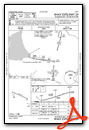
Instrument Approach Procedure (IAP) Charts

Nearby Airports with Instrument Procedures
| ID | Name | Heading / Distance | ||
|---|---|---|---|---|
 |
PAVA | Chevak Airport | 182° | 18.3 |
|
PAHP | Hooper Bay Airport | 220° | 25.3 |
|
PAMO | Mountain Village Airport | 073° | 55.6 |
|
PAEM | Emmonak Airport | 027° | 64.3 |
|
PASM | St Mary's Airport | 077° | 65.7 |
|
POKA | Tununak Airport | 172° | 77.3 |
|
PAOO | Toksook Bay Airport | 169° | 79.7 |
|
PAMY | Mekoryuk Airport | 193° | 90.9 |
|
PFKO | Kotlik Airport | 037° | 91.3 |
|
PAKI | Kipnuk Airport | 157° | 123.7 |
Airport Images
Do you have a recent image of this airport? Upload it here!


