Login
Register
OICK
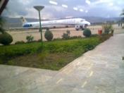
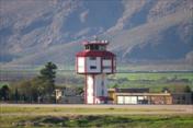
Khoram Abad Airport
VFR Chart of OICK
Sectional Charts at SkyVector.com
IFR Chart of OICK
Enroute Charts at SkyVector.com
Location Information for OICK
Coordinates: N33°26.32' / E48°16.83'View all Airports in Lorestan, Iran.
Elevation is 3793.0 feet MSL.
Operations Data
|
|
Airport Communications
| KHORAM ABAD Information: | 118.35 |
|---|---|
| KHORAM ABAD Information: | 121.50 |
| KHORAM ABAD Information: | 121.90 |
Nearby Navigation Aids
|
| ||||||||||||||||||||||||||||||||||||||||||||||||||||||||||||
Runway 11/29
| Dimensions: | 11457 x 148 feet / 3492 x 45 meters | |
|---|---|---|
| Surface: | Hard | |
| Runway 11 | Runway 29 | |
| Coordinates: | N33°26.52' / E48°15.85' | N33°25.83' / E48°17.80' |
| Elevation: | 3783 | 3791 |
| Runway Heading: | 109° | 289° |
| Displaced Threshold: | 666 Feet | |
Nearby Airports with Instrument Procedures
| ID | Name | Heading / Distance | ||
|---|---|---|---|---|
 |
OIAD | Dezful Airport | 175° | 60.4 |
 |
OICC | Kermanshah Airport | 314° | 78.2 |
 |
OIHH | Hamadan Airport | 008° | 86.7 |
 |
OIHR | Arak Airport | 061° | 88.6 |
 |
OICI | Ilam Airport | 275° | 94.5 |
 |
OICS | Sanandaj Airport | 330° | 125.5 |
 |
OIFS | Sharhe Kord Airport | 117° | 146.4 |
 |
OIIE | Tehran/Imam Khomaini Airport | 049° | 185.3 |


