Login
Register


RXE
Rexburg-Madison County Airport
Official FAA Data Effective 2025-11-27 0901Z
Chart Supplement

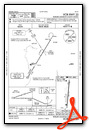
VFR Chart of KRXE
Sectional Charts at SkyVector.com
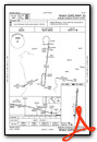
IFR Chart of KRXE
Enroute Charts at SkyVector.com
Location Information for KRXE
Coordinates: N43°50.04' / W111°48.31'Located 01 miles NW of Rexburg, Idaho on 144 acres of land. View all Airports in Idaho.
Surveyed Elevation is 4862 feet MSL.
Operations Data
|
|
Airport Communications
| ASOS: | 135.075 Tel. 208-356-0986 |
|---|---|
| CTAF: | 122.800 |
| UNICOM: | 122.800 |
| ASOS at IDA (22.1 SW): | 208-524-4553 |
| ATIS at IDA (22.4 SW): | 135.325 |
| AWOS-3PT at DIJ (31.1 E): | 120.775 208-354-6661 |
- APCH/DEP CTL SVC PRVDD BY SALT LAKE ARTCC (ZLC) ON FREQS 128.35/239.25 (ASHTON RCAG).
Nearby Navigation Aids
|
| ||||||||||||||||||||||||||||||||||||||||||


Runway 17/35
| Dimensions: | 4204 x 75 feet / 1281 x 23 meters | |
|---|---|---|
| Surface: | Asphalt in Good Condition | |
| Weight Limits: | S-30 | |
| Edge Lighting: | Medium Intensity | |
| Runway 17 | Runway 35 | |
| Coordinates: | N43°50.38' / W111°48.25' | N43°49.69' / W111°48.36' |
| Elevation: | 4858.1 | 4858.6 |
| Traffic Pattern: | Left | Left |
| Runway Heading: | 186° True | 6° True |
| Displaced Threshold: | 302 Feet | |
| Declared Distances: | TORA:4200 TODA:4200 ASDA:4200 LDA:3900 | TORA:4200 TODA:4200 ASDA:3900 LDA:3900 |
| Markings: | Non-Precision Instrument in good condition. | Non-Precision Instrument in good condition. |
| Glide Slope Indicator | V4R | V4L (3.00° Glide Path Angle) |
| REIL: | Yes | |
| Obstacles: | 35 ft Trees 470 ft from runway, 150 ft left of center RWY 17 APCH SLOPE 26:1 TO DSPLCD THLD. +20 TO 50 FT TREES AT 160 FT; 150 FT LEFT & RIGHT. |
50 ft Tree 725 ft from runway, 150 ft left of center |
Services Available
| Fuel: | 100LL (blue), Jet-A |
|---|---|
| Transient Storage: | Tiedowns |
| Airframe Repair: | MAJOR |
| Engine Repair: | MAJOR |
| Bottled Oxygen: | HIGH |
| Bulk Oxygen: | NONE |
| Other Services: | PILOT INSTRUCTION,AIRCRAFT RENTAL |
Ownership Information
| Ownership: | Publicly owned | |
|---|---|---|
| Owner: | CITY OF REXBURG & MADISON CO | |
| P.O. BOX 280 | ||
| REXBURG, ID 83440 | ||
| 208-359-3020 | ||
| Manager: | DAVID TAYLOR | |
| PO BOX 70 | ||
| REXBURG, ID 83440 | ||
| 208-356-9960 | ||
Other Remarks
- FOR CD CTC SALT LAKE ARTCC AT 801-320-2568.
- (CONTACT TITLE) EMAIL: KEITH.DAVIDSON@REXBURG.ORG
- ACTVT REIL RWY 35; VASI RWY 35; MIRL 17/35 - CTAF. VASI RWY 17 OPR CONSLY.
Weather Minimums

Instrument Approach Procedure (IAP) Charts
Nearby Airports with Instrument Procedures
| ID | Name | Heading / Distance | ||
|---|---|---|---|---|
 |
KIDA | Idaho Falls Regional Airport | 211° | 22.4 |
|
KDIJ | Driggs/Reed Memorial Airport | 099° | 31.5 |
|
U02 | Mccarley Field Airport | 212° | 44.4 |
|
KJAC | Jackson Hole Airport | 105° | 48.4 |
|
KWYS | Yellowstone Airport | 029° | 59.2 |
|
KPIH | Pocatello Regional Airport | 212° | 65.4 |
|
KAOC | Arco-Butte County Airport | 258° | 68.0 |
|
KAFO | Afton Lincoln County/General Boyd L Eddins Field Airport | 150° | 77.4 |
|
KEKS | Ennis Big Sky Airport | 004° | 86.8 |
|
KDLN | Dillon Airport | 339° | 91.1 |
|
KDUB | Dubois Municipal Airport | 099° | 93.6 |
|
1U7 | Bear Lake County Airport | 167° | 97.2 |
Airport Images
Do you have a recent image of this airport? Upload it here!


