Login
Register
SBCF
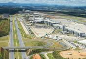
Tancredo Neves - International Airport
VFR Chart of SBCF
Sectional Charts at SkyVector.com
IFR Chart of SBCF
Enroute Charts at SkyVector.com
Location Information for SBCF
Coordinates: S19°37.47' / W43°58.32'View all Airports in Minas Gerais, Brazil.
Elevation is 2721.0 feet MSL.
Operations Data
|
|
Airport Communications
| BELO HORIZONTE CONTROL Approach: | 119.10 |
|---|---|
| BELO HORIZONTE CONTROL Approach: | 119.30 |
| BELO HORIZONTE CONTROL Approach: | 119.65 |
| BELO HORIZONTE CONTROL Approach: | 120.20 |
| BELO HORIZONTE CONTROL Approach: | 128.55 |
| BELO HORIZONTE CONTROL Approach: | 129.10 |
| BELO HORIZONTE CONTROL Approach: | 129.40 |
| TANCREDO NEVES ATIS: | 127.85 |
| CONFINS CLEARENCE Clearance Delivery: | 121.00 |
| TANCREDO NEVES Emergency: | 121.50 |
| CONFINS GROUND Ground Control: | 121.90 |
| BELO HORIZONTE OPERATIONS Operations: | 121.00 |
| BELO HORIZONTE OPERATIONS Operations: | 122.50 |
| CONFINS TOWER Tower: | 118.20 |
Nearby Navigation Aids
|
| ||||||||||||||||||||||||||||||||||||||||||||||||||||||


Runway 16/34
| Dimensions: | 11811 x 148 feet / 3600 x 45 meters | |
|---|---|---|
| Surface: | Hard | |
| Runway 16 | Runway 34 | |
| Coordinates: | S19°37.41' / W43°58.69' | S19°38.88' / W43°57.33' |
| Elevation: | 2713 | 2713 |
| Runway Heading: | 162° | 342° |
Nearby Airports with Instrument Procedures
| ID | Name | Heading / Distance | ||
|---|---|---|---|---|
 |
SBLS | Lagoa Santa Airport | 117° | 4.7 |
|
SBBH | Pampulha-Carlos Drummond De A Airport | 174° | 13.7 |
|
SBIP | Usiminas Airport | 084° | 84.6 |
|
SBBQ | Maj Brig Doorgal Borges Airport | 173° | 98.9 |
|
SBGV | Coronel Altino Machado Airport | 069° | 120.8 |
|
SBZM | Presidente Itamar Franco Airport | 158° | 121.5 |
|
SBVG | Major Brigadeiro Trompowsky Airport | 215° | 144.7 |
|
SBAX | Romeu Zema Airport | 270° | 169.6 |