Login
Register
SBVT
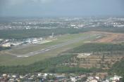
Eurico De Aguiar Salles Airport
VFR Chart of SBVT
Sectional Charts at SkyVector.com
IFR Chart of SBVT
Enroute Charts at SkyVector.com
Location Information for SBVT
Coordinates: S20°15.48' / W40°17.18'View all Airports in Espírito Santo, Brazil.
Elevation is 34.0 feet MSL.
Operations Data
|
|
Airport Communications
| VITORIA CONTROL Approach: | 119.85 |
|---|---|
| VITORIA ATIS: | 127.57 |
| VITORIA Emergency: | 121.50 |
| VITORIA GROUND Ground Control: | 121.95 |
| VITORIA TOWER Tower: | 118.10 |
Nearby Navigation Aids
|
| ||||||||||||||||||||||||||||||||||||||||||
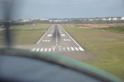
Runway 02/20
| Dimensions: | 6752 x 148 feet / 2058 x 45 meters | |
|---|---|---|
| Surface: | Hard | |
| Runway 02 | Runway 20 | |
| Coordinates: | S20°15.97' / W40°16.71' | S20°14.86' / W40°16.87' |
| Elevation: | 34 | 18 |
| Runway Heading: | 016° | 196° |
Runway 06/24
| Dimensions: | 5741 x 148 feet / 1750 x 45 meters | |
|---|---|---|
| Surface: | Unknown | |
| Runway 06 | Runway 24 | |
| Coordinates: | S20°15.87' / W40°17.47' | S20°15.07' / W40°16.94' |
| Elevation: | 13 | 13 |
| Runway Heading: | 056° | 236° |
Nearby Airports with Instrument Procedures
| ID | Name | Heading / Distance | ||
|---|---|---|---|---|
 |
SBCP | Bartolomeu Lisandro Airport | 213° | 103.6 |
 |
SBGV | Coronel Altino Machado Airport | 309° | 126.1 |
 |
SBIP | Usiminas Airport | 290° | 133.1 |
 |
SBZM | Presidente Itamar Franco Airport | 244° | 178.7 |


Comments
Runway change to 06-24
Runway change to 06-24
There are two runways operating at SBVT 06x24 - 02x20
Runways info
06 - L10 , L12 - ( 1750x45 ASPH 45/F/B/X/T L14 , L15 ) - L6 [1] , L9 [9] , L10 , L12 - 24
02 - L9 , L10 , L12 - ( 2058x45 ASPH 86/F/B/X/T L14 , L15 ) - L10 , L12 - 20
Pages