Login
Register


SDIG
Ibitinga Airport
VFR Chart of SDIG
Sectional Charts at SkyVector.com
IFR Chart of SDIG
Enroute Charts at SkyVector.com
Location Information for SDIG
Coordinates: S21°44.83' / W48°51.35'View all Airports in São Paulo, Brazil.
Elevation is 1778.0 feet MSL.
Operations Data
|
|
Nearby Navigation Aids
|
| ||||||||||||||||||||||||||||||||||||||||||||||||||||||||||||


Runway
| Surface: | Hard | |
|---|---|---|
Nearby Airports with Instrument Procedures
| ID | Name | Heading / Distance | ||
|---|---|---|---|---|
 |
SDMY | Fazenda Cambuhy Airport | 072° | 22.1 |
|
SBGP | Embraer-Unidade Gaviao Peixoto Airport | 092° | 25.2 |
|
SBAE | Bauru-Arealva Airport | 205° | 27.3 |
|
SBBU | Bauru Airport | 197° | 37.3 |
|
SBAQ | Bartolomeu De Gusmao Airport | 095° | 40.1 |
|
SWXQ | Lins Airport | 275° | 49.2 |
|
SBSR | Prof. Eriberto Manoel Reino Airport | 330° | 63.6 |
|
SBML | Frank Miloye Milenkovich Airport | 245° | 65.5 |
|
SBRP | Leite Lopes Airport | 059° | 70.6 |
|
SBYS | Campo Fontenelle Airport | 099° | 85.5 |
|
SBAU | Aracatuba Airport | 292° | 95.0 |
|
SBKP | Viracopos International Airport | 128° | 121.8 |
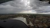
Airport Images
By: manuhboo


