Login
Register
WSSL
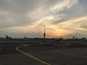
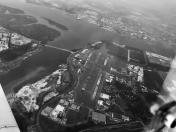
Seletar Airport
VFR Chart of WSSL
Sectional Charts at SkyVector.com
IFR Chart of WSSL
Enroute Charts at SkyVector.com
Location Information for WSSL
Coordinates: N1°25.02' / E103°52.06'View all Airports in Riau, Indonesia.
Elevation is 46.0 feet MSL.
Operations Data
|
|
Airport Communications
| SINGAPORE APPROACH Approach: | 120.05 |
|---|---|
| SELETAR APPROACH Approach: | 121.62 |
| SINGAPORE APPROACH Approach: | 124.60 |
| SINGAPORE APPROACH Approach: | 126.30 |
| SELETAR AIRPORT INFO ATIS: | 126.42 |
| SELETAR GROUND Ground Control: | 121.60 |
| SELETAR GROUND Ground Control: | 122.90 |
| SELETAR TOWER Tower: | 118.45 |
| SELETAR TOWER Tower: | 130.20 |
| SELETAR TOWER Tower: | 270.40 |
Nearby Navigation Aids
|
| ||||||||||||||||||||||||||||||||||||||||||||||||||||||||||||
Runway 03/21
| Dimensions: | 6024 x 151 feet / 1836 x 46 meters | |
|---|---|---|
| Surface: | Hard | |
| Runway 03 | Runway 21 | |
| Coordinates: | N1°24.51' / E103°51.73' | N1°25.35' / E103°52.27' |
| Elevation: | 46 | 16 |
| Runway Heading: | 033° | 213° |
Nearby Airports with Instrument Procedures
| ID | Name | Heading / Distance | ||
|---|---|---|---|---|
 |
WSAP | Paya Lebar Airport | 149° | 4.2 |
 |
WSSS | Singapore Changi International Airport | 115° | 8.1 |
 |
WSAT | Tengah Airport | 259° | 9.7 |
 |
WMKJ | Johor Bahru/Senai International Airport | 318° | 17.9 |
 |
WIDD | Batam / Hang Nadim Airport | 140° | 23.2 |
 |
WIDN | Raja Haji Fisabilillah Airport | 126° | 49.5 |
 |
WMKM | Malacca Airport | 297° | 109.4 |
 |
WIBL | Sultan Syarif Haroen Setia Neg Airport | 245° | 129.0 |
 |
WMKK | Kl International / Sepang Airport | 301° | 152.5 |
 |
WIBB | Sultan Syarif Kasim II Airport | 248° | 156.3 |
 |
WMSA | Sultan Abdul Aziz Shah Airport | 306° | 172.8 |


