Login
Register
LTFJ
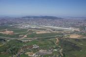
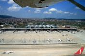
Istanbul/Sabiha Gokcen International Airport
VFR Chart of LTFJ
Sectional Charts at SkyVector.com
IFR Chart of LTFJ
Enroute Charts at SkyVector.com
Location Information for LTFJ
Coordinates: N40°53.90' / E29°18.55'View all Airports in Istanbul, Turkey.
Elevation is 312.0 feet MSL.
Operations Data
|
|
Airport Communications
| GOKCEN INFORMATION ATIS: | 128.55 |
|---|---|
| GOKCEN DELIVERY Clearance Delivery: | 122.62 |
| GOKCEN TOWER Emergency: | 121.50 |
| GOKCEN TOWER Emergency: | 243.00 |
| GOKCEN GROUND Ground Control: | 121.75 |
| GOKCEN TOWER Tower: | 118.80 |
| GOKCEN TOWER Tower: | 120.92 |
| GOKCEN TOWER Tower: | 243.10 |
Nearby Navigation Aids
|
| ||||||||||||||||||||||||||||||||||||||||||||||||||||||||||||
Runway 06/24
| Dimensions: | 9843 x 148 feet / 3000 x 45 meters | |
|---|---|---|
| Surface: | Hard | |
| Runway 06 | Runway 24 | |
| Coordinates: | N40°53.56' / E29°17.59' | N40°54.27' / E29°19.51' |
| Elevation: | 293 | 304 |
| Runway Heading: | 058° | 238° |
Nearby Airports with Instrument Procedures
| ID | Name | Heading / Distance | ||
|---|---|---|---|---|
 |
LTBA | Istanbul Ataturk International Airport | 281° | 23.0 |
 |
LTFM | Istanbul New Airport Airport | 311° | 33.9 |
 |
LTBQ | Kocaeli/Cengiz Topel Airport | 105° | 36.6 |
 |
LTBR | Bursa Yenisehir Airport | 163° | 40.2 |
 |
LTBU | Corlu - Ataturk / International Airport | 282° | 65.2 |
 |
LTBG | Balikesir/Bandirma Airport | 240° | 70.1 |
 |
LTBY | Hasan Polatkan Airport | 139° | 85.6 |
 |
LTBI | Eskisehir Airport | 138° | 88.7 |
 |
LTBF | Balikesir/Merkez Airport | 220° | 99.6 |
 |
LTBZ | Zafer Airport | 160° | 113.6 |
 |
LBBG | Burgas Airport | 321° | 128.6 |
 |
LTAS | Zonguldak/Caycuma Airport | 072° | 131.1 |


