Login
Register
SBMO
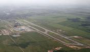
Zumbi Dos Palmares Airport
VFR Chart of SBMO
Sectional Charts at SkyVector.com
IFR Chart of SBMO
Enroute Charts at SkyVector.com
Location Information for SBMO
Coordinates: S9°30.65' / W35°47.50'View all Airports in Alagoas, Brazil.
Elevation is 387.0 feet MSL.
Operations Data
|
|
Airport Communications
| MACEIO CONTROL Approach: | 119.25 |
|---|---|
| MACEIO CONTROL Approach: | 128.90 |
| MACEIO CONTROL Radar: | 119.25 |
| MACEIO CONTROL Radar: | 128.90 |
| MACEIO TOWER Tower: | 118.00 |
| MACEIO TOWER Tower: | 118.25 |
Nearby Navigation Aids
|
| ||||||||||||||||||||||||||||||||||||
Runway 12/30
| Dimensions: | 8537 x 148 feet / 2602 x 45 meters | |
|---|---|---|
| Surface: | Hard | |
| Runway 12 | Runway 30 | |
| Coordinates: | S9°30.52' / W35°48.20' | S9°30.77' / W35°46.86' |
| Elevation: | 388 | 367 |
| Runway Heading: | 123° | 303° |
| Displaced Threshold: | 367 Feet | |
Nearby Airports with Instrument Procedures
| ID | Name | Heading / Distance | ||
|---|---|---|---|---|
 |
SJCH | Brejo/Fernando J Pereira Santo Airport | 343° | 84.1 |
 |
SBRF | Guararapes - Gilberto F International Airport | 032° | 97.5 |
 |
SBAR | Santa Maria International Airport | 220° | 116.2 |
 |
SBUF | Paulo Afonso Airport | 272° | 146.0 |


