Login
Register


02T
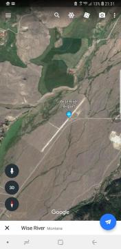
Wise River Airport
Official FAA Data Effective 2025-12-25 0901Z
Chart Supplement

VFR Chart of 02T
Sectional Charts at SkyVector.com
IFR Chart of 02T
Enroute Charts at SkyVector.com
Location Information for 02T
Coordinates: N45°46.20' / W112°58.83'Located 02 miles SW of Wise River, Montana on 45 acres of land. View all Airports in Montana.
Estimated Elevation is 5830 feet MSL.
Operations Data
|
|
Airport Communications
| CTAF: | 122.900 |
|---|---|
| ASOS at BTM (23.0 NE): | 135.175 406-494-1870 |
| AWOS-3PT at 3U3 (23.4 N): | 124.175 406-563-8275 |
| AWOS-3PT at RVF (31.4 SE): | 119.025 406-684-5285 |
Nearby Navigation Aids
|
| ||||||||||||||||||||||||||||||||||||||||||


Runway 02/20
| Dimensions: | 4050 x 60 feet / 1234 x 18 meters | |
|---|---|---|
| Surface: | Turf-Dirt in Poor Condition RUTS AND GROOVES FM VEHICLE TFC ALG RWY. | |
| Runway 02 | Runway 20 | |
| Coordinates: | N45°45.95' / W112°59.13' | N45°46.46' / W112°58.52' |
| Elevation: | 5830.0 | 5779.0 |
| Traffic Pattern: | Right | |
| Runway Heading: | 40° True | 220° True |
Services Available
| Fuel: | NONE |
|---|---|
| Transient Storage: | Tiedowns |
| Airframe Repair: | NOT AVAILABLE |
| Engine Repair: | NOT AVAILABLE |
| Bottled Oxygen: | NOT AVAILABLE |
| Bulk Oxygen: | NOT AVAILABLE |
Ownership Information
| Ownership: | Publicly owned | |
|---|---|---|
| Owner: | BEAVERHEAD COUNTY | |
| 2 SO PACIFIC ST | ||
| DILLON, MT 59725-2799 | ||
| 406-683-3700 | ||
| Manager: | YVONNE JONES | |
| 2400 AIRPORT RD | ||
| DILLON , MT 59725 | ||
| (406) 832-3130 | ||
Other Remarks
- ARPT NOT PLOWED WINTER MONTHS.
- FOR CD CTC SALT LAKE ARTCC AT 801-320-2568.
- RED CONES ON EACH RY END MARK THRESHOLDS.
Nearby Airports with Instrument Procedures
| ID | Name | Heading / Distance | ||
|---|---|---|---|---|
 |
KBTM | Bert Mooney Airport | 061° | 23.1 |
|
3U3 | Bowman Field Airport | 011° | 23.5 |
|
KRVF | Ruby Valley Field Airport | 116° | 31.8 |
|
KDLN | Dillon Airport | 149° | 35.8 |
|
38S | Deer Lodge-City-County Airport | 013° | 38.2 |
|
KSMN | Lemhi County Airport | 224° | 54.4 |
|
KHRF | Ravalli County Airport | 301° | 56.0 |
|
KEKS | Ennis Big Sky Airport | 117° | 63.5 |
|
32S | Stevensville Airport | 315° | 63.7 |
|
KHLN | Helena Regional Airport | 039° | 65.2 |
|
KBZN | Bozeman Yellowstone International Airport | 089° | 76.9 |
|
KMSO | Missoula Montana Airport | 326° | 82.8 |
Airport Images
By: astopka@gmail.com


