Login
Register
71J
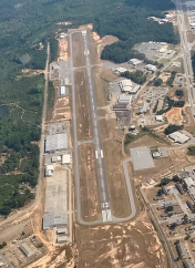
Ozark/Blackwell Field Airport
Official FAA Data Effective 2026-02-19 0901Z
VFR Chart of 71J
Sectional Charts at SkyVector.com
IFR Chart of 71J
Enroute Charts at SkyVector.com
Location Information for 71J
Coordinates: N31°25.91' / W85°37.23'Located 02 miles SE of Ozark, Alabama on 114 acres of land. View all Airports in Alabama.
Surveyed Elevation is 357 feet MSL.
Operations Data
|
|
Airport Communications
| CAIRNS APPROACH: | 125.4 327.125 |
|---|---|
| CAIRNS DEPARTURE: | 125.4 327.125 |
| UNICOM: | 122.700 |
| CTAF: | 122.700 |
| ATIS at HEY (4.8 S): | 141.375 |
| ATIS at LOR (8.1 SW): | 361.1 |
| ATIS at OZR (10.5 SW): | 111.2 |
- APCH/DEP SVC PRVDD BY JACKSONVILLE ARTCC ON FREQS 134.3/322.55 (DOTHAN RCAG) WHEN CAIRNS APCH/DEP CLSD.
Nearby Navigation Aids
|
| ||||||||||||||||||||||||||||||||||||||||||||||||||||||||||||
Runway 13/31
| Dimensions: | 5152 x 80 feet / 1570 x 24 meters | |
|---|---|---|
| Surface: | Asphalt in Fair Condition | |
| Weight Limits: | D-25 | |
| Edge Lighting: | Medium Intensity | |
| Runway 13 | Runway 31 | |
| Coordinates: | N31°26.13' / W85°37.66' | N31°25.69' / W85°36.81' |
| Elevation: | 357.9 | 340.8 |
| Traffic Pattern: | Left | Left |
| Runway Heading: | 121° True | 301° True |
| Markings: | Non-Precision Instrument in fair condition. | Non-Precision Instrument in fair condition. |
| Glide Slope Indicator | P4R (3.60° Glide Path Angle) | P4L (3.00° Glide Path Angle) |
| REIL: | Yes | Yes |
| Obstacles: | 45 ft Tree 615 ft from runway, 615 ft left of center CTLG OBSTN EXCEEDS A 45 DEG SLP. |
19 ft Tree 247 ft from runway, 163 ft right of center |
Services Available
| Fuel: | 100LL (blue), Jet-A |
|---|---|
| Transient Storage: | Tiedowns |
| Airframe Repair: | MAJOR |
| Engine Repair: | MAJOR |
| Bottled Oxygen: | NONE |
| Bulk Oxygen: | NONE |
| Other Services: | CHARTER SERVICE,PILOT INSTRUCTION,AIRCRAFT RENTAL |
Ownership Information
| Ownership: | Publicly owned | |
|---|---|---|
| Owner: | TOWN OF OZARK | |
| P.O. BOX 1987 | ||
| OZARK, AL 36361 | ||
| 334-774-5393 | ||
| Manager: | DENISE ELLIS | |
| 3269 HWY 231 S | ||
| OZARK, AL 36360 | ||
| 334-445-5045 | ||
Other Remarks
- LOW FLYING HOP IN TFC PAT.
- RWY & PARL TWYS CNTRLN SEPN IS 240 FT.
- PILOTS DEPG BLACKWELL VFR TO THE EAST OR NORTH RMN AT 1500 FT MSL OR BLW TIL APRXLY 5 MI FM THE ARPT TO AVOID CONFLICT WITH TFC ON IFR APCH TO THE DOTHAN ARPT.
- FOR CD CTC CAIRNS APCH AT 334-255-8402, WHEN APCH CLSD CTC JACKSONVILLE ARTCC AT 904-845-1592.
- RWY 13/31 CLSD TO HEL RUNNING LDG BY SKID EQUIPPED HEL
- 0LL AVGAS 24 HR CREDIT CARD SVC AVBL.
- ACTVT REIL RWY 13 & 31; PAPI RWY 13 & 31; MIRL RWY 13/31 - CTAF.
Weather Minimums
Instrument Approach Procedure (IAP) Charts
Nearby Airports with Instrument Procedures
| ID | Name | Heading / Distance | ||
|---|---|---|---|---|
 |
KOZR | Cairns AAF (Fort Rucker) Airport | 207° | 10.5 |
 |
KDHN | Dothan Regional Airport | 127° | 11.0 |
 |
KHDL | Headland Municipal Airport | 104° | 16.3 |
 |
KEDN | Enterprise Municipal Airport | 241° | 16.4 |
 |
33J | Geneva Municipal Airport | 209° | 26.0 |
 |
11A | Clayton Municipal Airport | 014° | 27.9 |
 |
KTOI | Troy Municipal At N Kenneth Campbell Field Airport | 321° | 32.6 |
 |
KBCR | Tri-County Airport | 178° | 35.2 |
 |
KBIJ | Early County Airport | 092° | 37.3 |
 |
KEUF | Weedon Field Airport | 038° | 40.0 |
 |
79J | South Alabama Regional At Bill Benton Field Airport | 259° | 40.3 |
 |
KMAI | Marianna Municipal Airport | 147° | 42.1 |


