Login
Register


91C
Sauk/Prairie Airport
Official FAA Data Effective 2024-04-18 0901Z
Chart Supplement

VFR Chart of 91C
Sectional Charts at SkyVector.com
IFR Chart of 91C
Enroute Charts at SkyVector.com
Location Information for 91C
Coordinates: N43°17.87' / W89°45.35'Located 02 miles W of Prairie Du Sac, Wisconsin on 20 acres of land. View all Airports in Wisconsin.
Surveyed Elevation is 832 feet MSL.
Operations Data
|
|
Airport Communications
| MADISON APPROACH: | 135.45 343.7 |
|---|---|
| MADISON DEPARTURE: | 135.45 343.7 |
| CTAF: | 122.900 |
| AWOS-3 at DLL (13.5 N): | 118.325 608-356-1071 |
| AWOS-3 at C29 (14.7 SE): | 118.675 608-833-1686 |
| AWOS-3PT at C35 (16.9 NW): | 118.95 608-768-0023 |
- APCH/DEP SVC PRVDD BY CHICAGO ARTCC ON FREQS 133.3/257.925 (LONE ROCK RCAG) WHEN MADISON TWR CLSD.
Nearby Navigation Aids
|
| ||||||||||||||||||||||||||||||||||||||||||||||||||||||||||||


Runway 18/36
| Dimensions: | 2936 x 60 feet / 895 x 18 meters | |
|---|---|---|
| Surface: | Asphalt in Good Condition | |
| Edge Lighting: | Medium Intensity | |
| Runway 18 | Runway 36 | |
| Coordinates: | N43°18.11' / W89°45.37' | N43°17.63' / W89°45.33' |
| Elevation: | 831.4 | 820.1 |
| Traffic Pattern: | Left | Left |
| Runway Heading: | 177° True | 357° True |
| Markings: | Non-Precision Instrument in good condition. | Non-Precision Instrument in good condition. |
| Glide Slope Indicator | P2L (3.00° Glide Path Angle) | P2L (3.00° Glide Path Angle) |
| REIL: | Yes | Yes |
Services Available
| Fuel: | 100LL (blue), UL94 |
|---|---|
| Transient Storage: | Tiedowns |
| Airframe Repair: | NONE |
| Engine Repair: | NONE |
| Bottled Oxygen: | NONE |
| Bulk Oxygen: | NONE |
Ownership Information
| Ownership: | Privately Owned | |
|---|---|---|
| Owner: | CFM INVESTMENTS | |
| ONE QUENCH DRIVE | ||
| PRAIRIE DU SAC, WI 53578 | ||
| 608-643-8530 | ||
| Manager: | SAUK PRAIRIE AIRPORT INC. | |
| P O BOX 7 | ||
| PRAIRIE DU SAC, WI 53754 | ||
| 608-577-3754 | ||
Operational Statistics
| Single Engine Aircraft Based on Field: | 30 | Statistics collected for 12 month period ending 2023-07-12 | |
|---|---|---|---|
| Multi-Engine Aircraft Based on Field: | none | Annual Commercial Operations: | none |
| Jet Aircraft Based on Field: | 1 | Annual Commuter Operations: | none |
| Helicopters Based on Field: | 2 | Annual Air Taxi Operations: | 50 |
| Military Aircraft Based on Field: | none | Annual Military Operations: | 300 |
| Gliders Based on Field: | 1 | Annual GA Local Operations: | 5500 |
| Ultralights Based on Field: | none | Annual GA Itinerant Operations: | 2500 |
Other Remarks
- ULTRALIGHT ACTVTY ON & INVOF ARPT.
- MAINT VEHICLE TFC ON AND INVOF ARPT.
- W RAMP AND TWY PVT, CLSD TSNT.
- AVOID HOSPITAL/HELIPAD 3,000 FT SOUTHEAST OF RY 36 THLD.
- RY 18 DEPS CLIMB TO 1,800 FT MSL ON RY HEADING BFR TURNING EAST/SOUTHEAST.
- TKOFS & LDGS ARE PROHIBITED ON UNPAVED SFCS.
- FOR CD CTC MADISON APP/DEP CON AT 608-249-8240. WHEN MADISON APCH CLSD, FOR CD CTC CHICAGO ARTCC AT 630-906-8921.
- 0LL 24 HR SELF SVC FUEL AVBL WITH CREDIT CARD.
- ACTVT MIRL RY 18/36, REIL RYS 18 & 36, & PAPI RYS 18 & 36 - CTAF.
Weather Minimums
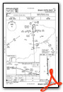
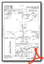
Instrument Approach Procedure (IAP) Charts
Nearby Airports with Instrument Procedures
| ID | Name | Heading / Distance | ||
|---|---|---|---|---|
 |
KDLL | Baraboo/Wisconsin Dells Regional Airport | 357° | 13.5 |
|
C29 | Middleton Municipal/Morey Field Airport | 138° | 14.8 |
|
C35 | Reedsburg Municipal Airport | 324° | 16.9 |
|
KLNR | Tri-County Regional Airport | 254° | 19.3 |
|
C47 | Portage Municipal Airport | 037° | 19.8 |
|
KMSN | Dane County Regional/Truax Field Airport | 117° | 20.7 |
|
93C | Richland Airport | 268° | 23.8 |
|
87Y | Blackhawk Airfield Airport | 114° | 27.6 |
|
KMRJ | Iowa County Airport | 220° | 32.5 |
|
82C | Mauston/New Lisbon Union Airport | 332° | 36.5 |
|
63C | Adams County Legion Field Airport | 357° | 39.8 |
|
KOVS | Boscobel Airport | 258° | 41.1 |
Airport Images

By: james_sm

By: Dave


Comments
Fuel at Sauk Prairie
Sauk Prairie now has Swiftfuels UL94 Avgas available on a new 24hr. Self Service Fuelmaster system.
Current Price $3.55 gal.