Login
Register


BFD
Bradford Regional Airport
Official FAA Data Effective 2024-04-18 0901Z
Chart Supplement

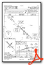
VFR Chart of KBFD
Sectional Charts at SkyVector.com
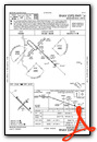
IFR Chart of KBFD
Enroute Charts at SkyVector.com
Location Information for KBFD
Coordinates: N41°48.18' / W78°38.40'Located 10 miles S of Bradford, Pennsylvania on 1015 acres of land. View all Airports in Pennsylvania.
Surveyed Elevation is 2143 feet MSL.
Operations Data
|
|
Airport Communications
| ASOS: | 133.825 Tel. 814-368-2581 |
|---|---|
| UNICOM: | 123.075 |
| CTAF: | 123.075 |
| AWOS-3P at OYM (24.2 S): | 118.05 814-834-9416 |
| AWOS-3 at OLE (28.9 NE): | 118.375 716-557-2001 |
| ASOS at ELZ (34.5 NE): | 119.275 585-593-0203 |
- APCH/DEP SVC PRVDD BY CLEVELAND ARTCC (ZOB) ON FREQS 124.325/353.85 (WAYLAND RCAG).
Nearby Navigation Aids
|
| ||||||||||||||||||||||||||||||||||||||||||||||||||||||||||||


Runway 14/32
| Dimensions: | 6307 x 150 feet / 1922 x 46 meters | |
|---|---|---|
| Surface: | Asphalt / Grooved in Good Condition | |
| Weight Limits: | S-48, D-60, ST-92 | |
| Edge Lighting: | High Intensity | |
| Runway 14 | Runway 32 | |
| Coordinates: | N41°48.56' / W78°38.93' | N41°47.84' / W78°37.93' |
| Elevation: | 2108.2 | 2100.2 |
| Traffic Pattern: | Left | Left |
| Runway Heading: | 134° True | 314° True |
| Declared Distances: | TORA:6306 TODA:6306 ASDA:6306 LDA:6306 | TORA:6306 TODA:6306 ASDA:6306 LDA:6306 |
| Markings: | Precision Instrument in fair condition. | Precision Instrument in fair condition. |
| Glide Slope Indicator | V4L (3.00° Glide Path Angle) | |
| Approach Lights: | MALSR 1,400 Foot Medium-intensity Approach Lighting System with runway alignment indicator lights. MALSR UNMONITORED. | |
| REIL: | Yes | |
| Obstacles: | 33 ft Trees 1193 ft from runway, 458 ft right of center | 28 ft Pole 1217 ft from runway, 358 ft left of center |
Runway 05/23
| Dimensions: | 4499 x 100 feet / 1371 x 30 meters | |
|---|---|---|
| Surface: | Asphalt / Grooved in Good Condition | |
| Weight Limits: | S-48, D-60 | |
| Edge Lighting: | Medium Intensity | |
| Runway 05 | Runway 23 | |
| Coordinates: | N41°47.88' / W78°38.70' | N41°48.41' / W78°38.01' |
| Elevation: | 2128.8 | 2143.1 |
| Traffic Pattern: | Left | Left |
| Runway Heading: | 44° True | 224° True |
| Declared Distances: | TORA:4499 TODA:4499 ASDA:4499 LDA:4499 | TORA:4499 TODA:4499 ASDA:4499 LDA:4499 |
| Markings: | Basic in good condition. | Basic in good condition. |
| Glide Slope Indicator | P4L (3.00° Glide Path Angle) | |
| REIL: | Yes | Yes |
| Obstacles: | 25 ft Trees 515 ft from runway, 63 ft right of center | |
Services Available
| Fuel: | 100LL (blue), Jet A+ |
|---|---|
| Transient Storage: | Hangars |
| Airframe Repair: | MINOR |
| Engine Repair: | MINOR |
| Bottled Oxygen: | NONE |
| Bulk Oxygen: | NONE |
| Other Services: | CARGO HANDLING SERVICES,CHARTER SERVICE,PILOT INSTRUCTION,AIRCRAFT RENTAL |
Ownership Information
| Ownership: | Publicly owned | |
|---|---|---|
| Owner: | BRADFORD REGIONAL ARPT AUTH | |
| 212 AIRPORT DR SUITE E | ||
| LEWIS RUN, PA 16738 | ||
| 814-368-5928 | ||
| Manager: | ALICIA DANKESREITER | |
| 212 AIRPORT DR SUITE E | ||
| LEWIS RUN, PA 16738 | ||
| 814-368-5928 | EXT 10 | |
Operational Statistics
| Single Engine Aircraft Based on Field: | 16 | Statistics collected for 12 month period ending 2023-03-31 | |
|---|---|---|---|
| Multi-Engine Aircraft Based on Field: | none | Annual Commercial Operations: | 2241 |
| Jet Aircraft Based on Field: | 1 | Annual Commuter Operations: | none |
| Helicopters Based on Field: | none | Annual Air Taxi Operations: | 263 |
| Military Aircraft Based on Field: | none | Annual Military Operations: | 11 |
| Gliders Based on Field: | none | Annual GA Local Operations: | 203 |
| Ultralights Based on Field: | none | Annual GA Itinerant Operations: | 600 |
Other Remarks
- DEER & BIRDS ON & INVOF ARPT.
- AIRCRAFT DEICING AVAIL
- ARPT UNATNDD, NO SNOW REMOVAL AVBL DAILY 2000-0700.
- FOR CD CTC CLEVELAND ARTCC AT 440-774-0227.
- CONDS NOT MNT OUTSIDE NML HRS OF ATNDC.
- ACTVT MALSR RWY 32; REIL RWY 05, 23 & 14; VASI RWY 14; PAPI RWY 23; MIRL RWY 05/23; HIRL RWY 14/32; TWY LGTS - CTAF.
Weather Minimums
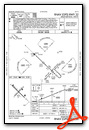
Instrument Approach Procedure (IAP) Charts
Nearby Airports with Instrument Procedures
| ID | Name | Heading / Distance | ||
|---|---|---|---|---|
 |
KOYM | St Marys Municipal Airport | 165° | 24.2 |
|
KOLE | Cattaraugus County-Olean Airport | 024° | 28.9 |
|
KELZ | Wellsville Municipal/Tarantine Field Airport | 057° | 34.4 |
|
KJHW | Chautauqua County/Jamestown Airport | 307° | 34.7 |
|
KDUJ | Dubois Regional Airport | 197° | 39.2 |
|
8G2 | Corry-Lawrence Airport | 278° | 45.3 |
|
KFIG | Clearfield-Lawrence Airport | 167° | 46.3 |
|
KAXQ | Clarion County Airport | 226° | 50.1 |
|
KDKK | Chautauqua County/Dunkirk Airport | 326° | 50.1 |
|
6G1 | Titusville Airport | 257° | 50.8 |
|
N35 | Punxsutawney Municipal Airport | 194° | 51.8 |
|
KHTF | Hornell Municipal Airport | 050° | 55.1 |
Airport Images
Do you have a recent image of this airport? Upload it here!


