Login
Register


DTL
Detroit Lakes/Wething Field Airport
Official FAA Data Effective 2025-12-25 0901Z
Chart Supplement

VFR Chart of KDTL
Sectional Charts at SkyVector.com
IFR Chart of KDTL
Enroute Charts at SkyVector.com
Location Information for KDTL
Coordinates: N46°49.38' / W95°52.97'Located 02 miles W of Detroit Lakes, Minnesota on 288 acres of land. View all Airports in Minnesota.
Surveyed Elevation is 1395 feet MSL.
Operations Data
|
|
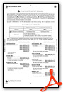
Airport Communications
| AWOS-3PT: | 119.075 Tel. 218-847-8626 |
|---|---|
| UNICOM: | 122.800 |
| CTAF: | 122.800 |
| AWOS-3PT at 3N8 (26.3 N): | 121.125 218-936-2507 |
| AWOS-3 at JKJ (32.1 W): | 120.0 218-287-5049 |
| ASOS at PKD (33.6 E): | 119.25 218-732-0920 |
- COMMUNICATIONS PRVDD BY PRINCETON RADIO ON FREQ 122.5 (DETROIT LAKES RCO).
- APCH/DEP SVC PRVDD BY MINNEAPOLIS ARTCC (ZMP) ON FREQ 126.1/269.2 (ALEXANDRIA RCAG).
Nearby Navigation Aids
|
| ||||||||||||||||||||||||||||||||||||||||||||||||||||||


Runway 14/32
| Dimensions: | 5201 x 100 feet / 1585 x 30 meters | |
|---|---|---|
| Surface: | Asphalt in Good Condition | |
| Weight Limits: | S-23, D-42 | |
| Edge Lighting: | High Intensity | |
| Runway 14 | Runway 32 | |
| Coordinates: | N46°49.65' / W95°53.22' | N46°48.99' / W95°52.42' |
| Elevation: | 1392.8 | 1362.0 |
| Traffic Pattern: | Left | Left |
| Runway Heading: | 140° True | 320° True |
| Markings: | Precision Instrument in good condition. | Precision Instrument in good condition. |
| Glide Slope Indicator | P4L (3.00° Glide Path Angle) | P4L (3.00° Glide Path Angle) |
| Approach Lights: | MALSF 1,400 Foot Medium-intensity Approach Lighting System with sequenced flashers. | |
| REIL: | Yes | |
Runway 18/36
NOT PLOWED WINTER MONTHS. | ||
| Dimensions: | 1890 x 250 feet / 576 x 76 meters | |
|---|---|---|
| Surface: | Turf in Fair Condition | |
| Runway 18 | Runway 36 | |
| Coordinates: | N46°49.71' / W95°53.36' | N46°49.40' / W95°53.37' |
| Elevation: | 1395.9 | 1373.0 |
| Traffic Pattern: | Left | Left |
| Runway Heading: | 180° True | 0 |
| Obstacles: | 45 ft Trees 618 ft from runway, 176 ft left of center | |
Services Available
| Fuel: | 100LL (blue), Jet-A |
|---|---|
| Transient Storage: | Hangars,Tiedowns |
| Airframe Repair: | MAJOR |
| Engine Repair: | MAJOR |
| Bottled Oxygen: | NONE |
| Bulk Oxygen: | NONE |
| Other Services: | AIRCRAFT SALES |
Ownership Information
| Ownership: | Publicly owned | |
|---|---|---|
| Owner: | CITY OF DETROIT LAKES | OWNED ALSO BY BECKER COUNTY. |
| 1025 ROOSEVELT AVE, PO BOX 647 | ||
| DETROIT LAKES, MN 56501 | ||
| 218-847-5658 | ||
| Manager: | ERIK CARLSON | |
| 1817 US HWY 10 W | ||
| DETROIT LAKES, MN 56501-7979 | ||
| 218-841-8233 | ||
Other Remarks
- FOR CD IF UNA TO CTC ON FSS FREQ, CTC MINNEAPOLIS ARTCC AT 651-463-5588.
- CONES.
- CONES.
- 0LL 100LL AVBL H24 SELF SVC. FOR JET A SVC AFT HRS CALL AMGR.
- ACTVT MALSF RWY 32; REIL RWY 14; HIRL RWY 14/32 - CTAF. PAPI RWY 14 & 32 OPR CONSLY.
Weather Minimums
Instrument Approach Procedure (IAP) Charts


Nearby Airports with Instrument Procedures
| ID | Name | Heading / Distance | ||
|---|---|---|---|---|
 |
16D | Perham Municipal Airport | 137° | 17.1 |
|
04Y | Hawley Municipal Airport | 280° | 19.6 |
|
3N8 | Mahnomen County Airport | 355° | 26.3 |
|
KJKJ | Moorhead Municipal/Florence Klingensmith Field Airport | 272° | 32.2 |
|
KPKD | Park Rapids Municipal/Konshok Field Airport | 081° | 33.7 |
|
D00 | Norman County Ada/Twin Valley Airport | 321° | 33.8 |
|
KFFM | Fergus Falls Regional Airport | 199° | 34.3 |
|
KADC | Wadena Municipal Airport | 128° | 35.8 |
|
KFAR | Hector International Airport | 279° | 38.8 |
|
KBWP | Harry Stern Airport | 221° | 45.9 |
|
KFSE | Fosston Municipal/Anderson Field Airport | 005° | 46.4 |
|
D14 | Fertile Municipal Airport | 339° | 46.8 |
Airport Images
Do you have a recent image of this airport? Upload it here!


