Login
Register
I83
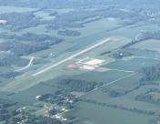
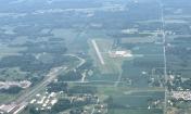
Salem Municipal Airport
Official FAA Data Effective 2026-01-22 0901Z
VFR Chart of I83
Sectional Charts at SkyVector.com
IFR Chart of I83
Enroute Charts at SkyVector.com
Location Information for I83
Coordinates: N38°36.24' / W86°9.14'Located 02 miles W of Salem, Indiana on 114 acres of land. View all Airports in Indiana.
Estimated Elevation is 839 feet MSL.
Operations Data
|
|
Airport Communications
| LOUISVILLE APPROACH: | 123.675 327.0 |
|---|---|
| LOUISVILLE DEPARTURE: | 123.675 327.0 |
| CTAF: | 123.000 |
| UNICOM: | 123.000 |
| AWOS-3PT at BFR (19.7 NW): | 119.125 812-275-8306 |
| AWOS-3 at SER (22.2 NE): | 119.425 812-522-4244 |
| AWOS-3 at FRH (23.5 W): | 118.075 812-936-2252 |
Nearby Navigation Aids
|
| ||||||||||||||||||||||||||||||||||||||||||||||||||||||||||||
Runway 08/26
| Dimensions: | 3000 x 75 feet / 914 x 23 meters | |
|---|---|---|
| Surface: | Asphalt in Good Condition | |
| Weight Limits: | S-30, D-60 | |
| Edge Lighting: | Medium Intensity | |
| Runway 08 | Runway 26 | |
| Coordinates: | N38°36.19' / W86°9.44' | N38°36.30' / W86°8.83' |
| Elevation: | 839.9 | 816.4 |
| Traffic Pattern: | Left | Left |
| Markings: | Non-Precision Instrument in good condition. | Non-Precision Instrument in good condition. |
| Glide Slope Indicator | P2L (3.00° Glide Path Angle) | |
| REIL: | Yes | Yes |
Services Available
| Fuel: | 100LL (blue) |
|---|---|
| Transient Storage: | Tiedowns ROPE AND WHEEL CHOCKS PROVIDED |
| Airframe Repair: | NOT AVAILABLE |
| Engine Repair: | NOT AVAILABLE |
| Bottled Oxygen: | NOT AVAILABLE |
| Bulk Oxygen: | NOT AVAILABLE |
| Other Services: | PILOT INSTRUCTION |
Ownership Information
| Ownership: | Publicly owned | |
|---|---|---|
| Owner: | SALEM BOARD OF AVN CMSNRS | |
| 334 N AIRPORT BLVD | ||
| SALEM, IN 47167 | ||
| (812) 883-5858 | ||
| Manager: | ARIC RUSSEL | |
| 334 N AIRPORT BLVD | ||
| SALEM, IN 47167 | ||
| 812-896-9723 | TRML: 812-883-5858. AMGR: 812-896-9723. | |
Other Remarks
- FOR CD CTC LOUISVILLE APCH AT 502-375-7499
- 0LL AVBL H24 WITH CREDIT CARD.
- ACTVT PAPI RWY 08; MIRL RWY 08/26 - CTAF. MIRL RWY 08/26 PRESET LOW INTST; INCR INTST - CTAF.
- UNICOM UNMNT.
Nearby Airports with Instrument Procedures
| ID | Name | Heading / Distance | ||
|---|---|---|---|---|
 |
KBFR | Virgil I Grissom Municipal Airport | 315° | 19.7 |
 |
KSER | Freeman Municipal Airport | 030° | 22.3 |
 |
KFRH | French Lick Municipal Airport | 255° | 23.6 |
 |
KJVY | Clark Regional Airport | 125° | 24.1 |
 |
KLOU | Bowman Field Airport | 134° | 32.2 |
 |
KSDF | Louisville Muhammad Ali International Airport | 142° | 32.4 |
 |
KIMS | Madison Regional Airport | 073° | 33.6 |
 |
KOVO | North Vernon Airport | 043° | 36.8 |
 |
KBMG | Monroe County Airport | 326° | 39.1 |
 |
KBAK | Columbus Municipal Airport | 016° | 41.2 |
 |
KFTK | Godman AAF Airport | 168° | 42.6 |
 |
KHNB | Huntingburg Airport | 240° | 43.3 |


