Login
Register


N86
Spanish Springs Airport
Official FAA Data Effective 2025-12-25 0901Z
Chart Supplement

VFR Chart of N86
Sectional Charts at SkyVector.com
IFR Chart of N86
Enroute Charts at SkyVector.com
Location Information for N86
Coordinates: N39°40.27' / W119°43.51'Located 10 miles N of Reno, Nevada on 35 acres of land. View all Airports in Nevada.
Estimated Elevation is 4620 feet MSL.
Operations Data
|
|
Airport Communications
| CTAF: | 122.900 |
|---|---|
| AWOS-3 at RTS (6.8 W): | 135.175 775-677-0589 |
| ASOS at RNO (10.0 S): | 135.8 775-432-6755 |
| D-ATIS at RNO (10.5 S): | 135.8 |
Nearby Navigation Aids
|
| ||||||||||||||||||||||||||||||||||||


Runway 17/35
RWY 17/35 CLSD INDEFLY. MARKED WITH YELLOW X'S AT EACH END. | ||
| Dimensions: | 3418 x 60 feet / 1042 x 18 meters | |
|---|---|---|
| Surface: | Dirt in Failed Condition RWY 17/35 CLSD INDEFLY. | |
| Edge Lighting: | Non-Standard RWY EDGE NOT MKD WITH REFLECTORS. | |
| Runway 17 | Runway 35 | |
| Coordinates: | N39°40.55' / W119°43.49' | N39°39.99' / W119°43.53' |
| Elevation: | 4587.0 | 4600.0 |
| Traffic Pattern: | Left | Right |
| Obstacles: | 62 ft Other 1589 ft from runway, 260 ft left of center ROCK CRUSHING / QUARRY EQUIPMENT ROCK CRUSHER SILO |
26 ft Building 213 ft from runway, 100 ft left of center |
Services Available
| Fuel: | NONE |
|---|---|
| Transient Storage: | NONE |
| Airframe Repair: | NONE |
| Engine Repair: | NONE |
| Bottled Oxygen: | NOT AVAILABLE |
| Bulk Oxygen: | NOT AVAILABLE |
Ownership Information
| Ownership: | Publicly owned | |
|---|---|---|
| Owner: | BUREAU OF LAND MANAGEMENT | LEASED FROM BUREAU OF LAND MANAGEMENT, 1340 FINANCIAL BLVD., RENO, NV 89502, 775-882-1037 |
| 1340 FINANCIAL BLVD. | ||
| RENO, NV 89502 | ||
| 502-808-6001 | ||
| Manager: | BUREAU OF LAND MANAGEMENT | |
| 1340 FINANCIAL BLVD. | ||
| RENO, NV 89502 | ||
| 502-808-6001 | ||
Other Remarks
- MOUNTAINS WEST & NORTH.
- FOR CD CTC NORCAL APCH AT 916-361-0596.
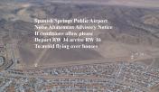
- ARPT CLSD INDEFLY.
- (ARPT STATUS) ARPT CLSD INDEFLY.
- RWY 17 GRADIENT +2.5% FIRST 5OO'.
- RWY 17/35 HAZARDOUS WHEN WET.
- UNCONTROLLED VEHICLE ACCESS ACROSS RYS.
- RY 17/35 THLDS MARKED WITH 4 WHITE CEMENT PADS FLUSH TO THE GROUND.
- NO LINE OF SIGHT BTN ENDS OF RY.
- RISING TERR AT RWY EDGES NARROWING PRI SFC AT CNTR OF RWY.
- PAR TWY CLSD INDEFLY.
Nearby Airports with Instrument Procedures
| ID | Name | Heading / Distance | ||
|---|---|---|---|---|
 |
KRTS | Reno/Stead Airport | 268° | 7.0 |
|
KRNO | Reno/Tahoe International Airport | 190° | 10.5 |
|
KSPZ | Silver Springs Airport | 126° | 27.2 |
|
KTRK | Truckee-Tahoe Airport | 222° | 28.5 |
|
KCXP | Carson City Airport | 180° | 28.7 |
|
O02 | Nervino Airport | 287° | 30.4 |
|
KMEV | Minden-Tahoe Airport | 181° | 40.2 |
|
KFLX | Fallon Municipal Airport | 102° | 46.4 |
|
O43 | Yerington Municipal Airport | 146° | 47.9 |
|
KTVL | Lake Tahoe Airport | 195° | 48.3 |
|
KSVE | Susanville Municipal Airport | 317° | 57.5 |
|
KLOL | Derby Field Airport | 065° | 58.6 |
Airport Images
By: jennapeep1@gmail.com


