Login
Register


POC
Brackett Field Airport
Official FAA Data Effective 2026-01-22 0901Z
Chart Supplement

KPOC Airport Diagram

VFR Chart of KPOC
Sectional Charts at SkyVector.com
IFR Chart of KPOC
Enroute Charts at SkyVector.com
Location Information for KPOC
Coordinates: N34°5.50' / W117°46.91'Located 01 miles SW of La Verne, California on 276 acres of land. View all Airports in California.
Surveyed Elevation is 1013 feet MSL.
Operations Data
|
|
Airport Communications
| D-ATIS: | 124.4 (909-962-5407) |
|---|---|
| AWOS-3PT: | Tel. 909-962-5407 |
| BRACKETT TOWER: | 118.2 ;RWY 08R/26L 133.3 ;RWY 08L/26R |
| BRACKETT GROUND: | 125.0 |
| SOCAL APPROACH: | 125.5 ;SW-NORTH 349.0 ;SW-NORTH 379.25 ;NE-EAST |
| SOCAL DEPARTURE: | 125.5 ;SW-NORTH 349.0 ;SW-NORTH 379.25 ;NE-EAST |
| IC: | 125.5 ;SW-NORTH 349.0 ;SW-NORTH |
| CLEARANCE DELIVERY: | 121.875 |
| CTAF: | 118.200 |
| UNICOM: | 122.950 |
| CLASS C: | 127.0 ;NORTH-NE 318.2 ;NORTH-NE 379.25 ;NE-EAST |
| ZIGGY STAR: | 127.0 318.2 |
| SETER STAR: | 127.0 318.2 |
| AWOS-3P at CCB (5.0 E): | 119.525 909-985-4731 |
| ASOS at ONT (9.2 E): | 909-937-2186 |
| D-ATIS at ONT (9.2 E): | 124.25 |
Nearby Navigation Aids
|
| ||||||||||||||||||||||||||||||||||||||||||


Runway 08R/26L
| Dimensions: | 4840 x 75 feet / 1475 x 23 meters | |
|---|---|---|
| Surface: | Asphalt in Good Condition | |
| Weight Limits: | S-26 | |
| Edge Lighting: | Medium Intensity | |
| Runway 08R | Runway 26L | |
| Coordinates: | N34°5.50' / W117°47.43' | N34°5.46' / W117°46.47' |
| Elevation: | 965.3 | 1011.1 |
| Traffic Pattern: | Right | Left |
| Runway Heading: | 93° True | 273° True |
| Displaced Threshold: | 689 Feet | |
| Markings: | Basic in good condition. | Precision Instrument in good condition. |
| Glide Slope Indicator | P4L (3.76° Glide Path Angle) UNUSBL BYD 5 DEG L OF CNTRLN. | P4L (3.76° Glide Path Angle) |
| REIL: | Yes | Yes |
| Obstacles: | 254 ft Hill 3651 ft from runway, 800 ft left of center | 15 ft Road 200 ft from runway, 290 ft left of center APCH RATIO TO DSPLCD THR 50:1. APCH RATIO TO DSPLCD THR OVER +65 FT POLES 1988 FT FROM DSPLCD THR, 250 FT L, 30:1. |
Runway 08L/26R
| Dimensions: | 3661 x 75 feet / 1116 x 23 meters | |
|---|---|---|
| Surface: | Asphalt in Good Condition | |
| Weight Limits: | S-12 | |
| Runway 08L | Runway 26R | |
| Coordinates: | N34°5.54' / W117°47.21' | N34°5.51' / W117°46.48' |
| Elevation: | 979.1 | 1013.9 |
| Traffic Pattern: | Left | Right |
| Runway Heading: | 93° True | 273° True |
| Markings: | Basic in good condition. | Basic in good condition. |
| Obstacles: | 240 ft Hill 4750 ft from runway, 500 ft left of center | 15 ft Road 540 ft from runway, 159 ft left of center |
Services Available
| Fuel: | 100LL (blue), Jet-A |
|---|---|
| Transient Storage: | Tiedowns |
| Airframe Repair: | MAJOR |
| Engine Repair: | MAJOR |
| Bottled Oxygen: | LOW |
| Bulk Oxygen: | NOT AVAILABLE |
| Other Services: | AIR AMBULANCE SERVICES,AVIONICS,CHARTER SERVICE,PILOT INSTRUCTION,AIRCRAFT RENTAL,AIRCRAFT SALES,ANNUAL SURVEYING |
Ownership Information
| Ownership: | Publicly owned | |
|---|---|---|
| Owner: | COUNTY OF LOS ANGELES | |
| PO BOX 1460 | ||
| ALHAMBRA, CA 91803-1331 | ||
| 626-300-4600 | LA COUNTY CTC: PAUL MASELBAS, 626-300-4600 X4615. | |
| Manager: | DAVID PRICE | |
| 1615 MCKINLEY AVENUE | ||
| LA VERNE, CA 91750 | ||
| 909-593-1395 | ||
Other Remarks
- NOISE ABATEMENT PROCEDURES IN EFFECT CTC AMGR (909) 593-1395.
- RY 08L/26R UNLGTD.
- BIRDS AND WILDLIFE IN VICINITY OF AIRPORT.
- RAPIDLY RISING TERRAIN 1 MILE W-NW OF ARPT.
- FOR CD WHEN ATCT CLSD CTC SOCAL APCH AT 800-448-3724.
- WHEN ATCT CLSD, ARPT LGT OPRS CONSLY FM 2100-0700 LCL.
Weather Minimums

Standard Terminal Arrival (STAR) Charts


Instrument Approach Procedure (IAP) Charts


Nearby Airports with Instrument Procedures
| ID | Name | Heading / Distance | ||
|---|---|---|---|---|
 |
KCCB | Cable Airport | 075° | 4.9 |
|
KONT | Ontario International Airport | 103° | 9.3 |
|
KCNO | Chino Airport | 133° | 10.1 |
|
KEMT | San Gabriel Valley Airport | 268° | 12.6 |
|
KAJO | Corona Municipal Airport | 142° | 14.7 |
|
KFUL | Fullerton Municipal Airport | 216° | 16.5 |
|
KRAL | Riverside Airport | 116° | 18.8 |
|
KRIR | Flabob Airport | 108° | 19.5 |
|
KSLI | Los Alamitos AAF Airport | 216° | 22.5 |
|
KLGB | Long Beach (Daugherty Field) Airport | 228° | 24.7 |
|
KSNA | John Wayne/Orange County Airport | 189° | 25.3 |
|
KSBD | San Bernardino International Airport | 089° | 27.3 |
Airport Images
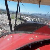
By: Barnstormers Bi...

By: photopilot-Mark
- 1 of 2
- next ›


