Login
Register


RTS
Reno/Stead Airport
Official FAA Data Effective 2025-12-25 0901Z
Chart Supplement

KRTS Airport Diagram

VFR Chart of KRTS
Sectional Charts at SkyVector.com
IFR Chart of KRTS
Enroute Charts at SkyVector.com
Location Information for KRTS
Coordinates: N39°40.09' / W119°52.59'Located 10 miles NW of Reno, Nevada on 5000 acres of land. View all Airports in Nevada.
Surveyed Elevation is 5050 feet MSL.
TPA-6246(1200) HEAVY/HIGH PERFORMANCE ACFT.
Operations Data
|
|
Airport Communications
| AWOS-3: | 135.175 Tel. 775-677-0589 |
|---|---|
| NORCAL APPROACH: | 126.3 353.9 |
| NORCAL DEPARTURE: | 126.3 353.9 |
| UNICOM: | 122.700 |
| CTAF: | 122.700 |
| ASOS at RNO (10.9 SE): | 135.8 775-432-6755 |
| D-ATIS at RNO (11.3 SE): | 135.8 |
| AWOS-2 at O02 (23.5 NW): | 119.35 530-832-6942 |
Nearby Navigation Aids
|
| ||||||||||||||||||||||||||||||||||||


Runway 14/32
| Dimensions: | 9000 x 150 feet / 2743 x 46 meters | |
|---|---|---|
| Surface: | Asphalt / Grooved in Good Condition | |
| Weight Limits: | 64 /R/B/X/T | |
| Edge Lighting: | High Intensity | |
| Runway 14 | Runway 32 | |
| Coordinates: | N39°41.00' / W119°52.90' | N39°39.68' / W119°52.04' |
| Elevation: | 5043.5 | 5043.8 |
| Traffic Pattern: | Left | Right |
| Runway Heading: | 153° True | 333° True |
| Displaced Threshold: | 1200 Feet | |
| Declared Distances: | LDA:7800 | |
| Markings: | Non-Precision Instrument in good condition. | Precision Instrument in good condition. |
| Glide Slope Indicator | P4L (3.00° Glide Path Angle) PAPI OTS INDEFLY. | P4L (3.00° Glide Path Angle) |
| Approach Lights: | MALSR 1,400 Foot Medium-intensity Approach Lighting System with runway alignment indicator lights. | |
| REIL: | Yes | |
Runway 08/26
| Dimensions: | 7608 x 150 feet / 2319 x 46 meters | |
|---|---|---|
| Surface: | Asphalt / Grooved in Excellent Condition | |
| Weight Limits: | 64 /R/B/X/T | |
| Edge Lighting: | High Intensity | |
| Runway 08 | Runway 26 | |
| Coordinates: | N39°39.86' / W119°53.53' | N39°39.73' / W119°51.92' |
| Elevation: | 4991.8 | 5050.1 |
| Traffic Pattern: | Left | Right |
| Runway Heading: | 96° True | 276° True |
| Declared Distances: | TORA:6956 TODA:6956 LDA:6956 | LDA:7294 |
| Markings: | Non-Precision Instrument in good condition. | Non-Precision Instrument in good condition. |
| Glide Slope Indicator | P4L (4.00° Glide Path Angle) PAPI UNUSBL BYD 5 DEGS RIGHT OF CNTRLN. | P4L (3.00° Glide Path Angle) |
| REIL: | Yes | Yes |
Services Available
| Fuel: | 100LL (blue), Jet-A |
|---|---|
| Transient Storage: | Hangars,Tiedowns |
| Airframe Repair: | MAJOR |
| Engine Repair: | MAJOR |
| Bottled Oxygen: | HIGH |
| Bulk Oxygen: | HIGH |
| Other Services: | AIR FREIGHT SERVICES,AIR AMBULANCE SERVICES,AVIONICS,PILOT INSTRUCTION,PARACHUTE JUMP ACTIVITY,AIRCRAFT RENTAL |
Ownership Information
| Ownership: | Publicly owned | |
|---|---|---|
| Owner: | RENO TAHOE ARPT AUTH | |
| P.O. BOX 12490 | ||
| RENO, NV 89510 | ||
| 775-328-6400 | ||
| Manager: | SCOTT GORDON | |
| 4895 TEXAS AVE | ||
| RENO, NV 89506 | ||
| 775-328-6573 | ||
Other Remarks
- FOR CD CTC NORCAL APCH AT 916-361-0596.
- FUEL AVBL H24 - 775-530-7164 OR 122.775.
- RNG HEL OPS INVOF ARPT; BALLOON OPS NW QUAD; TANKER & FIRE OPS INVOF ARPT DURG FIRE SEASON.
- COLD TEMPERATURE AIRPORT. ALTITUDE CORRECTION REQUIRED AT OR BELOW -15C.
- ACTVT MALSR RWY 32; REIL RWY 14; HIRL RWY 14/32 - CTAF. PAPI RWY 32 ON CONSLY.
- TPA-6246(1200) HEAVY/HIGH PERFORMANCE ACFT.
Weather Minimums
Instrument Approach Procedure (IAP) Charts


Departure Procedure Obstacles (DPO) Charts

Nearby Airports with Instrument Procedures
| ID | Name | Heading / Distance | ||
|---|---|---|---|---|
 |
KRNO | Reno/Tahoe International Airport | 153° | 11.3 |
|
O02 | Nervino Airport | 292° | 23.8 |
|
KTRK | Truckee-Tahoe Airport | 210° | 24.2 |
|
KCXP | Carson City Airport | 166° | 29.3 |
|
KSPZ | Silver Springs Airport | 118° | 33.1 |
|
KMEV | Minden-Tahoe Airport | 171° | 40.4 |
|
KTVL | Lake Tahoe Airport | 186° | 46.7 |
|
O43 | Yerington Municipal Airport | 139° | 52.0 |
|
KFLX | Fallon Municipal Airport | 100° | 53.3 |
|
KSVE | Susanville Municipal Airport | 323° | 53.2 |
|
KGOO | Nevada County Airport | 243° | 58.7 |
|
KLOL | Derby Field Airport | 068° | 65.1 |
Airport Images
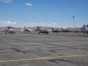
By: chipchap42
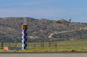
By: EDSeguin


