Login
Register


SVH
Statesville Regional Airport
Official FAA Data Effective 2024-04-18 0901Z
Chart Supplement

VFR Chart of KSVH
Sectional Charts at SkyVector.com
IFR Chart of KSVH
Enroute Charts at SkyVector.com
Location Information for KSVH
Coordinates: N35°45.90' / W80°57.23'Located 03 miles SW of Statesville, North Carolina on 382 acres of land. View all Airports in North Carolina.
Surveyed Elevation is 967 feet MSL.
Operations Data
|
|
Airport Communications
| AWOS-3: | 119.225 Tel. 704-873-1978 |
|---|---|
| CTAF: | 123.075 |
| KABEE STAR: | 126.15 282.325 |
| UNICOM: | 123.075 |
| AWOS-3 at IPJ (19.7 SW): | 119.675 704-735-6954 |
| ASOS at HKY (20.9 W): | 118.325 828-322-2996 |
| AWOS-3 at RUQ (22.3 E): | 118.175 704-637-6197 |
- APCH/DEP SVC PRVDD BY ATLANTA ARTCC (HICKORY RCAG) ON FREQS 125.15/263.0.
Nearby Navigation Aids
|
| ||||||||||||||||||||||||||||||||||||||||||||||||||||||||||||


Runway 10/28
| Dimensions: | 7003 x 100 feet / 2135 x 30 meters | |
|---|---|---|
| Surface: | Asphalt / Grooved in Excellent Condition | |
| Weight Limits: | S-30, D-100 | |
| Edge Lighting: | High Intensity | |
| Runway 10 | Runway 28 | |
| Coordinates: | N35°45.97' / W80°57.94' | N35°45.83' / W80°56.53' |
| Elevation: | 958.6 | 956.9 |
| Runway Heading: | 97° True | 277° True |
| Displaced Threshold: | 550 Feet | |
| Declared Distances: | TORA:7003 TODA:7003 ASDA:6453 LDA:6453 | TORA:7003 TODA:7003 ASDA:7003 LDA:6453 |
| Markings: | Non-Precision Instrument in good condition. | Precision Instrument in good condition. |
| Glide Slope Indicator | P4L (3.00° Glide Path Angle) | P4L (3.00° Glide Path Angle) |
| Approach Lights: | MALSR 1,400 Foot Medium-intensity Approach Lighting System with runway alignment indicator lights. | |
| REIL: | Yes | |
| Obstacles: | 49 ft Trees 671 ft from runway, 468 ft left of center | 46 ft Trees 1170 ft from runway, 560 ft left of center APCH SLP 34:1 AT DSPLCD THR DUE TO +43 FT TREES 1696 FT FM DSPLCD THR AND 617 FT LEFT OF CNTRLN. |
Services Available
| Fuel: | 100LL (blue), Jet-A, Jet A-1+ |
|---|---|
| Transient Storage: | Hangars,Tiedowns |
| Airframe Repair: | MAJOR |
| Engine Repair: | MAJOR |
| Bottled Oxygen: | HIGH |
| Bulk Oxygen: | HIGH |
| Other Services: | AIR FREIGHT SERVICES,AIR AMBULANCE SERVICES,CHARTER SERVICE,PILOT INSTRUCTION,AIRCRAFT RENTAL |
Ownership Information
| Ownership: | Publicly owned | |
|---|---|---|
| Owner: | CITY OF STATESVILLE | |
| PO BOX 1111 | ||
| STATESVILLE, NC 28687 | ||
| 704-873-1111 | ||
| Manager: | JOHN M. FERGUSON | |
| 238 AIRPORT ROAD | ||
| STATESVILLE, NC 28677 | ||
| 704-873-1111 | ||
Operational Statistics
| Single Engine Aircraft Based on Field: | 44 | Statistics collected for 12 month period ending 2023-06-30 | |
|---|---|---|---|
| Multi-Engine Aircraft Based on Field: | 13 | Annual Commercial Operations: | none |
| Jet Aircraft Based on Field: | 29 | Annual Commuter Operations: | none |
| Helicopters Based on Field: | none | Annual Air Taxi Operations: | 1410 |
| Military Aircraft Based on Field: | 1 | Annual Military Operations: | 200 |
| Gliders Based on Field: | none | Annual GA Local Operations: | 9873 |
| Ultralights Based on Field: | none | Annual GA Itinerant Operations: | 37142 |
Other Remarks
- RWY 28 HAS 100 FT DROP-OFF 250 FT RIGHT OF CNTRLN.
- NO LINE OF SIGHT BTN RWYS.
- FOR AFTER HRS NAVL/LGT FAILURE CALL 704-880-6897.
- FOR CD CTC ATLANTA ARTCC AT 770-210-7692.
- TWY A AT BOTH RWY ENDS HAS 80 FT TO 100 FT DROP-OFF 50 FT FM TWY CNTRLN.
- ACTVT MALSR RWY 28; REIL RWY 10; PAPI RWY 10 & 28; HIRL RWY 10/28 - CTAF.
Weather Minimums

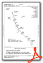
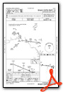
Standard Terminal Arrival (STAR) Charts
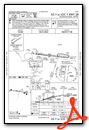
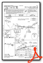
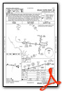
Instrument Approach Procedure (IAP) Charts
Nearby Airports with Instrument Procedures
| ID | Name | Heading / Distance | ||
|---|---|---|---|---|
 |
14A | Lake Norman Airpark Airport | 163° | 9.4 |
|
KIPJ | Lincolnton-Lincoln County Regional Airport | 211° | 19.7 |
|
KHKY | Hickory Regional Airport | 266° | 21.3 |
|
KRUQ | Mid-Carolina Regional Airport | 108° | 22.4 |
|
KJQF | Concord-Padgett Regional Airport | 152° | 25.6 |
|
8A7 | Twin Lakes Airport | 069° | 25.9 |
|
KUKF | Wilkes County Airport | 345° | 28.4 |
|
KEXX | Davidson County Exec Airport | 088° | 31.8 |
|
KZEF | Elkin Municipal Airport | 014° | 31.9 |
|
KMRN | Foothills Regional Airport | 276° | 32.3 |
|
KCLT | Charlotte/Douglas International Airport | 179° | 33.0 |
|
KAKH | Gastonia Municipal Airport | 195° | 35.0 |
Airport Images

By: racecityfo


