Login
Register


TOP
Philip Billard Municipal Airport
Official FAA Data Effective 2026-02-19 0901Z
Chart Supplement

KTOP Airport Diagram

VFR Chart of KTOP
Sectional Charts at SkyVector.com
IFR Chart of KTOP
Enroute Charts at SkyVector.com
Location Information for KTOP
Coordinates: N39°4.13' / W95°37.34'Located 03 miles NE of Topeka, Kansas on 920 acres of land. View all Airports in Kansas.
Surveyed Elevation is 881 feet MSL.
Operations Data
|
|
Airport Communications
| ASOS: | 121.275 Tel. 785-274-8258 |
|---|---|
| TOPEKA TOWER: | 118.7 257.8 |
| TOPEKA GROUND: | 121.9 |
| CLEARANCE DELIVERY: | 121.9 |
| UNICOM: | 122.950 |
| CTAF: | 118.700 |
| ATIS at FOE (7.3 S): | 128.25 |
| ASOS at FOE (7.3 S): | 785-862-8258 |
| ASOS at LWC (19.2 E): | 121.225 785-749-1309 |
- APCH/DEP CTL SVC PRVDD BY KANSAS CITY ARTCC (ZKC) ON FREQS 123.8/343.7 (TOPEKA RCAG).
- ATCT OPERATED BY INTERNATIONAL TECHNICAL AVIATION PERSONNEL INC.
Nearby Navigation Aids
|
| ||||||||||||||||||||||||||||||||||||||||||||||||||||||||||||


Runway 13/31
| Dimensions: | 5099 x 100 feet / 1554 x 30 meters | |
|---|---|---|
| Surface: | Asphalt in Good Condition | |
| Weight Limits: | 19 /F/C/Y/U, S-50, D-72, ST-110 | |
| Edge Lighting: | High Intensity | |
| Runway 13 | Runway 31 | |
| Coordinates: | N39°4.49' / W95°37.62' | N39°3.90' / W95°36.85' |
| Elevation: | 879.7 | 875.5 |
| Traffic Pattern: | Left | Left |
| Runway Heading: | 134° True | 314° True |
| Markings: | Precision Instrument in good condition. | Precision Instrument in good condition. |
| Glide Slope Indicator | V4L (3.00° Glide Path Angle) | |
| Approach Lights: | MALSR 1,400 Foot Medium-intensity Approach Lighting System with runway alignment indicator lights. | |
| REIL: | Yes | |
| Obstacles: | 107 ft Tree 2476 ft from runway, 920 ft right of center | 52 ft Tree 340 ft from runway, 410 ft left of center |
Runway 18/36
| Dimensions: | 4331 x 75 feet / 1320 x 23 meters | |
|---|---|---|
| Surface: | Asphalt in Good Condition | |
| Weight Limits: | 23 /F/C/Y/U, S-60, D-80, ST-96 | |
| Edge Lighting: | Medium Intensity | |
| Runway 18 | Runway 36 | |
| Coordinates: | N39°4.41' / W95°37.45' | N39°3.70' / W95°37.48' |
| Elevation: | 879.8 | 880.7 |
| Traffic Pattern: | Left | Left |
| Runway Heading: | 182° True | 2° True |
| Markings: | Non-Precision Instrument in fair condition. | Non-Precision Instrument in fair condition. |
| Glide Slope Indicator | V4L (3.00° Glide Path Angle) | V4R (3.00° Glide Path Angle) |
| REIL: | Yes | |
| Obstacles: | 35 ft Trees 658 ft from runway, 313 ft right of center | |
Services Available
| Fuel: | 100LL (blue), Jet-A |
|---|---|
| Transient Storage: | Hangars,Tiedowns |
| Airframe Repair: | MAJOR |
| Engine Repair: | MAJOR |
| Bottled Oxygen: | LOW |
| Bulk Oxygen: | NONE |
| Other Services: | PILOT INSTRUCTION,AIRCRAFT RENTAL |
Ownership Information
| Ownership: | Publicly owned | |
|---|---|---|
| Owner: | METRO. TOPEKA ARPT AUTH. | |
| FORBES FIELD, 6510 SE FORBES AVE | ||
| TOPEKA, KS 66619-1446 | ||
| 785-862-2362 | ||
| Manager: | ERIC M. JOHNSON | |
| FORBES FIELD, 6510 SE FORBES AVE | ||
| TOPEKA, KS 66619 | ||
| 785-862-2362 | ||
Other Remarks
- LARGE & SMALL MIGRATORY BIRDS ON & INVOF ARPT.
- FOR CD IF UNA TO CTC ON FSS FREQ, CTC KANSAS CITY ARTCC AT 913-254-8508.
- 0LL FOR FUEL AFTER HOURS CALL 785-234-2602.
- WHEN ATCT CLSD ACTVT MALSR RWY 13; REIL RWY 18 & 31; VASI RWY 18 & 31; HIRL RWY 13/31; MIRL RWY 18/36 - CTAF.
- MULTICOM - 121.900.
Weather Minimums


Instrument Approach Procedure (IAP) Charts


Nearby Airports with Instrument Procedures
| ID | Name | Heading / Distance | ||
|---|---|---|---|---|
 |
KFOE | Topeka Regional Airport | 195° | 7.3 |
|
KLWC | Lawrence Regional Airport | 100° | 19.3 |
|
KOWI | Ottawa Municipal Airport | 151° | 36.2 |
|
K59 | Amelia Earhart Airport | 034° | 36.4 |
|
KIXD | New Century Aircenter Airport | 112° | 37.1 |
|
KFLV | Sherman AAF Airport | 061° | 37.6 |
|
KOJC | Johnson County Exec Airport | 107° | 43.5 |
|
KMCI | Kansas City International Airport | 071° | 44.5 |
|
K81 | Miami County Airport | 133° | 45.7 |
|
KUKL | Coffey County Airport | 186° | 46.2 |
|
KMKC | Kansas City Downtown/Wheeler Field Airport | 085° | 48.2 |
|
KMHK | Manhattan Regional Airport | 275° | 49.2 |
Airport Images
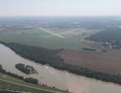
By: Big Orange Bird

By: RedHarrell


