Login
Register


TRM
Jacqueline Cochran Regional Airport
Official FAA Data Effective 2026-01-22 0901Z
Chart Supplement

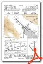
VFR Chart of KTRM
Sectional Charts at SkyVector.com
IFR Chart of KTRM
Enroute Charts at SkyVector.com
Location Information for KTRM
Coordinates: N33°37.60' / W116°9.58'Located 20 miles SE of Palm Springs, California on 1850 acres of land. View all Airports in California.
Surveyed Elevation is -114 feet MSL.
Operations Data
|
|
Airport Communications
| ASOS: | 118.325 Tel. 760-399-1494 |
|---|---|
| SOCAL APPROACH: | 135.275 251.1 |
| SOCAL DEPARTURE: | 135.275 251.1 |
| CLEARANCE DELIVERY: | 120.225 |
| CTAF: | 123.000 |
| SBONO STAR: | 126.7 370.95 |
| UNICOM: | 123.000 |
| SIZLR STAR: | 134.0 278.3 |
| CLOWD STAR: | 126.7 370.95 |
| ASOS at PSP (20.8 NW): | 760-322-7597 |
| ATIS at PSP (21.2 NW): | 124.65 |
| AWOS-3P at L08 (23.5 S): | 126.575 760-767-3308 |
- COMMUNICATIONS PRVDD BY RIVERSIDE RADIO ON FREQ 122.3 (THERMAL RCO).
Nearby Navigation Aids
|
| ||||||||||||||||||||||||||||||||||||||||||


Runway 17/35
| Dimensions: | 8500 x 150 feet / 2591 x 46 meters 200 FT BLAST PADS BOTH ENDS. | |
|---|---|---|
| Surface: | Asphalt in Good Condition | |
| Weight Limits: | S-75, D-200, ST-325, DT-850 | |
| Edge Lighting: | Medium Intensity | |
| Runway 17 | Runway 35 | |
| Coordinates: | N33°38.35' / W116°9.38' | N33°36.95' / W116°9.38' |
| Elevation: | -114.4 | -134.4 |
| Traffic Pattern: | Left | Left |
| Runway Heading: | 180° True | 0 |
| Markings: | Basic in good condition. | Non-Precision Instrument in good condition. |
| Glide Slope Indicator | P4L (3.00° Glide Path Angle) | P4L (3.00° Glide Path Angle) UNUSBL BYD 8 NM DUE TO TERRAIN. |
| REIL: | Yes | Yes |
Runway 12/30
| Dimensions: | 4995 x 100 feet / 1522 x 30 meters | |
|---|---|---|
| Surface: | Asphalt in Good Condition | |
| Weight Limits: | S-20, D-60 | |
| Edge Lighting: | Medium Intensity | |
| Runway 12 | Runway 30 | |
| Coordinates: | N33°37.81' / W116°10.26' | N33°37.23' / W116°9.56' |
| Elevation: | -115.0 | -130.3 |
| Traffic Pattern: | Left | Left |
| Runway Heading: | 135° True | 315° True |
| Markings: | Basic in good condition. | Non-Precision Instrument in good condition. |
| Glide Slope Indicator | P2L (3.00° Glide Path Angle) | P2L (3.00° Glide Path Angle) |
Services Available
| Fuel: | 100LL (blue), Jet-A |
|---|---|
| Transient Storage: | Hangars,Tiedowns |
| Airframe Repair: | MAJOR |
| Engine Repair: | MAJOR |
| Bottled Oxygen: | HIGH/LOW |
| Bulk Oxygen: | LOW |
| Other Services: | AIR AMBULANCE SERVICES,CHARTER SERVICE |
Ownership Information
| Ownership: | Publicly owned | |
|---|---|---|
| Owner: | COUNTY OF RIVERSIDE | |
| 4080 LEMON STREET, 14TH FLOOR | ||
| RIVERSIDE, CA 92501 | ||
| 951-955-9722 | ||
| Manager: | ANGELA JAMISON | |
| 4080 LEMON STREET, 14TH FLOOR | ||
| RIVERSIDE, CA 92501 | ||
| 951-955-9418 | ||
Other Remarks
- SOFT GND OFF RWY PAVEMENT.
- FOR CD CTC SOCAL APCH AT 800-448-3724.
- ACTVT REIL RWYS 17 & 35; PAPI RWYS 12, 17, 30 & 35; MIRL RWYS 12/30 & 17/35 - CTAF.
Weather Minimums

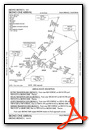
Standard Terminal Arrival (STAR) Charts


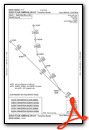
Instrument Approach Procedure (IAP) Charts


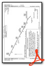
Departure Procedure (DP) Charts

Nearby Airports with Instrument Procedures
| ID | Name | Heading / Distance | ||
|---|---|---|---|---|
 |
KUDD | Bermuda Dunes Airport | 321° | 9.3 |
|
KPSP | Palm Springs International Airport | 305° | 21.2 |
|
L08 | Borrego Valley Airport | 200° | 23.5 |
|
KTNP | Twentynine Palms Airport | 019° | 32.1 |
|
KHMT | Hemet-Ryan Airport | 278° | 43.7 |
|
KCLR | Cliff Hatfield Memorial Airport | 132° | 43.7 |
|
F70 | French Valley Airport | 266° | 48.7 |
|
KBWC | Brawley Municipal Airport | 139° | 49.8 |
|
L35 | Big Bear City Airport | 317° | 51.6 |
|
KRNM | Ramona Airport | 227° | 51.8 |
|
KIPL | Imperial County Airport | 148° | 55.7 |
|
KREI | Redlands Municipal Airport | 299° | 56.4 |
Fuel Providers

Airport Images

By: phtm020


