Login
Register


00R
Livingston Municipal Airport
Official FAA Data Effective 2026-01-22 0901Z
Chart Supplement

VFR Chart of 00R
Sectional Charts at SkyVector.com
IFR Chart of 00R
Enroute Charts at SkyVector.com
Location Information for 00R
Coordinates: N30°41.15' / W95°1.08'Located 05 miles SW of Livingston, Texas on 63 acres of land. View all Airports in Texas.
Surveyed Elevation is 150 feet MSL.
Operations Data
|
|
Airport Communications
| CTAF: | 122.700 |
|---|---|
| UNICOM: | 122.700 |
| AWOS-3 at 6R3 (19.7 S): | 119.325 281-593-1754 |
| ATIS at CXO (28.6 SW): | 118.325 |
| ASOS at CXO (28.6 SW): | 936-760-4237 |
- APCH/DEP CTL SVC PRVDD BY HOUSTON ARTCC (ZHU) ON FREQS 125.175/285.575 (LUFKIN RCAG).
Nearby Navigation Aids
|
| ||||||||||||||||||||||||||||||||||||||||||||||||||||||||||||


Runway 12/30
| Dimensions: | 3704 x 60 feet / 1129 x 18 meters | |
|---|---|---|
| Surface: | Asphalt in Fair Condition | |
| Weight Limits: | S-11 | |
| Edge Lighting: | Medium Intensity | |
| Runway 12 | Runway 30 | |
| Coordinates: | N30°41.35' / W95°1.34' | N30°40.95' / W95°0.81' |
| Elevation: | 150.2 | 150.4 |
| Traffic Pattern: | Left | Left |
| Runway Heading: | 131° True | 311° True |
| Markings: | Non-Precision Instrument in fair condition. | Non-Precision Instrument in fair condition. |
| Obstacles: | 50 ft Trees 1200 ft from runway | 85 ft Trees 1200 ft from runway |
Services Available
| Fuel: | 100LL (blue) |
|---|---|
| Transient Storage: | Hangars,Tiedowns HNGRS ARE OFF ARPT PROPERTY. |
| Airframe Repair: | MAJOR |
| Engine Repair: | MAJOR |
| Bottled Oxygen: | NONE |
| Bulk Oxygen: | NONE |
| Other Services: | PILOT INSTRUCTION |
Ownership Information
| Ownership: | Publicly owned | |
|---|---|---|
| Owner: | CITY OF LIVINGSTON | |
| 200 WEST CHURCH | ||
| LIVINGSTON, TX 77351 | ||
| 936-327-4311 | ||
| Manager: | BILLY S. WIGGINS | CITY MGR. |
| 200 WEST CHURCH | ||
| LIVINGSTON, TX 77351 | ||
| 936-327-4311 | ||
Other Remarks
- FOR CD CTC HOUSTON ARTCC AT 281-230-5622.
Weather Minimums

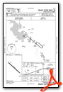
Instrument Approach Procedure (IAP) Charts
Nearby Airports with Instrument Procedures
| ID | Name | Heading / Distance | ||
|---|---|---|---|---|
 |
6R3 | Cleveland Municipal Airport | 178° | 19.7 |
|
KCXO | Conroe/North Houston Regional Airport | 226° | 28.6 |
|
KUTS | Huntsville Municipal Airport | 277° | 29.7 |
|
KLFK | Angelina County Airport | 022° | 35.6 |
|
T78 | Liberty Municipal Airport | 155° | 40.0 |
|
KDKR | Houston County Airport | 331° | 42.2 |
|
45R | Hawthorne Field Airport | 117° | 44.6 |
|
KIAH | George Bush Intcntl/Houston Airport | 201° | 45.2 |
|
KDWH | David Wayne Hooks Memorial Airport | 216° | 46.5 |
|
51R | Madisonville Municipal Airport | 285° | 50.1 |
|
KJAS | Jasper County/Bell Field Airport | 076° | 52.2 |
|
KHPY | Baytown Airport | 176° | 54.0 |
Airport Images
Do you have a recent image of this airport? Upload it here!


