Login
Register


12J
Brewton Municipal Airport
Official FAA Data Effective 2026-02-19 0901Z
Chart Supplement

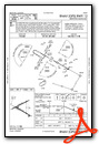
VFR Chart of 12J
Sectional Charts at SkyVector.com
IFR Chart of 12J
Enroute Charts at SkyVector.com
Location Information for 12J
Coordinates: N31°3.04' / W87°4.04'Located 03 miles S of Brewton, Alabama on 880 acres of land. View all Airports in Alabama.
Surveyed Elevation is 98 feet MSL.
Operations Data
|
|
Airport Communications
| AWOS-3PT: | 119.325 Tel. 251-809-2987 |
|---|---|
| PENSACOLA APPROACH: | 127.35 291.625 |
| PENSACOLA DEPARTURE: | 127.35 291.625 |
| UNICOM: | 122.725 |
| CTAF: | 122.725 |
| ASOS at NSE (19.5 S): | 850-623-7241 |
| ATIS at NSE (19.8 S): | 290.325 |
| ATIS at NDZ (21.3 S): | 273.575 |
Nearby Navigation Aids
|
| ||||||||||||||||||||||||||||||||||||||||||||||||||||||||||||


Runway 06/24
| Dimensions: | 5136 x 150 feet / 1565 x 46 meters | |
|---|---|---|
| Surface: | Asphalt in Fair Condition | |
| Weight Limits: | S-40, D-60 | |
| Runway 06 | Runway 24 | |
| Coordinates: | N31°3.00' / W87°4.55' | N31°3.38' / W87°3.67' |
| Elevation: | 80.9 | 83.3 |
| Traffic Pattern: | Left | Left |
| Runway Heading: | 63° True | 243° True |
| Markings: | Non-Precision Instrument in fair condition. | Non-Precision Instrument in fair condition. |
| Obstacles: | 10 ft Tree 245 ft from runway, 48 ft left of center | 97 ft Trees 1308 ft from runway, 92 ft left of center |
Runway 12/30
| Dimensions: | 5001 x 150 feet / 1524 x 46 meters | |
|---|---|---|
| Surface: | Asphalt in Poor Condition SFC EXPERIENCING EXTSV CRACKING. | |
| Weight Limits: | S-40, D-60 | |
| Edge Lighting: | Medium Intensity | |
| Runway 12 | Runway 30 | |
| Coordinates: | N31°3.10' / W87°4.38' | N31°2.68' / W87°3.55' |
| Elevation: | 82.1 | 98.8 |
| Traffic Pattern: | Left | Left |
| Runway Heading: | 120° True | 300° True |
| Markings: | Non-Precision Instrument in fair condition. | Non-Precision Instrument in fair condition. |
| Glide Slope Indicator | P2L (3.25° Glide Path Angle) UNUSBL BYD 6 DEG LEFT OF CNTRLN. | P2L (3.50° Glide Path Angle) |
| Obstacles: | 90 ft Trees 1913 ft from runway, 138 ft left of center | BRUSH LCTD 79 FT FM RWY END, 91 FT LEFT OF CNTLN. |
Services Available
| Fuel: | 100LL (blue), Jet A+ |
|---|---|
| Transient Storage: | Hangars,Tiedowns |
| Airframe Repair: | MAJOR |
| Engine Repair: | MAJOR |
| Bottled Oxygen: | NONE |
| Bulk Oxygen: | NONE |
| Other Services: | PILOT INSTRUCTION,AIRCRAFT RENTAL |
Ownership Information
| Ownership: | Publicly owned | |
|---|---|---|
| Owner: | CITY OF BREWTON | |
| PO BOX 368 | ||
| BREWTON, AL 36427 | ||
| 251-867-3281 | ||
| Manager: | MONTE MCGOUGHIN | |
| 111 DOGWOOD LANE W. | ||
| BREWTON, AL 36426 | ||
| 251-363-1551 | ||
Other Remarks
- USN PILOT TRNG FM WHITING FLD.
- FOR CD CTC PENSACOLA APCH AT 850-266-6884 OR 850-266-6885.
- MILITARY: MISC: OPR 1245-2230Z++ MON - FRI; SAT - SUN AS RQRD; CLSD HOL. MIL TRNG ACFT MNT UNICOM AND YIELD TO ALL CIV OPR. VFR TFC RQR TO STAY AT OR BLW 1000 FT AGL ON APCH TO ARPT. MIL ACFT RRQ PRIOR COORD WITH NAS WHITING FLD, DSN 868-7475, C850-623-7475.
- MARKINGS FADED, CNTLN OBSCURED.
- MARKINGS FADED, CNTLN OBSCURED.
- FIXED DISTANCE MARKER 500 FT FM RWY END.
- MARKINGS FADED, CNTLN OBSCURED.
- MARKINGS FADED, CNTLN OBSCURED.
- FIXED DISTANCE MARKER 500 FT FM RWY END.
- ACTVT PAPI RWY 12 & 30; MIRL RWY 12/30 - CTAF.
Weather Minimums

Instrument Approach Procedure (IAP) Charts


Nearby Airports with Instrument Procedures
| ID | Name | Heading / Distance | ||
|---|---|---|---|---|
 |
0R1 | Atmore Municipal Airport | 264° | 19.7 |
|
KNSE | Whiting Field NAS North Airport | 173° | 19.8 |
|
KNDZ | Whiting Field NAS South Airport | 172° | 21.3 |
|
KGZH | Evergreen Regional/Middleton Field Airport | 003° | 21.8 |
|
2R4 | Peter Prince Field Airport | 171° | 25.0 |
|
KMVC | Monroe County Aeroplex Airport | 329° | 28.4 |
|
KCEW | Bob Sikes Airport | 119° | 32.5 |
|
KPNS | Pensacola International Airport | 190° | 35.1 |
|
KEGI | Duke Field,(Eglin Af Aux Nr 3) Airport | 130° | 37.1 |
|
79J | South Alabama Regional At Bill Benton Field Airport | 065° | 38.0 |
|
0J4 | Florala Municipal Airport | 090° | 39.0 |
|
1R8 | Bay Minette Municipal Airport | 254° | 40.3 |
Airport Images
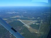
By: joeboe2


