Login
Register
15Z
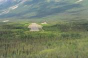
Mccarthy Airport
Official FAA Data Effective 2026-01-22 0901Z
VFR Chart of PAMX
Sectional Charts at SkyVector.com
IFR Chart of PAMX
Enroute Charts at SkyVector.com
Location Information for PAMX
Coordinates: N61°26.27' / W142°54.15'Located 01 miles NE of Mccarthy, Alaska. View all Airports in Alaska.
Surveyed Elevation is 1532 feet MSL.
Operations Data
|
|
Airport Communications
| CTAF: | 122.900 |
|---|
Nearby Navigation Aids
|
| ||||||||||||
Runway 01/19
| Dimensions: | 3501 x 60 feet / 1067 x 18 meters | |
|---|---|---|
| Surface: | Gravel-Dirt in Fair Condition | |
| Runway 01 | Runway 19 | |
| Coordinates: | N61°26.04' / W142°54.52' | N61°26.50' / W142°53.78' |
| Elevation: | 1531.0 | 1522.4 |
| Traffic Pattern: | Left | Left |
| Markings: | Non-Standard | Non-Standard |
| Obstacles: | 6 ft Brush 0 ft from runway, 90 ft right of center | 7 ft Brush 0 ft from runway, 110 ft right of center MT 2 MI FM RWY. |
Services Available
| Fuel: | NONE |
|---|---|
| Transient Storage: | Tiedowns |
| Airframe Repair: | NOT AVAILABLE |
| Engine Repair: | NOT AVAILABLE |
| Bottled Oxygen: | NOT AVAILABLE |
| Bulk Oxygen: | NOT AVAILABLE |
Ownership Information
| Ownership: | Publicly owned | |
|---|---|---|
| Owner: | ALASKA DOT&PF NORTHERN REGION | |
| 2301 PEGER ROAD | ||
| FAIRBANKS, AK 99709 | ||
| 907-451-2200 | ||
| Manager: | CHAD HELLER | |
| PO BOX 7 | ||
| GLENALLEN, AK 99588 | ||
| 907-822-3222 | ||
Other Remarks
- RWY COND UNMNT; RCMD VISUAL INSP PRIOR TO LNDG.
- WILDLIFE INVOF RWY.
- APCH OVR OLD MCCARTHY ARPT.
Nearby Airports with Instrument Procedures
| ID | Name | Heading / Distance | ||
|---|---|---|---|---|
 |
PAGK | Gulkana Airport | 301° | 84.5 |
 |
PACV | Merle K (Mudhole) Smith Airport | 234° | 94.4 |
 |
PAOR | Northway Airport | 016° | 95.7 |
 |
PFTO | Tok Junction Airport | 359° | 113.8 |


