Login
Register


16D
Perham Municipal Airport
Official FAA Data Effective 2026-01-22 0901Z
Chart Supplement

VFR Chart of 16D
Sectional Charts at SkyVector.com
IFR Chart of 16D
Enroute Charts at SkyVector.com
Location Information for 16D
Coordinates: N46°36.66' / W95°36.37'Located 02 miles NW of Perham, Minnesota on 80 acres of land. View all Airports in Minnesota.
Surveyed Elevation is 1376 feet MSL.
Operations Data
|
|
Airport Communications
| CTAF: | 122.900 |
|---|---|
| AWOS-3PT at DTL (17.4 NW): | 119.075 218-847-8626 |
| AWOS-3PT at ADC (19.0 SE): | 118.875 218-631-7774 |
| ASOS at PKD (28.0 NE): | 119.25 218-732-0920 |
- APCH/DEP SVC PRVDD BY MINNEAPOLIS ARTCC ON FREQS 126.1/269.2 (ALEXANDRIA RCAG).
Nearby Navigation Aids
|
| ||||||||||||||||||||||||||||||||||||||||||||||||||||||


Runway 13/31
| Dimensions: | 4102 x 75 feet / 1250 x 23 meters | |
|---|---|---|
| Surface: | Asphalt in Fair Condition | |
| Edge Lighting: | Medium Intensity | |
| Runway 13 | Runway 31 | |
| Coordinates: | N46°36.88' / W95°36.74' | N46°36.44' / W95°35.99' |
| Elevation: | 1376.0 | 1371.3 |
| Traffic Pattern: | Left | Left |
| Runway Heading: | 130° True | 310° True |
| Markings: | Non-Precision Instrument in good condition. | Non-Precision Instrument in good condition. |
| Glide Slope Indicator | P4L (3.00° Glide Path Angle) | P4L (3.00° Glide Path Angle) |
| REIL: | Yes | Yes |
Services Available
| Fuel: | 100LL (blue) |
|---|---|
| Transient Storage: | Hangars,Tiedowns |
| Airframe Repair: | NONE |
| Engine Repair: | NONE |
| Bottled Oxygen: | NONE |
| Bulk Oxygen: | NONE |
| Other Services: | CROP DUSTING SERVICES,AIRCRAFT SALES |
Ownership Information
| Ownership: | Publicly owned | |
|---|---|---|
| Owner: | CITY OF PERHAM | |
| 125 2ND ST NE,, P.O. BOX 130 | ||
| PERHAM, MN 56573 | ||
| 218-346-4455 | ||
| Manager: | JOHNATHAN SMITH | |
| 125 2ND ST NE,, P.O. BOX 130 | ||
| PERHAM, MN 56573 | ||
| (218) 346-4455 | ||
Other Remarks
- ULTRALIGHTS ON & INVOF ARPT.
- HEL OPS, NW CORNER OF ARPT.
- GCO AVBL ON FREQ 121.725.
- FOR CD IF UNA VIA GCO CTC MINNEAPOLIS ARTCC AT 651-463-5588.
- 0LL FUEL AVAIL 24 HRS W CREDIT CARD.
- MIRL RY 13/31 PRESET TO LOW INTENSITY; TO INCREASE INTENSITY AND ACTVT PAPI RY 13 & RY 31 AND REIL RY 13 & RY 31 - CTAF.
Weather Minimums

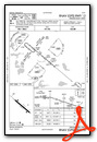
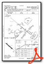
Instrument Approach Procedure (IAP) Charts
Nearby Airports with Instrument Procedures
| ID | Name | Heading / Distance | ||
|---|---|---|---|---|
 |
KDTL | Detroit Lakes/Wething Field Airport | 318° | 17.1 |
|
KADC | Wadena Municipal Airport | 120° | 19.1 |
|
KPKD | Park Rapids Municipal/Konshok Field Airport | 051° | 28.1 |
|
KFFM | Fergus Falls Regional Airport | 229° | 30.1 |
|
04Y | Hawley Municipal Airport | 298° | 34.8 |
|
KSAZ | Staples Municipal Airport | 112° | 35.9 |
|
Y63 | Elbow Lake Municipal/Pride of The Prairie Airport | 202° | 40.7 |
|
3N8 | Mahnomen County Airport | 341° | 41.2 |
|
KAXN | Alexandria Regional/Chandler Field Airport | 168° | 45.6 |
|
KJKJ | Moorhead Municipal/Florence Klingensmith Field Airport | 287° | 45.8 |
|
KBWP | Harry Stern Airport | 242° | 47.0 |
|
D00 | Norman County Ada/Twin Valley Airport | 320° | 50.9 |
Airport Images
Do you have a recent image of this airport? Upload it here!


