Login
Register
30PA
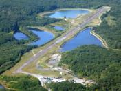
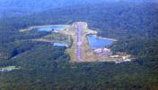
Nolnacs Airport
Official FAA Data Effective 2025-12-25 0901Z
VFR Chart of 30PA
Sectional Charts at SkyVector.com
IFR Chart of 30PA
Enroute Charts at SkyVector.com
Location Information for 30PA
Coordinates: N40°8.66' / W79°22.51'Located 02 miles W of Stahlstown, Pennsylvania. View all Airports in Pennsylvania.
Estimated Elevation is 1554 feet MSL.
Operations Data
|
|
Airport Communications
| ATIS at LBE (7.9 N): | 118.375 |
|---|---|
| AWOS-3 at LBE (8.1 N): | 724-537-0671 |
| AWOS-3P at VVS (17.1 SW): | 133.325 724-626-8745 |
Nearby Navigation Aids
|
| ||||||||||||||||||||||||||||||||||||||||||||||||||||||
Runway 10/28
| Dimensions: | 1169 x 100 feet / 356 x 30 meters | |
|---|---|---|
| Surface: | Turf | |
| Runway 10 | Runway 28 | |
| Coordinates: | N40°8.67' / W79°22.63' | N40°8.65' / W79°22.38' |
| Elevation: | 1554.0 | 1522.0 |
Ownership Information
| Ownership: | Privately Owned | |
|---|---|---|
| Owner: | SAM SCANLON | |
| 3855 ROUTE 981 | ||
| MOUNT PLEASANT, PA 15666 | ||
| 8173071137 | ||
| Manager: | ||
Other Remarks
- OWNER DESIRES ARPT BE CHARTED.
- PMSN TO LAND RQR BY OWNER.
Nearby Airports with Instrument Procedures
| ID | Name | Heading / Distance | ||
|---|---|---|---|---|
 |
KLBE | Arnold Palmer Regional Airport | 348° | 7.9 |
 |
KVVS | Joseph A Hardy Connellsville Airport | 229° | 17.1 |
 |
2G9 | Somerset County Airport | 110° | 17.7 |
 |
KFWQ | Rostraver Airport | 280° | 21.3 |
 |
KJST | John Murtha Johnstown/Cambria County Airport | 067° | 26.9 |
 |
KAGC | Allegheny County Airport | 296° | 28.4 |
 |
G05 | Finleyville Airpark Airport | 281° | 29.8 |
 |
KIDI | Indiana County/Jimmy Stewart Field Airport | 023° | 31.8 |
 |
9G8 | Ebensburg Airport | 055° | 33.5 |
 |
2G4 | Garrett County Airport | 176° | 33.8 |
 |
6P7 | Mcville Airport | 344° | 36.8 |
 |
KWAY | Greene County Airport | 247° | 37.8 |


