Login
Register


3D2
Ephraim/Gibraltar Airport
Official FAA Data Effective 2026-02-19 0901Z
Chart Supplement

VFR Chart of 3D2
Sectional Charts at SkyVector.com
IFR Chart of 3D2
Enroute Charts at SkyVector.com
Location Information for 3D2
Coordinates: N45°8.13' / W87°11.28'Located 01 miles SW of Ephraim, Wisconsin on 239 acres of land. View all Airports in Wisconsin.
Surveyed Elevation is 773 feet MSL.
Operations Data
|
|
Airport Communications
| AWOS-3PT: | 124.175 Tel. 920-854-5559 |
|---|---|
| GREEN BAY APPROACH: | 120.3 338.2 |
| GREEN BAY DEPARTURE: | 120.3 338.2 |
| CTAF: | 123.000 |
| UNICOM: | 123.000 |
| AWOS-3PT at 2P2 (18.8 NE): | 118.525 920 847 3024 |
| AWOS-3PT at MNM (19.1 W): | 121.45 906-863-8801 |
| AWOS-3PT at SUE (20.1 SW): | 128.325 920-743-7087 |
- APCH/DEP SVC PRVDD BY MINNEAPOLIS ARTCC ON FREQ 127.65 (ESCANABA RCAG) WHEN GREEN BAY APCH CTL CLSD.
Nearby Navigation Aids
|
| ||||||||||||||||||||||||||||||||||||||||||||||||||||||||||||


Runway 14/32
| Dimensions: | 2697 x 60 feet / 822 x 18 meters | |
|---|---|---|
| Surface: | Asphalt in Good Condition | |
| Weight Limits: | S-12 | |
| Edge Lighting: | Medium Intensity | |
| Runway 14 | Runway 32 | |
| Coordinates: | N45°8.28' / W87°11.37' | N45°7.96' / W87°10.94' |
| Elevation: | 763.0 | 750.7 |
| Traffic Pattern: | Left | Left |
| Runway Heading: | 136° True | 316° True |
| Markings: | Non-Precision Instrument in fair condition. | Non-Precision Instrument in fair condition. |
| Glide Slope Indicator | P2L (3.50° Glide Path Angle) | P2L (3.00° Glide Path Angle) |
Runway 01/19
| Dimensions: | 1941 x 100 feet / 592 x 30 meters | |
|---|---|---|
| Surface: | Turf in Fair Condition SLOPES MDTELY DOWN TO SOUTH--CANNOT SEE ONE END FM THE OTHER. | |
| Runway 01 | Runway 19 | |
| Coordinates: | N45°7.97' / W87°11.48' | N45°8.29' / W87°11.42' |
| Elevation: | 755.3 | 763.4 |
| Traffic Pattern: | Left | Left |
| Runway Heading: | 8° True | 188° True |
| Markings: | None | None |
Services Available
| Fuel: | 100LL (blue) |
|---|---|
| Transient Storage: | Tiedowns |
| Airframe Repair: | NONE |
| Engine Repair: | NONE |
| Bottled Oxygen: | NONE |
| Bulk Oxygen: | NONE |
Ownership Information
| Ownership: | Publicly owned | |
|---|---|---|
| Owner: | VILLAGE OF EPHRAIM | & TOWN OF GIBRALTAR. |
| PO BOX 850 | ||
| FISH CREEK, WI 54212 | ||
| 920-868-1714 | ||
| Manager: | TRAVIS THYSSEN | |
| P O BOX 850 | ||
| FISH CREEK, WI 54212 | ||
| 920-868-1714 | ARPT OFC PHONE NR 920-854-3312, AVBL JUN-OCT, FRI-SUN. | |
Other Remarks
- DEER NR MOVEMENT AREAS.
- FOR CD CTC GREEN BAY APCH AT 920-431-5741, WHEN GREEN BAY APCH CLSD, FOR CD CTC MINNEAPOLIS ARTCC AT 651-463-5588.
- MKD WITH YELLOW CONES.
- MKD WITH YELLOW CONES.
- 0LL 24 HR SELF SVC FUEL AVBL WITH CREDIT CARD.
- MIRL RWY 14/32 PRESET LOW SS-SR; INCR INTST AND ACTVT PAPI RWY 14 & 32; MIRL RWY 14/32 - CTAF.
Weather Minimums


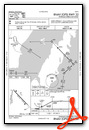
Instrument Approach Procedure (IAP) Charts

Nearby Airports with Instrument Procedures
| ID | Name | Heading / Distance | ||
|---|---|---|---|---|
 |
2P2 | Washington Island Airport | 036° | 18.8 |
|
KMNM | Menominee Regional Airport | 268° | 19.1 |
|
KSUE | Door County Cherryland Airport | 209° | 20.1 |
|
KOCQ | Oconto/J Douglas Bake Municipal Airport | 243° | 34.5 |
|
KESC | Delta County Airport | 006° | 35.5 |
|
KFKS | Frankfort Dow Memorial Field Airport | 125° | 52.1 |
|
KGRB | Green Bay/Austin Straubel International Airport | 226° | 56.1 |
|
KIMT | Ford Airport | 316° | 56.7 |
|
KEZS | Shawano Municipal Airport | 250° | 62.1 |
|
KMTW | Manitowoc County Airport | 199° | 64.0 |
|
KMBL | Manistee County/Blacker Airport | 141° | 65.6 |
|
KISQ | Schoolcraft County Airport | 040° | 66.1 |
Airport Images

By: WisDOT Aeronautics


