Login
Register


MNM
Menominee Regional Airport
Official FAA Data Effective 2026-02-19 0901Z
Chart Supplement

KMNM Airport Diagram

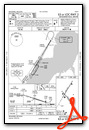
VFR Chart of KMNM
Sectional Charts at SkyVector.com
IFR Chart of KMNM
Enroute Charts at SkyVector.com
Location Information for KMNM
Coordinates: N45°7.60' / W87°38.31'Located 01 miles NW of Menominee, Michigan on 760 acres of land. View all Airports in Michigan.
Surveyed Elevation is 624 feet MSL.
Operations Data
|
|
Airport Communications
| AWOS-3PT: | 121.45 Tel. 906-863-8801 |
|---|---|
| GREEN BAY APPROACH: | 120.3 338.2 |
| GREEN BAY DEPARTURE: | 120.3 338.2 |
| CTAF: | 122.800 |
| UNICOM: | 122.800 |
| AWOS-3 at OCQ (19.0 SW): | 120.925 920-835-1599 |
| AWOS-3PT at 3D2 (19.1 E): | 124.175 920-854-5559 |
| AWOS-3PT at SUE (19.3 SE): | 128.325 920-743-7087 |
- APCH/DEP SVC PRVDD BY MINNEAPOLIS ARTCC ON 124.4/317.7 (MOSINEE RCAG) WHEN GREEN BAY APCH CLSD.
Nearby Navigation Aids
|
| ||||||||||||||||||||||||||||||||||||||||||||||||||||||||||||


Runway 03/21
| Dimensions: | 6001 x 100 feet / 1829 x 30 meters | |
|---|---|---|
| Surface: | Asphalt / Grooved in Excellent Condition | |
| Weight Limits: | S-80, D-100, ST-175
PCR VALUE: 365/F/D/X/T
| |
| Edge Lighting: | High Intensity | |
| Runway 03 | Runway 21 | |
| Coordinates: | N45°7.39' / W87°38.66' | N45°8.24' / W87°37.95' |
| Elevation: | 614.3 | 621.6 |
| Runway Heading: | 31° True | 211° True |
| Markings: | Precision Instrument in good condition. | Precision Instrument in good condition. |
| Glide Slope Indicator | P4L (3.00° Glide Path Angle) | |
| Approach Lights: | MALSR 1,400 Foot Medium-intensity Approach Lighting System with runway alignment indicator lights. | |
| REIL: | Yes | |
Runway 14/32
| Dimensions: | 5101 x 100 feet / 1555 x 30 meters | |
|---|---|---|
| Surface: | Asphalt in Good Condition | |
| Weight Limits: | S-30, D-35, ST-60 | |
| Edge Lighting: | Medium Intensity | |
| Runway 14 | Runway 32 | |
| Coordinates: | N45°7.67' / W87°38.70' | N45°7.03' / W87°37.94' |
| Elevation: | 621.1 | 605.1 |
| Traffic Pattern: | Left | Left |
| Runway Heading: | 140° True | 320° True |
| Markings: | Non-Precision Instrument in good condition. | Non-Precision Instrument in good condition. |
| Glide Slope Indicator | P4R (4.00° Glide Path Angle) | P4L (4.00° Glide Path Angle) |
| Obstacles: | 57 ft Trees 910 ft from runway, 400 ft left of center | 51 ft Tree 739 ft from runway, 238 ft left of center |
Services Available
| Fuel: | 100LL (blue), Jet A+ |
|---|---|
| Transient Storage: | Hangars,Tiedowns ROPES NOT PRVDD. |
| Airframe Repair: | MAJOR |
| Engine Repair: | MAJOR |
| Bottled Oxygen: | HIGH/LOW |
| Bulk Oxygen: | NONE |
| Other Services: | PILOT INSTRUCTION,AIRCRAFT RENTAL |
Ownership Information
| Ownership: | Publicly owned | |
|---|---|---|
| Owner: | MENOMINEE COUNTY | |
| 2801 22ND ST | ||
| MENOMINEE, MI 49858-3401 | ||
| 906-863-8408 | ||
| Manager: | JEFF LAFLEUR | |
| 2801 22ND ST | ||
| MENOMINEE, MI 49858-3401 | ||
| 715-938-2006 | CELL. ASST AMGR CELL 262-365-1991. | |
Other Remarks
- DEER, BIRDS, & WILDLIFE ON & INVOF ARPT.
- 0LL 100LL AVBL H24 SELF SVC VIA CREDIT CARD.
- ACTVT MALSR RWY 03; REIL RWY 21; PAPI RWY 21, 14, & 32; HIRL RWY 03/21; MIRL RWY 14/32 - CTAF.
Weather Minimums


Instrument Approach Procedure (IAP) Charts


Nearby Airports with Instrument Procedures
| ID | Name | Heading / Distance | ||
|---|---|---|---|---|
 |
KOCQ | Oconto/J Douglas Bake Municipal Airport | 217° | 19.1 |
|
3D2 | Ephraim/Gibraltar Airport | 088° | 19.1 |
|
KSUE | Door County Cherryland Airport | 151° | 19.3 |
|
2P2 | Washington Island Airport | 062° | 34.1 |
|
KESC | Delta County Airport | 032° | 42.5 |
|
KGRB | Green Bay/Austin Straubel International Airport | 208° | 43.9 |
|
KEZS | Shawano Municipal Airport | 242° | 44.2 |
|
KIMT | Ford Airport | 334° | 46.1 |
|
KCLI | Clintonville Municipal Airport | 236° | 55.9 |
|
Y55 | Crandon/Steve Conway Municipal Airport | 293° | 59.5 |
|
KMTW | Manitowoc County Airport | 181° | 59.9 |
|
KAIG | Langlade County Airport | 272° | 62.5 |
Airport Images
Do you have a recent image of this airport? Upload it here!


