Login
Register
58M
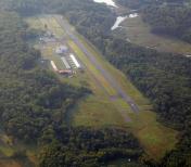
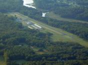
Claremont Airport
Official FAA Data Effective 2026-01-22 0901Z
VFR Chart of 58M
Sectional Charts at SkyVector.com
IFR Chart of 58M
Enroute Charts at SkyVector.com
Location Information for 58M
Coordinates: N39°34.45' / W75°52.19'Located 03 miles SW of Elkton, Maryland on 22 acres of land. View all Airports in Maryland.
Surveyed Elevation is 106 feet MSL.
Operations Data
|
|
Airport Communications
| PHILADELPHIA APPROACH: | 118.35 323.1 |
|---|---|
| PHILADELPHIA DEPARTURE: | 118.35 323.1 |
| UNICOM: | 122.800 |
| CTAF: | 122.800 |
| AWOS-3 at EVY (7.7 SE): | 132.325 302-378-2063 |
| ATIS at ILG (13.7 NE): | 123.95 |
| ASOS at ILG (13.7 NE): | 123.95 302-217-3317 |
- APCH/DEP SVC PRVDD BY PHILADELPHIA (PHL) APCH CTL ON 118.35/323.1
Nearby Navigation Aids
|
| ||||||||||||||||||||||||||||||||||||||||||||||||||||||||||||
Runway 13/31
RWY 13/31 NO TGL. | ||
| Dimensions: | 2989 x 70 feet / 911 x 21 meters | |
|---|---|---|
| Surface: | Asphalt / Aggregate Friction Seal Coated in Fair Condition UNFILLED CRACKS, ALLIGATOR CRACKING, LATERAL & LONGL CRACKING, VEG GROWTH, OXIDATION. | |
| Edge Lighting: | Medium Intensity | |
| Runway 13 | Runway 31 | |
| Coordinates: | N39°34.56' / W75°52.47' | N39°34.34' / W75°51.90' |
| Elevation: | 106.4 | 62.2 |
| Traffic Pattern: | Left | Left |
| Runway Heading: | 116° True | 296° True |
| Displaced Threshold: | 288 Feet | 601 Feet |
| Markings: | Basic in fair condition. | Non-Precision Instrument in fair condition. |
| Glide Slope Indicator | P2R (5.00° Glide Path Angle) | P2L (4.00° Glide Path Angle) |
| REIL: | Yes | Yes |
| Obstacles: | 49 ft Trees 803 ft from runway, 28 ft left of center APCH SLOPE 20:1 TO DSPLCD THR AT CNTRLN. |
102 ft Trees 476 ft from runway, 110 ft right of center APCH SLOPE 20:1 TO DSPLCD THR AT CNTRLN. PLINE, MKD 10 FT, 40 FT FM THR. TREES 35 FT, 145 FT FM THR. |
Services Available
| Fuel: | 100LL (blue) |
|---|---|
| Transient Storage: | Tiedowns |
| Airframe Repair: | MINOR |
| Engine Repair: | MINOR |
| Bottled Oxygen: | NOT AVAILABLE |
| Bulk Oxygen: | NOT AVAILABLE |
| Other Services: | AVIONICS |
Ownership Information
| Ownership: | Privately Owned | |
|---|---|---|
| Owner: | CJ FLIGHT CLA LLC | CJ FLIGHT CLA LLC DBA CLAREMONT AIRPORT. |
| P.O. BOX 445 | ||
| ELKTON, MD 21922 | ||
| (410) 398-0234 | ||
| Manager: | MARY HALL | |
| P.O. BOX 445 | ||
| ELKTON, MD 21922 | ||
| (410) 398-0234 | ||
Other Remarks
- DEER & BIRDS ON & INVOF ARPT.
- REDUCED BRAKING ACTION RWY 13 DOWNHILL 1.5 DEG.
- CALM/LIGHT WIND USE RWY 31.
- FOR CD CTC PHILADELPHIA APCH AT (800) 354-9884.
- FADED.
- FADED.
- 0LL SELF SERVE.
- ACTVT REIL RWY 13 & 31; PAPI RWY 13 & 31; MIRL RWY 13/31 - 123.0.
- ACTVT ROTG BCN - 123.0.
Weather Minimums
Instrument Approach Procedure (IAP) Charts
Nearby Airports with Instrument Procedures
| ID | Name | Heading / Distance | ||
|---|---|---|---|---|
 |
KEVY | Summit Airport | 115° | 7.5 |
 |
KILG | New Castle Airport | 062° | 13.7 |
 |
0W3 | Harford County Airport | 268° | 15.5 |
 |
N57 | New Garden Airport | 016° | 16.1 |
 |
KMQS | Chester County G O Carlson Airport | 000° | 24.3 |
 |
33N | Delaware Airpark Airport | 149° | 24.7 |
 |
KOQN | Brandywine Regional Airport | 028° | 28.3 |
 |
KMTN | Martin State Airport | 239° | 29.3 |
 |
KDOV | Dover AFB Airport | 144° | 32.6 |
 |
KPHL | Philadelphia International Airport | 058° | 34.2 |
 |
KRJD | Gooden Airpark Airport | 179° | 36.2 |
 |
KLNS | Lancaster Airport | 329° | 38.3 |


