Login
Register
6B6
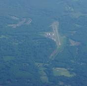
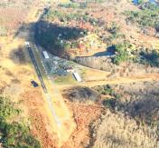
Minute Man Air Field Airport
Official FAA Data Effective 2026-01-22 0901Z
VFR Chart of 6B6
Sectional Charts at SkyVector.com
IFR Chart of 6B6
Enroute Charts at SkyVector.com
Location Information for 6B6
Coordinates: N42°27.62' / W71°31.08'Located 02 miles N of Stow, Massachusetts on 225 acres of land. View all Airports in Massachusetts.
Estimated Elevation is 280 feet MSL.
Operations Data
|
|
Airport Communications
| BOSTON APPROACH: | 124.4 279.6 |
|---|---|
| BOSTON DEPARTURE: | 124.4 279.6 |
| CTAF: | 122.800 |
| UNICOM: | 122.800 |
| ATIS at BED (10.2 E): | 124.6 |
| ASOS at BED (10.2 E): | 124.6 781-372-5512 |
| ASOS at FIT (12.0 NW): | 135.175 978-343-9121 |
Nearby Navigation Aids
|
| ||||||||||||||||||||||||||||||||||||||||||||||||||||||||||||
Runway 03/21
| Dimensions: | 3110 x 48 feet / 948 x 15 meters | |
|---|---|---|
| Surface: | Asphalt in Excellent Condition | |
| Weight Limits: | S-12 | |
| Edge Lighting: | Low Intensity | |
| Runway 03 | Runway 21 | |
| Coordinates: | N42°27.40' / W71°31.23' | N42°27.89' / W71°31.03' |
| Elevation: | 280.0 | 268.0 |
| Traffic Pattern: | Left | Left |
| Runway Heading: | 17° True | 197° True |
| Markings: | Basic in good condition. | Non-Precision Instrument in good condition. |
| Glide Slope Indicator | P2L (3.50° Glide Path Angle) | |
| REIL: | Yes | |
| Obstacles: | 156 ft Trees 2085 ft from runway | 98 ft Trees 1750 ft from runway, 150 ft left of center |
Runway 12/30
| Dimensions: | 1600 x 40 feet / 488 x 12 meters | |
|---|---|---|
| Surface: | Turf in Excellent Condition | |
| Runway 12 | Runway 30 | |
| Coordinates: | N42°27.62' / W71°31.15' | N42°27.55' / W71°30.81' |
| Elevation: | 259.0 | 254.0 |
| Traffic Pattern: | Left | Left |
| Runway Heading: | 106° True | 286° True |
| Obstacles: | 30 ft Trees 300 ft from runway | 50 ft Trees 400 ft from runway, 125 ft left of center |
Services Available
| Fuel: | 100LL (blue) |
|---|---|
| Transient Storage: | Hangars,Tiedowns |
| Airframe Repair: | MAJOR |
| Engine Repair: | MAJOR |
| Bottled Oxygen: | NONE |
| Bulk Oxygen: | NONE |
| Other Services: | PILOT INSTRUCTION,AIRCRAFT RENTAL,AIRCRAFT SALES |
Ownership Information
| Ownership: | Privately Owned | |
|---|---|---|
| Owner: | MINUTE MAN AIRFIELD INC | |
| 302 BOXBORO RD | ||
| STOW, MA 01775 | ||
| 978-897-3933 | ||
| Manager: | DONALD MC PHERSON | |
| 302 BOXBORO RD | ||
| STOW, MA 01775 | ||
| 978-897-3933 | ||
Other Remarks
- TPA FOR LGT ACFT 1032 FT AGL.
- BFR USING RWY 12/30 CALL AMGR TO DTRM RWY CONDS.
- TREE OBSTN IN APCH; PRIM & TRSN SFCS RWYS 03 & 12/30.
- NOISE ABATEMENT PROCS IN EFCT NTFY AMGR 978-897-3933 OF INTN TO OPR BTN 2300-0600.
- FOR CD CTC BOSTON APCH AT 603-594-5552.
- ACTVT REIL RWY 21 - CTAF.
Weather Minimums
Instrument Approach Procedure (IAP) Charts
Nearby Airports with Instrument Procedures
| ID | Name | Heading / Distance | ||
|---|---|---|---|---|
 |
KBED | Laurence G Hanscom Field Airport | 086° | 10.2 |
 |
KFIT | Fitchburg Municipal Airport | 297° | 12.1 |
 |
KASH | Boire Field Airport | 000° | 19.3 |
 |
KORH | Worcester Regional Airport | 234° | 19.7 |
 |
1B6 | Hopedale Industrial Park Airport | 179° | 21.2 |
 |
KOWD | Norwood Memorial Airport | 136° | 22.3 |
 |
KGDM | Gardner Municipal Airport | 283° | 22.7 |
 |
KLWM | Lawrence Municipal Airport | 048° | 23.3 |
 |
KBOS | General Edward Lawrence Logan International Airport | 104° | 23.5 |
 |
KBVY | Beverly Regional Airport | 074° | 27.7 |
 |
KMHT | Manchester Boston Regional Airport | 007° | 28.6 |
 |
KAFN | Jaffrey Airfield Silver Ranch Airport | 314° | 29.8 |


