Login
Register


9D4
Deck Airport
Official FAA Data Effective 2026-01-22 0901Z
Chart Supplement

VFR Chart of 9D4
Sectional Charts at SkyVector.com
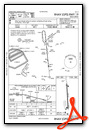
IFR Chart of 9D4
Enroute Charts at SkyVector.com
Location Information for 9D4
Coordinates: N40°21.13' / W76°19.78'Located 01 miles SW of Myerstown, Pennsylvania on 92 acres of land. View all Airports in Pennsylvania.
Surveyed Elevation is 523 feet MSL.
Operations Data
|
|
Airport Communications
| AWOS-2: | 118.45 Tel. 717-866-2906 |
|---|---|
| HARRISBURG APPROACH: | 118.25 269.45 |
| HARRISBURG DEPARTURE: | 118.25 269.45 |
| UNICOM: | 122.800 |
| CTAF: | 122.800 |
| ASOS at MUI (11.9 NW): | 124.175 717-861-6493 |
| ASOS at LNS (13.9 S): | 125.675 717-568-6942 |
| ATIS at LNS (13.9 S): | 125.675 |
Nearby Navigation Aids
|
| ||||||||||||||||||||||||||||||||||||||||||||||||||||||||||||


Runway 01/19
| Dimensions: | 3786 x 50 feet / 1154 x 15 meters | |
|---|---|---|
| Surface: | Asphalt in Good Condition | |
| Weight Limits: | S-12 | |
| Edge Lighting: | Medium Intensity NO AMBER CAUTION LGTS LAST HALF OF RWY. | |
| Runway 01 | Runway 19 | |
| Coordinates: | N40°20.82' / W76°19.74' | N40°21.44' / W76°19.82' |
| Elevation: | 511.3 | 523.3 |
| Runway Heading: | 354° True | 174° True |
| Displaced Threshold: | 177 Feet | |
| Markings: | Basic in fair condition. | Non-Precision Instrument in fair condition. |
| Glide Slope Indicator | P2L (3.00° Glide Path Angle) | P2L (4.00° Glide Path Angle) |
| REIL: | Yes NSTD REIL - STROBE LGTS IDENTIFY RWY ENDS. | Yes NSTD REIL - STROBE LGTS IDENTIFY RWY ENDS. |
| Obstacles: | 34 ft Building 420 ft from runway, 243 ft left of center FUEL TANK 22 FT OFF AER AND 208 FT L. |
|
Services Available
| Fuel: | 100LL (blue), Jet-A |
|---|---|
| Transient Storage: | Hangars,Tiedowns |
| Airframe Repair: | MAJOR |
| Engine Repair: | MAJOR |
| Bottled Oxygen: | HIGH |
| Bulk Oxygen: | HIGH |
| Other Services: | CHARTER SERVICE,AIRCRAFT RENTAL |
Ownership Information
| Ownership: | Privately Owned | |
|---|---|---|
| Owner: | CLYDE E DECK | |
| 351 S RAMONA RD | ||
| LEBANON, PA 17042 | ||
| 717-866-6529 | ||
| Manager: | CLYDE E DECK | |
| 351 S RAMONA RD | ||
| LEBANON, PA 17042 | ||
| 717-866-4388 | 717-866-2184. | |
Other Remarks
- THIS AIRPORT HAS BEEN SURVEYED BY THE NATIONAL GEODETIC SURVEY.
- FOR CD CTC HARRISBURG APCH AT 800-932-0712.
- ACFT HGR 570 FT BEHIND RWY 01 THR & 212 FT LEFT. ACFT MAY BE PARKED 57 FT BEHIND RWY 01 THLD & 132 FT LEFT.
- RWY 01/19 TURN AROUND AREA AT DEP END OF RWY 01 LEFT SIDE.
- HOVERING BY LRG MIL HEL NA.
- ACTVT REIL RWY 01 & 19; PAPI RWY 01 & 19; MIRL RWY 01/19 - CTAF.
- ACTVT ROTG BCN - CTAF.
Weather Minimums

Instrument Approach Procedure (IAP) Charts

Nearby Airports with Instrument Procedures
| ID | Name | Heading / Distance | ||
|---|---|---|---|---|
 |
08N | Keller Brothers Airport | 179° | 3.6 |
|
58N | Reigle Field Airport | 251° | 12.0 |
|
KLNS | Lancaster Airport | 173° | 13.9 |
|
74N | Bendigo Airport | 319° | 16.3 |
|
KRDG | Reading Regional/Carl A Spaatz Field Airport | 084° | 16.8 |
|
N71 | Donegal Springs Airpark Airport | 215° | 19.2 |
|
KZER | Schuylkill County/Joe Zerbey Airport | 354° | 21.4 |
|
KMDT | Harrisburg International Airport | 244° | 22.0 |
|
KCXY | Capital City Airport | 251° | 25.3 |
|
N47 | Pottstown Municipal Airport | 100° | 30.7 |
|
N79 | Northumberland County Airport | 340° | 30.8 |
|
KMQS | Chester County G O Carlson Airport | 136° | 30.9 |
Airport Images
")
By: N714AJ
")
By: N714AJ


