Login
Register


A08
Vaiden Field Airport
Official FAA Data Effective 2025-11-27 0901Z
Chart Supplement

VFR Chart of A08
Sectional Charts at SkyVector.com
IFR Chart of A08
Enroute Charts at SkyVector.com
Location Information for A08
Coordinates: N32°30.63' / W87°23.09'Located 08 miles SW of Marion, Alabama on 480 acres of land. View all Airports in Alabama.
Surveyed Elevation is 220 feet MSL.
Operations Data
|
|
Airport Communications
| CTAF: | 122.900 |
|---|---|
| AWOS-3PT at SEM (22.5 SE): | 119.15 (334) 872-9090 |
| AWOS-3P at DYA (29.0 W): | 119.475 |
| ASOS at TCL (43.7 N): | 132.825 205-750-8940 |
- APCH/DEP SVC PRVDD BY ATLANTA ARTCC ON FREQS 132.25/263.025 (UNIONTOWN RCAG).
Nearby Navigation Aids
|
| ||||||||||||||||||||||||||||||||||||||||||||||||||||||


Runway 16/34
| Dimensions: | 6400 x 80 feet / 1951 x 24 meters | |
|---|---|---|
| Surface: | Asphalt in Fair Condition 80 FT OVERLAY; SIDE TRSNS SMOOTH. | |
| Weight Limits: | S-30, D-50 | |
| Edge Lighting: | Medium Intensity LCTD 10 FT FROM RWY EDGE. | |
| Runway 16 | Runway 34 | |
| Coordinates: | N32°31.14' / W87°23.27' | N32°30.13' / W87°22.91' |
| Elevation: | 219.8 | 207.8 |
| Runway Heading: | 163° True | 343° True |
| Markings: | Non-Precision Instrument in poor condition. | Non-Precision Instrument in poor condition. |
| Glide Slope Indicator | P2L (3.00° Glide Path Angle) | P2L (3.00° Glide Path Angle) |
Services Available
| Fuel: | 100LL (blue), Jet-A |
|---|---|
| Transient Storage: | Tiedowns |
| Airframe Repair: | NONE |
| Engine Repair: | NONE |
| Bottled Oxygen: | NONE |
| Bulk Oxygen: | NONE |
| Other Services: | CROP DUSTING SERVICES,PILOT INSTRUCTION |
Ownership Information
| Ownership: | Publicly owned | |
|---|---|---|
| Owner: | PERRY COUNTY ARPT & INDUSTRIAL AUTH | |
| P.O. BOX 666 | ||
| MARION, AL 36756 | ||
| 734-250-4119 | ||
| Manager: | DONALD BENNETT | |
| 5310 VAIDEN ACCESS | ||
| MARION JUNCTION, AL 36759 | ||
| 734-250-4119 | ||
Other Remarks
- FOR CD CTC ATLANTA ARTCC AT 770-210-7692.
- MARKINGS ALMOST COMPLETELY GONE
- MARKINGS SVRLY FADED OR OBSC.
- ACTVT PAPI RWY 16 & 34; MIRL RWY 16/34 - CTAF.
Weather Minimums
Instrument Approach Procedure (IAP) Charts
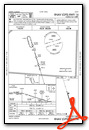

Nearby Airports with Instrument Procedures
| ID | Name | Heading / Distance | ||
|---|---|---|---|---|
 |
7A0 | Greensboro Municipal Airport | 306° | 17.4 |
|
KSEM | Craig Field Airport | 116° | 22.5 |
|
KDYA | Demopolis Regional Airport | 264° | 29.0 |
|
0A8 | Bibb County Airport | 030° | 29.6 |
|
61A | Camden Municipal Airport | 175° | 31.9 |
|
02A | Chilton County Airport | 062° | 44.1 |
|
KTCL | Tuscaloosa Ntl Airport | 344° | 44.0 |
|
1A9 | Prattville/Grouby Field Airport | 095° | 44.5 |
|
09A | Butler/Choctaw County Airport | 238° | 44.4 |
|
KEET | Shelby County Airport | 037° | 50.2 |
|
KMGM | Montgomery Regional (Dannelly Field) Airport | 103° | 51.9 |
|
KMXF | Maxwell AFB Airport | 098° | 52.3 |
Airport Images
Do you have a recent image of this airport? Upload it here!


