Login
Register
AFO
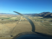
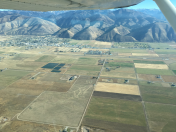
Afton Lincoln County/General Boyd L Eddins Field Airport
Official FAA Data Effective 2025-12-25 0901Z
VFR Chart of KAFO
Sectional Charts at SkyVector.com
IFR Chart of KAFO
Enroute Charts at SkyVector.com
Location Information for KAFO
Coordinates: N42°42.53' / W110°56.53'Located 01 miles SW of Afton, Wyoming on 328 acres of land. View all Airports in Wyoming.
Surveyed Elevation is 6220 feet MSL.
Operations Data
|
|
Airport Communications
| AWOS-3P: | 119.025 Tel. 307-885-2654 |
|---|---|
| UNICOM: | 122.800 |
| CTAF: | 122.800 |
| AWOS-3 at 46U (28.4 N): | 119.925 307-654-2004 |
| AWOS-3 at 1U7 (32.5 SW): | 118.525 208 847 0613 |
| ASOS at BPI (37.4 E): | 135.225 307-276-9917 |
- APCH/DEP CTL SVC PRVDD BY SALT LAKE ARTCC (ZLC) ON FREQS 128.35/239.25 (BLACKFOOT RCAG).
- COMMUNICATIONS PRVDD BY CASPER RADIO ON FREQ 122.3 (BIG PINEY RCO).
Nearby Navigation Aids
|
| ||||||||||||||||||||||||||||||||||||
Runway 16/34
| Dimensions: | 7025 x 75 feet / 2141 x 23 meters | |
|---|---|---|
| Surface: | Asphalt in Good Condition | |
| Weight Limits: | S-24 | |
| Edge Lighting: | Medium Intensity | |
| Runway 16 | Runway 34 | |
| Coordinates: | N42°43.10' / W110°56.53' | N42°41.95' / W110°56.53' |
| Elevation: | 6187.7 | 6220.9 |
| Traffic Pattern: | Right | |
| Runway Heading: | 180° True | 0 |
| Markings: | Non-Precision Instrument in fair condition. | Non-Precision Instrument in fair condition. |
| Glide Slope Indicator | P4L (3.50° Glide Path Angle) | P4L (3.50° Glide Path Angle) RWY 34 PAPI DOES NOT PRVD OBST CLNC BYD 5.0 NM FM THR, UNUSBL BYD 5.0 NM. |
| REIL: | Yes | Yes |
| Obstacles: | 51 ft Pole 1290 ft from runway, 278 ft left of center | 90 ft Tree 2014 ft from runway, 185 ft right of center |
Services Available
| Fuel: | 100LL (blue), Jet-A |
|---|---|
| Transient Storage: | Hangars,Tiedowns PILOT SUPD ROPES RQRD. |
| Airframe Repair: | MAJOR |
| Engine Repair: | MAJOR |
| Bottled Oxygen: | NONE |
| Bulk Oxygen: | LOW |
| Other Services: | PILOT INSTRUCTION,AIRCRAFT RENTAL |
Ownership Information
| Ownership: | Publicly owned | |
|---|---|---|
| Owner: | TOWN OF AFTON | ALSO LINCOLN COUNTY-307-877-2004. |
| BOX 1181 | ||
| AFTON, WY 83110 | ||
| (307) 885-9831 | ||
| Manager: | RICK SESSIONS | |
| BOX 1181 | ||
| AFTON, WY 83110 | ||
| 307-885-3245 | ||
Other Remarks
- SNBNKS 4 FT TO 7 FT ALG RWYS & TXYS EDGES FM NOV-APR WITH SLICK SPOTS ALL SFCS.
- COLD TEMPERATURE AIRPORT. ALTITUDE CORRECTION REQUIRED AT OR BELOW -18C.
- FOR CD CTC SALT LAKE ARTCC AT 801-320-2568.
- WILDLIFE ON & INVOF ARPT.
- 0LL AVBL H24 SELF SVC VIA CREDIT CARD. FULL SERVICE AVBL WITH CALL OUT 307-885-7030.
- FUEL 24 HR CREDIT CARD SVC; FULL SVC JET AVBL WITH CALLOUT 307-8881485.
- ACTVT REIL RWY 16 & 34; MIRL RWY 16/34 - CTAF. PAPI RWY 16 & 34 OPR CONSLY.
Weather Minimums
Instrument Approach Procedure (IAP) Charts
Departure Procedure Obstacles (DPO) Charts
Nearby Airports with Instrument Procedures
| ID | Name | Heading / Distance | ||
|---|---|---|---|---|
 |
1U7 | Bear Lake County Airport | 212° | 32.7 |
 |
KBPI | Miley Memorial Field Airport | 101° | 37.7 |
 |
KPNA | Ralph Wenz Field Airport | 083° | 50.3 |
 |
KJAC | Jackson Hole Airport | 009° | 54.6 |
 |
KEMM | Kemmerer Municipal Airport | 161° | 55.8 |
 |
KDIJ | Driggs/Reed Memorial Airport | 354° | 62.6 |
 |
KLGU | Logan-Cache Airport | 216° | 68.3 |
 |
U02 | Mccarley Field Airport | 296° | 68.9 |
 |
KIDA | Idaho Falls Regional Airport | 314° | 69.2 |
 |
KPIH | Pocatello Regional Airport | 279° | 74.0 |
 |
KDUB | Dubois Municipal Airport | 047° | 74.6 |
 |
KRXE | Rexburg-Madison County Airport | 331° | 77.4 |


