Login
Register


APG
Phillips AAF Airport
Official FAA Data Effective 2026-01-22 0901Z
Chart Supplement

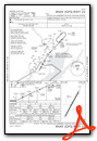
VFR Chart of KAPG
Sectional Charts at SkyVector.com
IFR Chart of KAPG
Enroute Charts at SkyVector.com
Location Information for KAPG
Coordinates: N39°27.93' / W76°10.10'Located 02 miles S of Aberdeen Proving Grounds (Aberdeen), Maryland. View all Airports in Maryland.
Surveyed Elevation is 44 feet MSL.
Operations Data
|
|
Airport Communications
| POTOMAC APPROACH: | 125.525 291.625 |
|---|---|
| POTOMAC DEPARTURE: | 125.525 291.625 |
| CTAF: | 126.150 |
| VFR ADZY: | 126.15 |
| AWOS-3PT at 0W3 (6.5 N): | 132.725 667-340-6003 |
| AWOS-3PT at MTN (14.0 SW): | 410-682-8848 |
| ATIS at MTN (14.1 SW): | 124.925 |
- OPR 1300-2100Z++ MON-FRI EXC HOL.
Nearby Navigation Aids
|
| ||||||||||||||||||||||||||||||||||||||||||||||||||||||||||||


Runway 04/22
| Dimensions: | 7998 x 200 feet / 2438 x 61 meters | |
|---|---|---|
| Surface: | Asphalt | |
| Weight Limits: | 44 /F/A/W/T | |
| Edge Lighting: | High Intensity | |
| Runway 04 | Runway 22 | |
| Coordinates: | N39°27.35' / W76°10.50' | N39°28.51' / W76°9.69' |
| Elevation: | 27.6 | 44.5 |
| Markings: | Precision Instrument in good condition. | Precision Instrument in good condition. |
| Glide Slope Indicator | P4L (3.00° Glide Path Angle) | |
| REIL: | Yes | |
Ownership Information
| Ownership: | Owned by the Army | |
|---|---|---|
| Owner: | US ARMY ATCA-ASO | |
| CAMERON STA | ||
| ALEXANDRIA, VA 22314 | ||
| Manager: | WARREN HADAWAY | |
| 410-278-4902 | ||
Other Remarks
- MISC- AFLD SIGNS NSTD OR MISSING. AFLD MARKINGS FADED OR MISSING.
- FOR CD WHEN ADVSY CLSD CTC POTOMAC APCH AT 866-429-5882.
- CSTMS/AG/IMG: CSTMS AND IMG AVBL 48 PN.
- MISC: SEE AP/1 FLIP FOR VFR/SVFR ARR/DEP PRO.
- FUEL: J8.
- OIL: 0-113-556(MIL).
- MISC: OPR 1100-2300Z++ MON-FRI EXC HOL.
- RSTD: 48 HR PPR ALL ACFT. C410-278-3483/3074. RWY 08/26 LTD TO 25,000 LB GWT. TOUCH AND GO LDG PROH WHILE VEH TEST IN PROGRESS, LO APCH ONLY.
- CAUTION: IMPACT AREA 1300 YD 'S' OF RWY 04/22 AND 2.5 MILES 'SW' OF DEP ENF OF RWY 22. DEER HAZ. CTC ADVSY 15 MIN PRIOR TO ARR TO ARNG DEER SWEEP. IF ADVSY CLSD USE EXTREME CAUTION.
- NS ABTMT: NOISE SENSITIVE AREA. USE NS ABTMT OPR PRO.
- MISC: ARFF PROTECTION NOT LCTD ON AFLD.
- ACFT RESCUE AND FIRE FIGHTING PROTECTION NOT LCTD ON AFLD.
- ACTVT HIRL RWY 04/22, REIL RWY 22; TWY A LGT - CTAF. PAPI RWY 22 OPR H24.
Weather Minimums

Instrument Approach Procedure (IAP) Charts
Nearby Airports with Instrument Procedures
| ID | Name | Heading / Distance | ||
|---|---|---|---|---|
 |
0W3 | Harford County Airport | 344° | 6.4 |
|
KMTN | Martin State Airport | 233° | 14.2 |
|
58M | Claremont Airport | 064° | 15.3 |
|
KEVY | Summit Airport | 080° | 20.9 |
|
N57 | New Garden Airport | 040° | 28.6 |
|
KILG | New Castle Airport | 063° | 29.0 |
|
KBWI | Baltimore/Washington International Thurgood Marshall Airport | 233° | 29.1 |
|
33N | Delaware Airpark Airport | 119° | 30.3 |
|
W29 | Bay Bridge Airport | 194° | 30.3 |
|
KRJD | Gooden Airpark Airport | 154° | 32.9 |
|
KMQS | Chester County G O Carlson Airport | 024° | 33.8 |
|
KFME | Fort Meade Exec Airport | 230° | 35.7 |
Airport Images
Do you have a recent image of this airport? Upload it here!


