Login
Register


ATA
Hall-Miller Municipal Airport
Official FAA Data Effective 2025-12-25 0901Z
Chart Supplement

VFR Chart of KATA
Sectional Charts at SkyVector.com
IFR Chart of KATA
Enroute Charts at SkyVector.com
Location Information for KATA
Coordinates: N33°6.15' / W94°11.70'Located 02 miles SW of Atlanta, Texas on 162 acres of land. View all Airports in Texas.
Surveyed Elevation is 280 feet MSL.
Operations Data
|
|
Airport Communications
| AWOS-3: | 118.250 Tel. 903-799-4066 |
|---|---|
| CTAF: | 122.900 |
| ATIS at TXK (23.4 NE): | 120.2 |
| ASOS at TXK (23.6 NE): | 120.2 870-774-0404 |
| AWOS-3PT at ASL (35.4 S): | 118.675 903-938-2060 |
- APCH/DEP CTL SVC PRVDD BY FORT WORTH ARTCC (ZFW) ON FREQS 123.925/269.475 (TEXARKANA RCAG).
Nearby Navigation Aids
|
| ||||||||||||||||||||||||||||||||||||||||||||||||||||||||||||


Runway 05/23
| Dimensions: | 3800 x 60 feet / 1158 x 18 meters | |
|---|---|---|
| Surface: | Asphalt in Fair Condition | |
| Weight Limits: | S-12 | |
| Edge Lighting: | Medium Intensity | |
| Runway 05 | Runway 23 | |
| Coordinates: | N33°5.97' / W94°11.98' | N33°6.36' / W94°11.39' |
| Elevation: | 280.3 | 268.2 |
| Traffic Pattern: | Left | Left |
| Runway Heading: | 52° True | 232° True |
| Markings: | Non-Precision Instrument in fair condition. | Non-Precision Instrument in fair condition. |
| Glide Slope Indicator | P2L (4.00° Glide Path Angle) | P2L (4.00° Glide Path Angle) |
| REIL: | Yes | Yes |
| Obstacles: | 45 ft Trees 350 ft from runway, 250 ft right of center APCH SLOPE 3:1 TO RWY END BASED ON STRAIGHT OUT. 25 FT TREES, 0 FT DSTC, 165 FT R. |
60 ft Trees 201 ft from runway, 185 ft left of center 40 FT TREES 0-199 FT FM THR 135 L. |
Runway 15/33
| Dimensions: | 2264 x 75 feet / 690 x 23 meters | |
|---|---|---|
| Surface: | Turf in Good Condition | |
| Runway 15 | Runway 33 | |
| Coordinates: | N33°6.30' / W94°11.81' | N33°5.95' / W94°11.65' |
| Elevation: | 273.2 | 261.4 |
| Traffic Pattern: | Left | Left |
| Runway Heading: | 160° True | 340° True |
| Obstacles: | 30 ft Trees 0 ft from runway, 80 ft left of center 50 FT UNMKD PWR LINES 560 DSTC ACRS APCH. MKD PWR LINES LWR THAN TREES. |
50 ft Trees 0 ft from runway, 50 ft right of center |
Services Available
| Fuel: | 100LL (blue) |
|---|---|
| Transient Storage: | Tiedowns |
| Airframe Repair: | NOT AVAILABLE |
| Engine Repair: | NOT AVAILABLE |
| Bottled Oxygen: | NONE |
| Bulk Oxygen: | NONE |
Ownership Information
| Ownership: | Publicly owned | |
|---|---|---|
| Owner: | CITY OF ATLANTA | |
| CITY HALL 315 N BUCKER, P.O. BOX 669 | ||
| ATLANTA, TX 75551 | ||
| 903-796-7153 | ||
| Manager: | DANICA PORTER | CITY/ARPT MGR. |
| PO BOX 669 | ||
| ATLANTA, TX 75551 | ||
| 903-796-2192 | EXT 120. | |
Other Remarks
- FERAL HOGS & DEER ON ARPT.
- RWY 23, 24 FT MKD POWERLINE 500 FT DSTC.
- RWY 05 TRRN SLOPES +20 FT 670 FT FM THR.
- RWY 33, 42 FT MKD POWERLINE, 285 FT DSTC.
- FOR CD CTC FORT WORTH ARTCC AT 817-858-7584.
- RWY MKD WITH 1 FT YELLOW PLASTIC PIPES.
- 0LL FUEL AVBL 24 HRS SELF-SERVE.
- ACTVT REIL RWY 05 & 23; MIRL RWY 05/23 - CTAF.
Weather Minimums
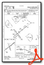
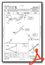
Instrument Approach Procedure (IAP) Charts
Nearby Airports with Instrument Procedures
| ID | Name | Heading / Distance | ||
|---|---|---|---|---|
 |
3F4 | Vivian Airport | 147° | 17.2 |
|
KTXK | Texarkana Regional-Webb Field Airport | 025° | 23.4 |
|
KASL | Harrison County Airport | 189° | 35.3 |
|
KOSA | Mount Pleasant Regional Airport | 269° | 38.6 |
|
KSPH | Springhill Airport | 099° | 40.3 |
|
KDTN | Shreveport Downtown Airport | 145° | 40.6 |
|
KSHV | Shreveport Regional Airport | 154° | 43.5 |
|
KBAD | Barksdale AFB Airport | 143° | 44.9 |
|
KJXI | Fox Stephens Field/Gilmer Municipal Airport | 237° | 45.1 |
|
M18 | Hope Municipal Airport | 035° | 45.7 |
|
KAGO | Ralph C Weiser Field Airport | 081° | 49.8 |
|
KGGG | East Texas Regional Airport | 211° | 50.3 |
Airport Images
Do you have a recent image of this airport? Upload it here!


