Login
Register


BML
Berlin Regional Airport
Official FAA Data Effective 2026-01-22 0901Z
Chart Supplement

VFR Chart of KBML
Sectional Charts at SkyVector.com
IFR Chart of KBML
Enroute Charts at SkyVector.com
Location Information for KBML
Coordinates: N44°34.52' / W71°10.56'Located 07 miles N of Berlin, New Hampshire on 628 acres of land. View all Airports in New Hampshire.
Surveyed Elevation is 1161 feet MSL.
Operations Data
|
|
Airport Communications
| ASOS: | 135.175 Tel. 603-449-3328 |
|---|---|
| UNICOM: | 122.700 |
| CTAF: | 122.700 |
| AWOS-AV at 0B1 (18.2 SE): | 119.075 207-512-2516 |
| AWOS-AV at NH08 (18.5 NW): | |
| ASOS at HIE (20.2 SW): | 118.525 603-837-2769 |
- APCH/DEP SVC PRVDD BY BOSTON ARTCC ON FREQS 135.7/282.2 (BERLIN RCAG).
Nearby Navigation Aids
|
| ||||||||||||||||||||||||||||||||||||||||||||||||||||||||||||


Runway 18/36
| Dimensions: | 5200 x 100 feet / 1585 x 30 meters | |
|---|---|---|
| Surface: | Asphalt in Good Condition | |
| Weight Limits: | S-53, D-82, ST-140 | |
| Edge Lighting: | High Intensity | |
| Runway 18 | Runway 36 | |
| Coordinates: | N44°34.92' / W71°10.77' | N44°34.12' / W71°10.34' |
| Elevation: | 1161.3 | 1130.4 |
| Traffic Pattern: | Left | Left |
| Runway Heading: | 159° True | 339° True |
| Markings: | Non-Precision Instrument in good condition. | Non-Precision Instrument in good condition. |
| Glide Slope Indicator | P4L (3.50° Glide Path Angle) | |
| REIL: | Yes | Yes |
| Obstacles: | 17 ft Trees 335 ft from runway, 115 ft left of center | 51 ft Trees 711 ft from runway, 151 ft right of center |
Services Available
| Fuel: | 100LL (blue), Jet-A |
|---|---|
| Transient Storage: | Tiedowns |
| Airframe Repair: | MINOR |
| Engine Repair: | MINOR |
| Bottled Oxygen: | NONE |
| Bulk Oxygen: | NONE |
Ownership Information
| Ownership: | Publicly owned | |
|---|---|---|
| Owner: | CITY OF BERLIN | |
| 168 MAIN ST | ||
| BERLIN, NH 03570 | ||
| 603-752-7532 | ||
| Manager: | MARCEL LEVEILLE | |
| 800 EAST SIDE RIVER RD. | ||
| MILAN, NH 03588 | ||
| 603-449-2168 | AMGR AFT HRS FONE 603-915-0214. | |
Other Remarks
- OBSTN LGTS ON ANT POLES; HAZARD BCNS ON SURROUNDING HILLS.
- WILDLIFE ON & INVOF ARPT.
- COLD TEMPERATURE AIRPORT. ALTITUDE CORRECTION REQUIRED AT OR BELOW -28C.
- FOR CD IF UNA TO CTC ON FSS FREQ, CTC BOSTON ARTCC AT 603-879-6859.
- RENTAL CARS & CATERING AVBL BY REQ, CALL 603-915-0214.
- CORPORATE AND CHTR ACFT LDG FEE FOR ALL PISTON, TURBOPROP & JET ACFT. LDG FEE WAIVED WITH FUEL PURCHASE & OVNGT PRKG, CORPORATE & CHTR ACFT OVNGT PRKG FEE. CTC AMGR.
- 0LL SELF-SERVE 100LL AVBL 24 HRS WITH CREDIT CARD SYSTEM. FOR JET A AFTER HRS CALL 603-915-0214.
- ACTVT REIL RWY 18 & 36, PAPI RWY 18, HIRL RWY 18/36 - CTAF.
Weather Minimums

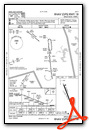
Instrument Approach Procedure (IAP) Charts
Nearby Airports with Instrument Procedures
| ID | Name | Heading / Distance | ||
|---|---|---|---|---|
 |
0B1 | Bethel Regional Airport | 119° | 18.1 |
|
KHIE | Mount Washington Regional Airport | 232° | 20.2 |
|
M57 | Rangeley Lake Seaplane Base | 043° | 31.5 |
|
8B0 | Stephen A Bean Municipal Airport | 040° | 33.2 |
|
KCDA | Caledonia County Airport | 269° | 36.1 |
|
KIZG | White Mountain Regional Airport | 164° | 36.4 |
|
81B | Oxford County Regional Airport | 129° | 39.0 |
|
5B9 | Dean Memorial Airport | 230° | 46.5 |
|
KEFK | Northeast Kingdom International Airport | 292° | 48.8 |
|
KLEW | Auburn/Lewiston Municipal Airport | 129° | 49.8 |
|
B21 | Sugarloaf Regional Airport | 052° | 51.1 |
|
CYSC | Sherbrooke Airport | 337° | 56.2 |
Airport Images
Do you have a recent image of this airport? Upload it here!


