Login
Register


CJX
Crooked Creek Airport
Official FAA Data Effective 2026-02-19 0901Z
Chart Supplement

VFR Chart of PACJ
Sectional Charts at SkyVector.com
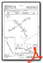
IFR Chart of PACJ
Enroute Charts at SkyVector.com
Location Information for PACJ
Coordinates: N61°52.27' / W158°8.28'Located 02 miles S of Crooked Creek, Alaska on 179 acres of land. View all Airports in Alaska.
Surveyed Elevation is 177 feet MSL.
Operations Data
|
|
Airport Communications
| AWOS-3PT: | 118.4 Tel. 907-269-2726 |
|---|---|
| CTAF: | 122.800 |
| AWOS-3P at SLQ (29.3 E): | 134.85 907-449-4226 |
| AWOS-3P at ANI (43.4 SW): | 124.3 907-675-4282 |
| AWOS-3P at HCA (49.9 NW): | 118.325 907-621-7974 |
- APCH/DEP SVC PRVDD BY ANCHORAGE ARTCC (ZAN) ON FREQS 128.5/379.9 (SPARREVOHN RCAG).
Nearby Navigation Aids
|
| ||||||||||||||||||

Runway 14/32
SLOPES DOWN TO S. LINE OF SIGHT BTN ENDS NA. | ||
| Dimensions: | 3300 x 75 feet / 1006 x 23 meters | |
|---|---|---|
| Surface: | Gravel in Excellent Condition | |
| Edge Lighting: | Medium Intensity | |
| Runway 14 | Runway 32 | |
| Coordinates: | N61°52.51' / W158°8.52' | N61°52.02' / W158°8.03' |
| Elevation: | 164.1 | 177.2 |
| Traffic Pattern: | Left | Left |
| Runway Heading: | 155° True | 335° True |
| Markings: | None in poor condition. | None in poor condition. |
| REIL: | Yes | Yes |
Services Available
| Fuel: | Automotive Gasoline |
|---|---|
| Transient Storage: | NONE |
| Airframe Repair: | NOT AVAILABLE |
| Engine Repair: | NOT AVAILABLE |
| Bottled Oxygen: | NOT AVAILABLE |
| Bulk Oxygen: | NOT AVAILABLE |
Ownership Information
| Ownership: | Publicly owned | |
|---|---|---|
| Owner: | ALASKA DOT&PF CENTRAL REGION | |
| PO BOX 196900 | ||
| ANCHORAGE, AK 99519-6900 | ||
| 907-269-0760 | ||
| Manager: | KEN SMITH | |
| PO BOX 73 | ||
| ANIAK, AK 99557 | ||
| 907-676-0505 | ||
Other Remarks
- RWY COND UNMNT; RCMD VISUAL INSP BFR USE.
- FIRST 100 FT CLSD INDEFLY.
Weather Minimums

Instrument Approach Procedure (IAP) Charts
Departure Procedure Obstacles (DPO) Charts

Nearby Airports with Instrument Procedures
| ID | Name | Heading / Distance | ||
|---|---|---|---|---|
 |
PASL | Sleetmute Airport | 109° | 29.5 |
|
PACH | Chuathbaluk Airport | 240° | 35.4 |
|
PANI | Aniak Airport | 247° | 43.8 |
|
PAHC | Holy Cross Airport | 293° | 50.1 |
|
PAHX | Shageluk Airport | 321° | 63.7 |
|
PALG | Kalskag Airport | 253° | 66.2 |
|
PANV | Anvik Airport | 309° | 74.1 |
|
PAGX | Grayling Airport | 319° | 81.7 |
|
PAMC | Mc Grath Airport | 046° | 96.0 |
Airport Images
Do you have a recent image of this airport? Upload it here!


