



Login
Register
CNV6
Orillia/Lake St John (Orillia Rama Seaplane Base
VFR Chart of CNV6
Sectional Charts at SkyVector.com
IFR Chart of CNV6
Enroute Charts at SkyVector.com
Location Information for CNV6
Coordinates: N44°41.00' / W79°19.00'View all Airports in Ontario, Canada.
Elevation is 718 feet MSL.
Time Zone is UTC-5(4).
Operations Data
|
|
Customs Information
AOE/15/SEAPL 888-226-7277
14-22Z Mon-Fri exc hols
Airport Communications
| Aerodrome Traffic Frequency (ATF) | UNICOM limited hours other times traffic 122.95 5NM 3800 ASL |
|---|
Nearby Navigation Aids
|
| ||||||||||||||||||||||||||||||||||||||||||||||||||||||||||||


Water Aerodrome Information
Open water May-mid Nov. Ramp & Dock. Ski-plane opr mid Dec-Mar.
Services Available
| Fuel Available | 100LL, JA-1 (Land Pump), MG-3 (Land pump) |
|---|---|
| Oil Available | All |
| Servicing Available | Storage, Minor Repairs, Major Repairs, Extended Parking, Tie Downs |
Public Facilities
| Location | Facilities | Remarks |
|---|---|---|
| On Aerodrome | Telephone, Food | |
| Within 5 NM | Taxi, Accomodations | |
| Within 30 NM | Car Rental | at adj land A/D |
Flight Planning
| Flight Information Centre (FIC) | London 866-WXBRIEF (Toll free within Canada) or 866-541-4104 (Toll free within Canada & USA) |
|---|
Aerodrome Operator
Orillia Rama Regional APM
705-325-9838 Reg
Nearby Airports with Instrument Procedures
| ID | Name | Heading / Distance | ||
|---|---|---|---|---|
 |
CYLS | Barrie-Orillia/Lake Simcoe Airport | 220° | 15.7 |
|
CYQA | Muskoka Airport | 001° | 17.5 |
|
CNV8 | Edenvale Airport | 242° | 31.5 |
|
CNY3 | Collingwood Airport | 249° | 38.8 |
|
CYPQ | Peterborough Airport | 123° | 49.2 |
|
CYOO | Toronto/Oshawa Executive Airport Airport | 158° | 49.1 |
|
CYYZ | Toronto/Lester B. Pearson International Airport | 192° | 61.9 |
|
CYTZ | Toronto/Billy Bishop Toronto City Airport | 183° | 63.4 |
|
CYVV | Wiarton Airport | 273° | 76.8 |
|
CYTR | Trenton Airport | 113° | 84.1 |
|
CYKF | Kitchener/Waterloo Airport | 212° | 86.5 |
|
CYSN | St Catharines/Niagara District Airport | 175° | 89.7 |
Airport Images
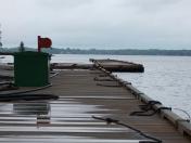
By: aholmes



