Login
Register


DEE
Deering Airport
Official FAA Data Effective 2025-12-25 0901Z
Chart Supplement

VFR Chart of PADE
Sectional Charts at SkyVector.com
IFR Chart of PADE
Enroute Charts at SkyVector.com
Location Information for PADE
Coordinates: N66°4.15' / W162°46.02'Located 02 miles SW of Deering, Alaska on 262 acres of land. View all Airports in Alaska.
Surveyed Elevation is 29 feet MSL.
Operations Data
|
|
Airport Communications
| ASOS: | 135.5 Tel. 907-363-2102 |
|---|---|
| CTAF: | 122.900 |
| AWOS-3P at BVK (39.8 E): | 135.15 907-494-2180 |
| ASOS at OTZ (49.1 N): | 135.45 907-931-5182 |
| AWOS-3P at D76 (61.4 NE): | 120.00 907-636-2010 |
- APCH/DEP SVC PRVDD BY ANCHORAGE ARTCC ON FREQS 119.2/263.0 (KOTZEBUE RCAG).
- COMMUNICATIONS PRVDD BY KOTZEBUE FSS ON FREQ 122.25 (DEERING RCO).
Nearby Navigation Aids
|
| ||||||||||||||||||||||||


Runway 03/21
| Dimensions: | 3320 x 75 feet / 1012 x 23 meters | |
|---|---|---|
| Surface: | Gravel in Good Condition RWY 03/21 PLOWED IN WINTER. | |
| Edge Lighting: | Medium Intensity | |
| Runway 03 | Runway 21 | |
| Coordinates: | N66°3.91' / W162°46.44' | N66°4.34' / W162°45.62' |
| Elevation: | 22.6 | 19.8 |
| Traffic Pattern: | Left | Left |
| Runway Heading: | 38° True | 218° True |
| Markings: | Non-Standard | Non-Standard |
| Glide Slope Indicator | P4R (3.00° Glide Path Angle) | |
| REIL: | Yes | |
Runway 12/30
| Dimensions: | 2660 x 75 feet / 811 x 23 meters | |
|---|---|---|
| Surface: | Gravel in Good Condition | |
| Edge Lighting: | Medium Intensity | |
| Runway 12 | Runway 30 | |
| Coordinates: | N66°4.30' / W162°46.44' | N66°4.04' / W162°45.58' |
| Elevation: | 29.9 | 20.4 |
| Runway Heading: | 126° True | 306° True |
| Markings: | Non-Standard | Non-Standard |
Services Available
| Fuel: | NONE |
|---|---|
| Transient Storage: | NONE |
| Airframe Repair: | NONE |
| Engine Repair: | NONE |
| Bottled Oxygen: | NONE |
| Bulk Oxygen: | NONE |
Ownership Information
| Ownership: | Publicly owned | |
|---|---|---|
| Owner: | ALASKA DOT&PF NORTHERN REGION | |
| 2301 PEGER RD | ||
| FAIRBANKS, AK 99709 | ||
| 907-451-2200 | ||
| Manager: | ALVIN WERNEKE | |
| BOX 55 | ||
| KOTZEBUE, AK 99752 | ||
| 907-442-3147 | ||
Other Remarks
- RY COND NOT MONITORED; RCMD VISUAL INSPECTION PRIOR TO LNDG.
- MIGRATORY BIRDS AS WELL AS MUSK OXEN AND OTHER LARGE ANIMALS ON AND IN THE VCNTY OF RYS.
- WX CAMERA AVBL ON INTERNET AT HTTPS://WEATHERCAMS.FAA.GOV
- COLD TEMPERATURE AIRPORT. ALTITUDE CORRECTION REQUIRED AT OR BELOW -39C.
- WINDSOCK MISSING AT RWY 12.
- RY 03/21 NSTD MKGS; MKD WITH LIGHTS AND PLASTIC MARKERS.
- RY 12/30 NSTD MKGS; MKD WITH LIGHTS AND PLASTIC MARKERS.
- NORTHWEST ARCTIC BOROUGH
- ACTVT MIRL RYS 03/21 & 12/30; REIL RY 03 & PAPI RY 03 - CTAF.
- ACTVT ROTG BCN - CTAF.
Weather Minimums

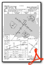
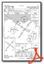
Instrument Approach Procedure (IAP) Charts


Nearby Airports with Instrument Procedures
| ID | Name | Heading / Distance | ||
|---|---|---|---|---|
 |
PABL | Buckland Airport | 096° | 40.0 |
|
PAOT | Ralph Wien Memorial Airport | 004° | 49.3 |
|
PFNO | Robert/Bob/Curtis Memorial Airport | 042° | 61.6 |
|
PASK | Selawik Airport | 063° | 74.5 |
|
PAIK | Bob Baker Memorial Airport | 044° | 78.2 |
|
PAKK | Koyuk Alfred Adams Airport | 148° | 79.0 |
|
PAWM | White Mountain Airport | 191° | 84.6 |
|
PFEL | Elim Airport | 171° | 88.4 |
|
PAWN | Noatak Airport | 356° | 90.0 |
|
PAGL | Golovin Airport | 183° | 91.6 |
|
PAVL | Kivalina Airport | 337° | 109.0 |
|
PFSH | Shaktoolik Airport | 158° | 109.4 |
Airport Images
Do you have a recent image of this airport? Upload it here!


