Login
Register


WMO
White Mountain Airport
Official FAA Data Effective 2026-01-22 0901Z
Chart Supplement

VFR Chart of PAWM
Sectional Charts at SkyVector.com
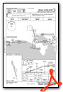
IFR Chart of PAWM
Enroute Charts at SkyVector.com
Location Information for PAWM
Coordinates: N64°41.35' / W163°24.76'Located 01 miles N of White Mountain, Alaska on 82 acres of land. View all Airports in Alaska.
Surveyed Elevation is 267 feet MSL.
Operations Data
|
|
Airport Communications
| AWOS-3P: | 121.45 Tel. 907-638-2103 |
|---|---|
| CTAF: | 122.900 |
| AWOS-3P at GLV (13.3 SE): | 135.750 907-779-2228 |
| AWOS-3P at ELI (29.7 E): | 121.425 907-890-2014 |
- APCH/DEP SVC PRVDD BY ANCHORAGE ARTCC ON FREQS 133.3/290.4 (NOME RCAG).
- COMMUNICATIONS PRVDD BY NOME FSS ON FREQ 122.05 (GOLOVIN RCO).
Nearby Navigation Aids
|
| ||||||||||||||||||||||||||||||


Runway 15/33
SLOPES DOWN AT RWY 33 THR NW TO SE. S END 45 FT HYR. | ||
| Dimensions: | 3000 x 60 feet / 914 x 18 meters | |
|---|---|---|
| Surface: | Gravel in Good Condition | |
| Edge Lighting: | Medium Intensity | |
| Runway 15 | Runway 33 | |
| Coordinates: | N64°41.59' / W163°24.92' | N64°41.11' / W163°24.61' |
| Elevation: | 222.2 | 267.4 |
| Traffic Pattern: | Left | Left |
| Runway Heading: | 164° True | 344° True |
| Markings: | Non-Standard in good condition. | Non-Standard in good condition. |
| Obstacles: | 3 ft Brush 0 ft from runway, 80 ft right of center | 4 ft Brush 0 ft from runway, 125 ft left of center |
Ownership Information
| Ownership: | Publicly owned | |
|---|---|---|
| Owner: | ALASKA DOT&PF NORTHERN REGION | |
| NORTHERN REGION, 2301 PEGER RD | ||
| FAIRBANKS, AK 99709 | ||
| (907) 451-2200 | ||
| Manager: | GEORGE KOST | |
| PO BOX 1048 | ||
| NOME, AK 99762 | ||
| 907-443-2500 | ||
Other Remarks
- THIS AIRPORT HAS BEEN SURVEYED BY THE NATIONAL GEODETIC SURVEY.
- RWY COND UNMNT; RCMD VISUAL INSP BFR LNDG.
- WX CAMERA AVBL ON INTERNET AT HTTPS://WEATHERCAMS.FAA.GOV
- EXP TURB DURG APCH.
- CONES, LGTS & REFLECTIVE THR PANELS.
- CONES, LGTS & REFLECTIVE THR PANELS.
- ACTVT MIRL RWY 15/33 - CTAF.
- H24.
Weather Minimums


Instrument Approach Procedure (IAP) Charts

Nearby Airports with Instrument Procedures
| ID | Name | Heading / Distance | ||
|---|---|---|---|---|
 |
PAGL | Golovin Airport | 128° | 13.4 |
|
PFEL | Elim Airport | 098° | 29.8 |
|
PAOM | Nome Airport | 259° | 53.6 |
|
PAKK | Koyuk Alfred Adams Airport | 074° | 59.9 |
|
PFSH | Shaktoolik Airport | 107° | 59.9 |
|
PAMK | St Michael Airport | 153° | 79.9 |
|
PATE | Teller Airport | 295° | 81.7 |
|
PAUN | Unalakleet Airport | 124° | 83.6 |
|
PADE | Deering Airport | 010° | 84.6 |
|
PABL | Buckland Airport | 035° | 96.4 |
|
PFKO | Kotlik Airport | 181° | 99.9 |
|
PASH | Shishmaref Airport | 325° | 115.4 |
Airport Images
Do you have a recent image of this airport? Upload it here!


