Login
Register


KKA
Koyuk Alfred Adams Airport
Official FAA Data Effective 2025-11-27 0901Z
Chart Supplement

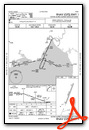
VFR Chart of PAKK
Sectional Charts at SkyVector.com
IFR Chart of PAKK
Enroute Charts at SkyVector.com
Location Information for PAKK
Coordinates: N64°56.37' / W161°9.26'Located 00 miles NE of Koyuk, Alaska on 132 acres of land. View all Airports in Alaska.
Surveyed Elevation is 161 feet MSL.
Operations Data
|
|
Airport Communications
| AWOS-3P: | 134.95 Tel. 907-963-4000 |
|---|---|
| CTAF: | 122.800 |
| AWOS-3P at 2C7 (34.2 S): | 124.175 907-955-3896 |
| AWOS-3P at ELI (34.6 SW): | 121.425 907-890-2014 |
| AWOS-3P at GLV (53.2 SW): | 135.750 907-779-2228 |
- APCH/DEP SVC PRVDD BY ANCHORAGE ARTCC ON FREQS 135.7/335.5 (UNALAKLEET RCAG).
- COMMUNICATIONS PRVDD BY NOME FSS ON FREQ 122.35 (KOYUK RCO).
Nearby Navigation Aids
|
| ||||||||||||||||||

Runway 01/19
| Dimensions: | 3002 x 60 feet / 915 x 18 meters | |
|---|---|---|
| Surface: | Gravel in Good Condition GRAVEL-DIRT. | |
| Edge Lighting: | Medium Intensity | |
| Runway 01 | Runway 19 | |
| Coordinates: | N64°56.15' / W161°9.49' | N64°56.60' / W161°9.02' |
| Elevation: | 159.8 | 152.6 |
| Traffic Pattern: | Left | Left |
| Runway Heading: | 24° True | 204° True |
| Markings: | Non-Standard in fair condition. | Non-Standard in fair condition. |
| Glide Slope Indicator | V4L (3.00° Glide Path Angle) | V4R (4.00° Glide Path Angle) |
| Obstacles: | 13 ft Brush 0 ft from runway, 220 ft left of center | 5 ft Brush 0 ft from runway, 47 ft left of center |
Ownership Information
| Ownership: | Publicly owned | |
|---|---|---|
| Owner: | ALASKA DOT&PF NORTHERN REGION | |
| 2301 PEGER RD | ||
| FAIRBANKS, AK 99709 | ||
| 907-451-2200 | ||
| Manager: | JOHN WILSON | |
| PO BOX 192 | ||
| UNALAKLEET, AK 99684 | ||
| (907) 625-1025 | ||
Other Remarks
- RWY COND UNMNT; RCMD VISUAL INSP PRIOR TO LNDG.
- TURB ON APCH WHEN WIND FM NW.
- WX CAMERA AVBL ON INTERNET AT HTTPS://WEATHERCAMS.FAA.GOV
- LGTS, CONES & THR PANELS.
- LGTS, CONES & THR PANELS.
- ACTVT MIRL RWY 01/19 - CTAF. VASI RWY 01 & 19 ON CONSLY.
Weather Minimums
Instrument Approach Procedure (IAP) Charts
Nearby Airports with Instrument Procedures
| ID | Name | Heading / Distance | ||
|---|---|---|---|---|
 |
PFSH | Shaktoolik Airport | 183° | 34.3 |
|
PFEL | Elim Airport | 236° | 34.7 |
|
PAGL | Golovin Airport | 244° | 53.1 |
|
PAWM | White Mountain Airport | 256° | 59.9 |
|
PABL | Buckland Airport | 000° | 62.7 |
|
PAUN | Unalakleet Airport | 171° | 63.9 |
|
PAKV | Kaltag Airport | 119° | 72.6 |
|
PADE | Deering Airport | 330° | 79.0 |
|
PAMK | St Michael Airport | 196° | 90.8 |
|
PASK | Selawik Airport | 015° | 104.1 |
|
PFNO | Robert/Bob/Curtis Memorial Airport | 001° | 113.1 |
|
PAOT | Ralph Wien Memorial Airport | 343° | 122.4 |
Airport Images
Do you have a recent image of this airport? Upload it here!


