Login
Register
L62
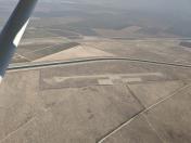
Elk Hills-Buttonwillow Airport
Official FAA Data Effective 2025-12-25 0901Z
VFR Chart of L62
Sectional Charts at SkyVector.com
IFR Chart of L62
Enroute Charts at SkyVector.com
Location Information for L62
Coordinates: N35°21.21' / W119°28.78'Located 03 miles S of Buttonwillow, California on 216 acres of land. View all Airports in California.
Estimated Elevation is 326 feet MSL.
Operations Data
|
|
Airport Communications
| CTAF: | 122.900 |
|---|---|
| AWOS-3 at MIT (16.8 NE): | 121.125 661-393-8596 |
| ATIS at BFL (21.2 E): | 118.6 |
| ASOS at BFL (21.3 E): | 661-246-3170 |
Nearby Navigation Aids
|
| ||||||||||||||||||||||||||||||||||||||||||||||||
Runway 11/29
| Dimensions: | 3260 x 50 feet / 994 x 15 meters | |
|---|---|---|
| Surface: | Asphalt in Poor Condition ALLIGATOR CRACKING; PAVEMENT STBL. | |
| Weight Limits: | S-10 | |
| Runway 11 | Runway 29 | |
| Coordinates: | N35°21.38' / W119°29.03' | N35°21.03' / W119°28.53' |
| Traffic Pattern: | Right | Left |
| Markings: | Basic in good condition. | Basic in good condition. |
Services Available
| Fuel: | NONE |
|---|---|
| Transient Storage: | Tiedowns |
| Airframe Repair: | NONE |
| Engine Repair: | NONE |
| Bottled Oxygen: | NONE |
| Bulk Oxygen: | NONE |
Ownership Information
| Ownership: | Publicly owned | |
|---|---|---|
| Owner: | COUNTY OF KERN DEPT OF AIRPORTS | |
| 3701 WINGS WAY, SUITE 300 | ||
| BAKERSFIELD, CA 93308-7026 | ||
| 661-391-1800 | ||
| Manager: | ERIC GRANT | |
| 3701 WINGS WAY, SUITE 300 | ||
| BAKERSFIELD, CA 93308-7026 | ||
| (661) 391-1824 | CELL PHONE: 661-747-4051; H24: 661-393-3868; FAX: 661-391-1801; EMAIL: GRANTE@KERNCOUNTY.COM. | |
Other Remarks
- ARPT CLSD TO NIGHT OPNS.
- ELK HILLS-BUTTONWILLOW ELEV 326 PAINTED ON CENTER OF RWY.
- CROP DUSTING OPNS PROHIBITED EXCP BY PPR AMGR 661-391-1800.
- RADIO CTLD MODEL ACFT BELOW 800 FT AGL INVOF ARPT.
- FOR CD CTC LOS ANGELES ARTCC AT 661-575-2079.
Nearby Airports with Instrument Procedures
| ID | Name | Heading / Distance | ||
|---|---|---|---|---|
 |
KMIT | Shafter-Minter Field Airport | 056° | 16.9 |
 |
KBFL | Meadows Field Airport | 076° | 21.3 |
 |
L45 | Bakersfield Municipal Airport | 093° | 23.8 |
 |
KDLO | Delano Municipal Airport | 026° | 26.3 |
 |
KPTV | Porterville Municipal Airport | 026° | 45.3 |
 |
KTLR | Mefford Field Airport | 008° | 48.7 |
 |
KIZA | Santa Ynez/Kunkle Field Airport | 213° | 53.5 |
 |
KSMX | Santa Maria Pub/Capt G Allan Hancock Field Airport | 240° | 55.3 |
 |
KSBP | San Luis Obispo County Regional Airport | 263° | 57.5 |
 |
KVIS | Visalia Municipal Airport | 004° | 58.0 |
 |
KHJO | Hanford Municipal Airport | 352° | 58.2 |
 |
KSBA | Santa Barbara Municipal Airport | 197° | 58.3 |


