Login
Register


L72
Trona Airport
Official FAA Data Effective 2026-02-19 0901Z
Chart Supplement

VFR Chart of L72
Sectional Charts at SkyVector.com
IFR Chart of L72
Enroute Charts at SkyVector.com
Location Information for L72
Coordinates: N35°48.76' / W117°19.62'Located 04 miles N of Trona, California on 450 acres of land. View all Airports in California.
Estimated Elevation is 1717 feet MSL.
Operations Data
|
|
Airport Communications
| CTAF: | 122.900 |
|---|---|
| ATIS at NID (19.5 W): | 322.375 |
| ASOS at 1AF (34.9 SE): | |
| AWOS-1 at L71 (51.9 SW): | 120.875 760-373-7670 |
Nearby Navigation Aids
|
| ||||||||||||||||||||||||||||||||||||

Runway 17/35
| Dimensions: | 5910 x 60 feet / 1801 x 18 meters | |
|---|---|---|
| Surface: | Asphalt in Fair Condition | |
| Edge Lighting: | Low Intensity NSTD LIRL EDGE LIGHTS 55 FT FM EDGES OF RY. | |
| Runway 17 | Runway 35 | |
| Coordinates: | N35°49.24' / W117°19.52' | N35°48.28' / W117°19.71' |
| Elevation: | 1717.8 | 1645.5 |
| Traffic Pattern: | Left | Left |
| Runway Heading: | 189° True | 9° True |
| Markings: | Basic in good condition. | Basic in good condition. |
| Obstacles: | 7 ft Fence 346 ft from runway | |
Helipad H1
| Dimensions: | 52 x 52 feet / 16 x 16 meters | |
|---|---|---|
| Surface: | Asphalt in Good Condition | |
Services Available
| Fuel: | NONE |
|---|---|
| Transient Storage: | Tiedowns |
| Airframe Repair: | NONE |
| Engine Repair: | NONE |
| Bottled Oxygen: | NONE |
| Bulk Oxygen: | NONE |
Ownership Information
| Ownership: | Publicly owned | |
|---|---|---|
| Owner: | US DEPT OF INTERIOR BLM | |
| 300 S. RICHMOND RD. | ||
| RIDGECREST, CA 93555 | ||
| (760) 384-5400 | ||
| Manager: | GEORGE BASS | |
| PO BOX 70 | ||
| TRONA, CA 93552 | ||
| (928) 592-3427 | ARPT MGR/CARETAKERS: GEORGE & BETH BASS 928-592-3427 | |
Other Remarks
- HELIPAD H1 IS LOCATED 230 FEET WEST OF RY 17/35 AND 3,380 FT SOUTH OF RY 17 THLD.
- FOR CD CTC JOSHUA APCH AT 661-277-3843.
- ACTVT LIRL RY 17/35 (5) CLICKS ON FREQ - 122.8.
Nearby Airports with Instrument Procedures
| ID | Name | Heading / Distance | ||
|---|---|---|---|---|
 |
KIYK | Inyokern Airport | 249° | 26.2 |
|
L71 | California City Municipal Airport | 220° | 52.1 |
|
KMHV | Mojave Air & Space Port/Rutan Field Airport | 222° | 60.6 |
|
KEDW | Edwards AFB Airport | 206° | 60.7 |
|
KDAG | Barstow-Daggett Airport | 155° | 63.3 |
|
KVCV | Southern California Logistics Airport | 182° | 73.0 |
|
KAPV | Apple Valley Airport | 174° | 74.4 |
|
KWJF | General Wm J Fox Airfield Airport | 214° | 77.7 |
|
KPMD | Palmdale Usaf Plant 42 Airport | 207° | 80.1 |
|
KPTV | Porterville Municipal Airport | 279° | 85.6 |
|
L45 | Bakersfield Municipal Airport | 250° | 86.8 |
|
KBFL | Meadows Field Airport | 255° | 87.6 |
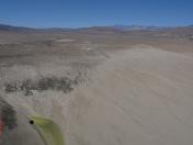
Airport Images

By: Skydog222
By: chipchap42


