Login
Register
L88
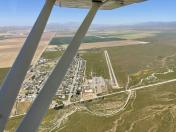
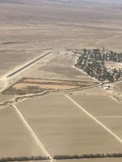
New Cuyama Airport
Official FAA Data Effective 2025-12-25 0901Z
VFR Chart of L88
Sectional Charts at SkyVector.com
IFR Chart of L88
Enroute Charts at SkyVector.com
Location Information for L88
Coordinates: N34°56.41' / W119°41.17'Located 00 miles S of New Cuyama, California on 308 acres of land. View all Airports in California.
Estimated Elevation is 2204 feet MSL.
Operations Data
|
|
Airport Communications
| CTAF: | 122.900 |
|---|---|
| AWOS-3PT at IZA (27.8 SW): | 118.075 805-686-5325 |
| ATIS at SBA (31.8 S): | 132.65 |
| ASOS at SBA (31.9 S): | 132.65 805-957-6133 |
Nearby Navigation Aids
|
| ||||||||||||||||||||||||||||||||||||
Runway 11/29
| Dimensions: | 3380 x 60 feet / 1030 x 18 meters | |
|---|---|---|
| Surface: | Asphalt in Excellent Condition | |
| Runway 11 | Runway 29 | |
| Coordinates: | N34°56.53' / W119°41.47' | N34°56.29' / W119°40.86' |
| Elevation: | 2154.0 | 2204.0 |
| Traffic Pattern: | Right | Left |
| Markings: | Basic in good condition. | Basic in good condition. |
Services Available
| Fuel: | NONE |
|---|---|
| Transient Storage: | Tiedowns |
| Airframe Repair: | NONE |
| Engine Repair: | NONE |
| Bottled Oxygen: | NONE |
| Bulk Oxygen: | NONE |
Ownership Information
| Ownership: | Privately Owned | |
|---|---|---|
| Owner: | BLUE SKY SUSTAINABLE LIVING CENTER | |
| P.O. BOX 271 | ||
| NEW CUYAMA, CA 93254 | ||
| 661-413-3005 | ||
| Manager: | EMILY JOHNSON | |
| PO BOX 271 | ||
| NEW CUYAMA, CA 93254 | ||
| 805-770-0926 | ||
Other Remarks
- ACFT PRKG 125 FT N OF RWY CNTRLN AT RWY 11 APCH END.
- RWY 11 +25 FT PWR POLES & PLINES RUN PARTIALLY UNDERGROUND 270 FT BYD RWY END, 164 FT R OF CNTRLN.
- FOR CD CTC LOS ANGELES ARTCC AT 661-575-2079.
Nearby Airports with Instrument Procedures
| ID | Name | Heading / Distance | ||
|---|---|---|---|---|
 |
KIZA | Santa Ynez/Kunkle Field Airport | 224° | 27.7 |
 |
KSBA | Santa Barbara Municipal Airport | 194° | 31.7 |
 |
KSMX | Santa Maria Pub/Capt G Allan Hancock Field Airport | 266° | 38.2 |
 |
L45 | Bakersfield Municipal Airport | 055° | 41.0 |
 |
KMIT | Shafter-Minter Field Airport | 035° | 41.8 |
 |
KLPC | Lompoc Airport | 247° | 42.0 |
 |
KBFL | Meadows Field Airport | 046° | 42.8 |
 |
KVBG | Vandenberg Space Force Base Airport | 254° | 46.0 |
 |
KSBP | San Luis Obispo County Regional Airport | 290° | 50.3 |
 |
KOXR | Oxnard Airport | 151° | 50.2 |
 |
KCMA | Camarillo Airport | 145° | 52.5 |
 |
KDLO | Delano Municipal Airport | 024° | 53.1 |


Comments
L-88 New Cuyama is Open
L-88 New Cuyama is now open as of Oct 2022.
Runway has been resurfaced and is in excellent condition.
Runway is shortened to 3380 ft long x 60 ft wide.
Buckhorn restaurant and hotel are also open for business.
Michael J Kent
Pages