Login
Register
LSGC
Les Eplatures Airport
VFR Chart of LSGC
Sectional Charts at SkyVector.com
IFR Chart of LSGC
Enroute Charts at SkyVector.com
Location Information for LSGC
Coordinates: N47°5.05' / E6°47.60'View all Airports in Neuchâtel, Switzerland.
Elevation is 3368.0 feet MSL.
Operations Data
|
|
Airport Communications
| LES EPLATURES Tower: | 118.12 |
|---|
Nearby Navigation Aids
|
| ||||||||||||||||||||||||||||||||||||||||||||||||||||||||||||
Runway 06/24
| Dimensions: | 3576 x 89 feet / 1090 x 27 meters | |
|---|---|---|
| Surface: | Hard | |
| Runway 06 | Runway 24 | |
| Coordinates: | N47°4.88' / E6°47.27' | N47°5.20' / E6°47.92' |
| Elevation: | 3368 | 3346 |
| Runway Heading: | 052° | 232° |
| Displaced Threshold: | 131 Feet | 177 Feet |
Nearby Airports with Instrument Procedures
| ID | Name | Heading / Distance | ||
|---|---|---|---|---|
 |
LSMP | Payerne Airport | 161° | 15.3 |
 |
LFSM | Montbeliard Courcelles Airport | 359° | 24.2 |
 |
LSZG | Grenchen Airport | 076° | 26.2 |
 |
LFQM | Besancon La Veze Airport | 284° | 30.1 |
 |
LSZB | Bern Belp Airport | 109° | 30.8 |
 |
LFSB | Bale-Mulhouse Airport | 044° | 42.7 |
 |
LFSX | Luxeuil St.Sauveur Airport | 337° | 45.7 |
 |
LFEV | Gray/Saint-Adrien Airport | 293° | 52.3 |
 |
LFGJ | Dole Tavaux Airport | 267° | 55.8 |
 |
LSGS | Sion Airport | 156° | 56.4 |
 |
LSGG | Geneve Airport | 209° | 58.1 |
 |
LFGA | Colmar Houssen Airport | 020° | 65.7 |


Comments
Friendly
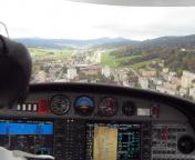
Interesting airport in the Jura. Approach to runway 24 between some hills and buildings.
Friendly staff at the C-Office. Small local restaurant and a McDonalds across the road.
Info about landing fees:
IFR approach and landing with a M20M (1528Kg MTOM): SFr. 37.- (Spring 2016)