


Login
Register
LSGS
Sion Airport
VFR Chart of LSGS
Sectional Charts at SkyVector.com
IFR Chart of LSGS
Enroute Charts at SkyVector.com
Location Information for LSGS
Coordinates: N46°13.15' / E7°19.62'View all Airports in Valais, Switzerland.
Elevation is 1582.0 feet MSL.
Operations Data
|
|
Airport Communications
| SION RADAR Approach: | 126.82 |
|---|---|
| SION ATIS: | 130.63 |
| SION GROUND Ground Control: | 121.70 |
| GENEVA INFORMATION Information: | 126.35 |
| SION TOWER Tower: | 118.27 |
Nearby Navigation Aids
|
| ||||||||||||||||||||||||||||||||||||||||||||||||||||||||||||


Runway 07/25
| Dimensions: | 6562 x 131 feet / 2000 x 40 meters | |
|---|---|---|
| Surface: | Hard | |
| Runway 07 | Runway 25 | |
| Coordinates: | N46°13.01' / E7°18.92' | N46°13.31' / E7°20.32' |
| Elevation: | 1575 | 1582 |
| Runway Heading: | 072° | 252° |
| Displaced Threshold: | 213 Feet | 197 Feet |
Nearby Airports with Instrument Procedures
| ID | Name | Heading / Distance | ||
|---|---|---|---|---|
 |
LIMW | Aosta Airport | 176° | 28.9 |
|
LSMP | Payerne Airport | 335° | 41.1 |
|
LSZB | Bern Belp Airport | 009° | 42.2 |
|
LSGG | Geneve Airport | 271° | 50.7 |
|
LFLP | Annecy Meythet Airport | 251° | 53.8 |
|
LSGC | Les Eplatures Airport | 337° | 56.4 |
|
LSZG | Grenchen Airport | 003° | 57.9 |
|
LIMF | Torino/Caselle Airport | 167° | 62.5 |
|
LSZA | Lugano Airport | 100° | 67.3 |
|
LIMC | Milano/Malpensa Airport | 120° | 68.3 |
|
LIMN | Cameri Airport | 125° | 69.7 |
|
LFLB | Chambery Aix Les Bains Airport | 240° | 69.9 |
Airport Images
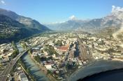
By: czyeager



