Login
Register
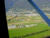
LSZL
Locarno Airport
VFR Chart of LSZL
Sectional Charts at SkyVector.com
IFR Chart of LSZL
Enroute Charts at SkyVector.com
Location Information for LSZL
Coordinates: N46°9.90' / E8°52.70'View all Airports in Ticino, Switzerland.
Elevation is 650.0 feet MSL.
Operations Data
|
|
Airport Communications
| LOCARNO GND Ground Control: | 121.70 |
|---|---|
| LOCARNO INFO Information: | 133.45 |
| LOCARNO INFO Information: | 138.05 |
| LOCARNO INFO Information: | 301.20 |
| LOCARNO TWR Tower: | 134.82 |
Nearby Navigation Aids
|
| ||||||||||||||||||||||||||||||||||||||||||||||||||||||||||||
Runway 08L/26R
| Dimensions: | 2625 x 75 feet / 800 x 23 meters | |
|---|---|---|
| Surface: | Hard | |
| Runway 08L | Runway 26R | |
| Coordinates: | N46°9.88' / E8°52.46' | N46°9.94' / E8°52.93' |
| Elevation: | 643 | 646 |
| Runway Heading: | 076° | 256° |
| Displaced Threshold: | 427 Feet | 164 Feet |
Runway 08C/26C
| Dimensions: | 2297 x 98 feet / 700 x 30 meters | |
|---|---|---|
| Surface: | Unknown | |
| Runway 08C | Runway 26C | |
| Coordinates: | N46°9.61' / E8°52.45' | N46°9.68' / E8°52.98' |
| Elevation: | 650 | 650 |
| Runway Heading: | 076° | 256° |
Runway 08R/26L
| Dimensions: | 2297 x 98 feet / 700 x 30 meters | |
|---|---|---|
| Surface: | Unknown | |
| Runway 08R | Runway 26L | |
| Coordinates: | N46°9.52' / E8°52.48' | N46°9.59' / E8°53.01' |
| Elevation: | 650 | 650 |
| Runway Heading: | 076° | 256° |
Nearby Airports with Instrument Procedures
| ID | Name | Heading / Distance | ||
|---|---|---|---|---|
 |
LSZA | Lugano Airport | 172° | 9.8 |
 |
LILN | Varese/Venegono Airport | 179° | 25.4 |
 |
LIMC | Milano/Malpensa Airport | 191° | 32.8 |
 |
LIMN | Cameri Airport | 193° | 39.1 |
 |
LIME | Bergamo/Orio Al Serio Airport | 130° | 45.5 |
 |
LIML | Milano/Linate Airport | 158° | 46.1 |
 |
LSGS | Sion Airport | 273° | 64.7 |
 |
LIMW | Aosta Airport | 248° | 68.2 |
 |
LSZB | Bern Belp Airport | 308° | 72.6 |
 |
LIPL | Ghedi Airport | 126° | 73.1 |
 |
LIPO | Brescia/Montichiari Airport | 125° | 75.3 |
 |
LIMF | Torino/Caselle Airport | 222° | 77.5 |


