Login
Register


P19
Stellar Airpark Airport
Official FAA Data Effective 2026-02-19 0901Z
Chart Supplement

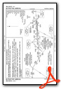
VFR Chart of P19
Sectional Charts at SkyVector.com
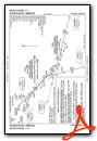
IFR Chart of P19
Enroute Charts at SkyVector.com
Location Information for P19
Coordinates: N33°17.93' / W111°54.95'Located 03 miles W of Chandler, Arizona on 200 acres of land. View all Airports in Arizona.
Surveyed Elevation is 1178 feet MSL.
Operations Data
|
|
Airport Communications
| PHOENIX APPROACH: | 123.7 363.0 |
|---|---|
| PHOENIX DEPARTURE: | 123.7 363.0 |
| SUNSS STAR: | 124.1 256.9 |
| CTAF: | 122.975 |
| UNICOM: | 122.975 |
| ATIS at CHD (5.5 E): | 128.325 |
| AWOS-3PT at CHD (5.7 E): | 480-814-9952 |
| ASOS at PHX (8.9 NW): | 602-551-6092 |
Nearby Navigation Aids
|
| ||||||||||||||||||||||||||||||||||||

Runway 17/35
RWY 17 CALM WIND RWY. | ||
| Dimensions: | 4417 x 80 feet / 1346 x 24 meters | |
|---|---|---|
| Surface: | Asphalt in Good Condition | |
| Edge Lighting: | Medium Intensity | |
| Runway 17 | Runway 35 | |
| Coordinates: | N33°18.29' / W111°54.95' | N33°17.56' / W111°54.95' |
| Elevation: | 1178.0 | 1173.7 |
| Traffic Pattern: | Left | Left |
| Runway Heading: | 180° True | 0 |
| Displaced Threshold: | 366 Feet | 349 Feet |
| Declared Distances: | LDA:4051 | LDA:4068 |
| Markings: | Non-Precision Instrument in good condition. | Non-Precision Instrument in good condition. |
| Glide Slope Indicator | P2L (3.25° Glide Path Angle) | P2R (3.25° Glide Path Angle) |
| REIL: | Yes | Yes |
| Obstacles: | 15 ft Road 201 ft from runway 50:1 SLOPE TO DTHR; 11 FT TREE 565 FT FM DTHR 10 FT L OF CNTRLN. +8 FT FENCE 130 FT FM RWY END; +15 FT ROAD 164 FT FM RWY END ACRS THR. |
11 ft Tree 216 ft from runway, 10 ft left of center APCH SLOPE 22:1 TO DTHR. +6 FT FENCE 80 FT FM RWY END ACRS THR; +15 FT ROAD 85 FT FM RWY END ACRS THR. |
Services Available
| Fuel: | 100LL (blue), Jet-A |
|---|---|
| Transient Storage: | NONE |
| Airframe Repair: | MINOR |
| Engine Repair: | MINOR |
| Bottled Oxygen: | NOT AVAILABLE |
| Bulk Oxygen: | NOT AVAILABLE |
Ownership Information
| Ownership: | Privately Owned | |
|---|---|---|
| Owner: | STELLAR RUNWAY UTILIZERS ASSN, INC. | |
| 11 NORTH STELLAR PARKWAY | ||
| CHANDLER, AZ 85226 | ||
| 480-359-6575 | ||
| Manager: | BOARD OF DIRECTORS | |
| 11 NORTH STELLAR PARKWAY | ||
| CHANDLER, AZ 85226-3715 | ||
| 480-359-6575 | AVBL TO ALL 7 MEMBER BOARD. | |
Other Remarks
- ALERT: NON RADIO ACFT & BIRDS ON & INVOF ARPT.
- TSNT CRTFYD FOR 15000 GROSS TKOF WEIGHT PPR.
- FOR CD CTC PHOENIX APCH AT 602-306-2565.
- TRNG TGL & TRNG HEL NA.
- AVOID OTFC OF NOISE SENS AREA W OF RWY 17/35 & N OF ARPT.
- COML & STUDENT TRNG OPS PMT ONLY.
- FLOOD IRRIGATION BTW RWY & TWY; WATER UP TO 1 FT IREG SKED.
- ENG RUNUP USE E SIDE AREA.
- 0LL SELF SVC H24; INFO 623-277-0000.
- PPR - 602-750-2226.
- DUSK-DAWN: ACTVT REIL RWY 17 & 35; MIRL RWY 17/35 - CTAF.
Weather Minimums

Standard Terminal Arrival (STAR) Charts

Instrument Approach Procedure (IAP) Charts

Departure Procedure (DP) Charts

Nearby Airports with Instrument Procedures
| ID | Name | Heading / Distance | ||
|---|---|---|---|---|
 |
KCHD | Chandler Municipal Airport | 108° | 5.6 |
|
KPHX | Phoenix Sky Harbor International Airport | 329° | 9.4 |
|
KIWA | Mesa Gateway Airport | 087° | 13.1 |
|
KFFZ | Falcon Field Airport | 044° | 13.5 |
|
KSDL | Scottsdale Airport | 000° | 19.4 |
|
KCGZ | Casa Grande Municipal Airport | 159° | 21.9 |
|
KGEU | Glendale Regional Airport | 305° | 23.4 |
|
KGYR | Phoenix Goodyear Airport | 288° | 24.3 |
|
KDVT | Phoenix Deer Valley Airport | 340° | 24.8 |
|
KLUF | Luke AFB Airport | 301° | 27.4 |
|
P08 | Coolidge Municipal Airport | 131° | 32.9 |
|
P13 | San Carlos Apache Airport | 086° | 62.8 |
Airport Images
Do you have a recent image of this airport? Upload it here!


