Login
Register


P08
Coolidge Municipal Airport
Official FAA Data Effective 2026-02-19 0901Z
Chart Supplement

VFR Chart of P08
Sectional Charts at SkyVector.com
IFR Chart of P08
Enroute Charts at SkyVector.com
Location Information for P08
Coordinates: N32°56.16' / W111°25.59'Located 05 miles SE of Coolidge, Arizona on 1268 acres of land. View all Airports in Arizona.
Surveyed Elevation is 1576 feet MSL.
Operations Data
|
|
Airport Communications
| AWOS-3PT: | 119.350 Tel. 520-723-4920 |
|---|---|
| UNICOM: | 123.075 |
| CTAF: | 123.075 |
| AWOS-3PT at CGZ (17.5 W): | 132.175 520-836-3392 |
| AWOS-3 at IWA (24.5 NW): | 133.5 480-988-9428 |
| ATIS at IWA (25.1 NW): | 270.275 |
- APCH/DEP SVC PRVDD BY ALBUQUERQUE ARTCC (ABQ) ON FREQS 125.4/269.3 (GLOBE NR 2 RCAG).
Nearby Navigation Aids
|
| ||||||||||||||||||||||||||||||||||||||||||||||||


Runway 05/23
| Dimensions: | 5564 x 150 feet / 1696 x 46 meters 25 FT PAVED SHOULDERS EACH SIDE. | |
|---|---|---|
| Surface: | Asphalt in Good Condition | |
| Weight Limits: | S-80, D-115, ST-210 | |
| Edge Lighting: | Medium Intensity | |
| Runway 05 | Runway 23 | |
| Coordinates: | N32°56.02' / W111°26.12' | N32°56.47' / W111°25.18' |
| Elevation: | 1549.5 | 1576.1 |
| Traffic Pattern: | Right | |
| Runway Heading: | 60° True | 240° True |
| Markings: | Non-Precision Instrument in good condition. | Non-Precision Instrument in good condition. |
| Glide Slope Indicator | P2L (3.00° Glide Path Angle) | P2L (3.00° Glide Path Angle) |
| REIL: | Yes | Yes |
Runway 17/35
| Dimensions: | 3872 x 75 feet / 1180 x 23 meters | |
|---|---|---|
| Surface: | Asphalt in Good Condition | |
| Weight Limits: | S-17 | |
| Edge Lighting: | Medium Intensity | |
| Runway 17 | Runway 35 | |
| Coordinates: | N32°56.36' / W111°25.49' | N32°55.72' / W111°25.50' |
| Elevation: | 1567.4 | 1575.3 |
| Traffic Pattern: | Right | |
| Runway Heading: | 180° True | 0 |
| Markings: | Basic in poor condition. | Basic in poor condition. |
| Obstacles: | 12 ft Brush 327 ft from runway, 75 ft right of center CTLG OBSTN EXCEEDS 45 DEG SLOPE. |
2 ft Brush 201 ft from runway |
Services Available
| Fuel: | 100LL (blue), Jet-A |
|---|---|
| Transient Storage: | Tiedowns |
| Airframe Repair: | NOT AVAILABLE |
| Engine Repair: | NOT AVAILABLE |
| Bottled Oxygen: | NOT AVAILABLE |
| Bulk Oxygen: | NOT AVAILABLE |
Ownership Information
| Ownership: | Publicly owned | |
|---|---|---|
| Owner: | CITY OF COOLIDGE | |
| 131 W PINKLEY AVE | ||
| COOLIDGE, AZ 85128 | ||
| 520-251-1365 | ||
| Manager: | JAMES MYERS | |
| CITY OF COOLIDGE MUNI ARPT, 131 WEST PINKLEY | ||
| COOLIDGE, AZ 85128 | ||
| (520) 723-6075 | ||
Other Remarks
- FOR CD CTC ALBUQUERQUE ARTCC AT 505-856-4861.
- PAJA TRNG ON ARPT; DROP ZONE ESE RWY 35. AEROBATIC ACT SFC-4500 FT 0.5 NM E.
- LIVESTOCK & LRG MIL ACFT ON & INVOF ARPT.
- R2310 OPS - AZARNG 138.15
- 0LL SELF SVC WITH CREDIT CARD
- DUSK-DAWN: ACTVT MIRL RWY 05/23 & 17/35 - CTAF. PAPI RWY 05 & 23; REIL 05 & 23 OPR CONSLY.
Weather Minimums


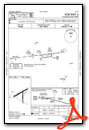
Instrument Approach Procedure (IAP) Charts

Nearby Airports with Instrument Procedures
| ID | Name | Heading / Distance | ||
|---|---|---|---|---|
 |
KCGZ | Casa Grande Municipal Airport | 273° | 17.2 |
|
KIWA | Mesa Gateway Airport | 332° | 25.1 |
|
KCHD | Chandler Municipal Airport | 315° | 27.8 |
|
P19 | Stellar Airpark Airport | 311° | 32.9 |
|
KAVQ | Marana Regional Airport | 161° | 33.2 |
|
KFFZ | Falcon Field Airport | 334° | 34.9 |
|
KPHX | Phoenix Sky Harbor International Airport | 315° | 41.9 |
|
P13 | San Carlos Apache Airport | 056° | 45.7 |
|
KSDL | Scottsdale Airport | 329° | 47.8 |
|
KRYN | Ryan Field Airport | 164° | 49.2 |
|
KDMA | Davis Monthan AFB Airport | 148° | 53.7 |
|
KTUS | Tucson International Airport | 153° | 54.9 |
 from the east")
")


