Login
Register


RSH
Russian Mission Airport
Official FAA Data Effective 2026-01-22 0901Z
Chart Supplement

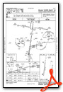
VFR Chart of PARS
Sectional Charts at SkyVector.com
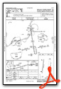
IFR Chart of PARS
Enroute Charts at SkyVector.com
Location Information for PARS
Coordinates: N61°46.49' / W161°19.16'Located 00 miles SE of Russian Mission, Alaska on 143 acres of land. View all Airports in Alaska.
Surveyed Elevation is 58 feet MSL.
Operations Data
|
|
Airport Communications
| AWOS-3P: | 118.375 Tel. 907-560-7678 |
|---|---|
| CTAF: | 122.900 |
| AWOS-3P at MDM (20.7 W): | 119.675 907-621-7985 |
| AWOS-3P at KLG (31.5 SE): | 119.025 907-471-2434 |
| AWOS-3P at HCA (50.2 NE): | 118.325 907-621-7974 |
- APCH/DEP SVC PRVDD BY ANCHORAGE ARTCC ON FREQS 118.15/251.05 (ANIAK RCAG) .
Nearby Navigation Aids
|
| ||||||||||||||||||||||||||||||||||||


Runway 18/36
| Dimensions: | 3620 x 100 feet / 1103 x 30 meters | |
|---|---|---|
| Surface: | Gravel in Good Condition | |
| Edge Lighting: | Medium Intensity | |
| Runway 18 | Runway 36 | |
| Coordinates: | N61°46.79' / W161°19.08' | N61°46.20' / W161°19.25' |
| Elevation: | 58.3 | 58.2 |
| Traffic Pattern: | Left | Left |
| Runway Heading: | 188° True | 8° True |
| Glide Slope Indicator | P4L (4.25° Glide Path Angle) PAPI UNUSBL BYD 9 DEGS RIGHT OF CNTRLN. | |
| REIL: | Yes | Yes |
| Obstacles: | 26 ft Trees 0 ft from runway, 230 ft right of center | 30 ft Trees 0 ft from runway, 240 ft right of center |
Runway 18W/36W
| Dimensions: | 3000 x 500 feet / 914 x 152 meters | |
|---|---|---|
| Surface: | Water | |
| Runway 18W | Runway 36W | |
Services Available
| Fuel: | NONE |
|---|---|
| Transient Storage: | Tiedowns |
| Airframe Repair: | NONE |
| Engine Repair: | NONE |
| Bottled Oxygen: | NONE |
| Bulk Oxygen: | NONE |
Ownership Information
| Ownership: | Publicly owned | |
|---|---|---|
| Owner: | ALASKA DOT&PF NORTHERN REGION | |
| 2301 PEGER RD | ||
| FAIRBANKS, AK 99709 | ||
| 907-451-2200 | ||
| Manager: | ERIK WEINGARTH | |
| PO BOX 135 | ||
| ST MARYS, AK 99658 | ||
| 907-438-2416 | ||
Other Remarks
- SEAPLANES OPERATE N-S IN YUKON RIVER AND E-W IN NUNVOTCHUK LAKE. WATCH FOR FISH NETS CLOSE TO SHORE.
- RWY CONDITION NOT MONITORED - RECOMMEND VISUAL INSPECTION PRIOR TO LNDG.
- WX CAMERA AVBL ON INTERNET AT HTTPS://WEATHERCAMS.FAA.GOV
- COLD TEMPERATURE AIRPORT. ALTITUDE CORRECTION REQUIRED AT OR BELOW -30C.
- ACTVT REIL RWY 18 & 36; PAPI RWY 36; MIRL RWY 18/36; WINDSOCK - CTAF.
- ACTVT ROTG BCN - CTAF.
Weather Minimums


Instrument Approach Procedure (IAP) Charts
Nearby Airports with Instrument Procedures
| ID | Name | Heading / Distance | ||
|---|---|---|---|---|
 |
PADM | Marshall Don Hunter Sr Airport | 285° | 20.8 |
|
PALG | Kalskag Airport | 116° | 31.4 |
|
PAHC | Holy Cross Airport | 059° | 50.3 |
|
PANI | Aniak Airport | 102° | 52.0 |
|
PFZK | Akiachak Airport | 185° | 52.1 |
|
PFAK | Akiak Airport | 177° | 52.5 |
|
PASM | St Mary's Airport | 287° | 58.8 |
|
PFKW | Kwethluk Airport | 183° | 59.3 |
|
PACH | Chuathbaluk Airport | 100° | 61.3 |
|
PANV | Anvik Airport | 030° | 61.3 |
|
PABE | Bethel Airport | 194° | 61.8 |
|
PFKA | Kasigluk Airport | 213° | 64.5 |
Airport Images
Do you have a recent image of this airport? Upload it here!


